
M01 is a Ukraine international highway (M-highway) that stretches from the state capital, Kyiv, to the northern border with Belarus.

Pennsylvania Route 653 (PA 653) is a 26-mile-long (42 km) state highway in Fayette and Somerset counties in Pennsylvania, United States. The western terminus is at PA 381 in Springfield Township. The eastern terminus is at Mason Dixon Highway in Garrett.

The Poltava Governorate or Poltavshchyna was a gubernia in the historical Left-bank Ukraine region of the Russian Empire. It was officially created in 1802 from the disbanded Malorossiya Governorate, which was split between the Chernigov Governorate and Poltava Governorate with an administrative center of Poltava.
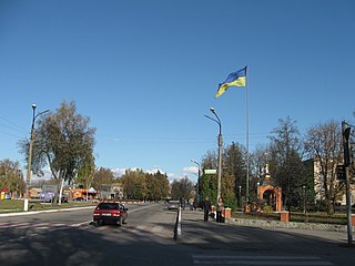
Nedryhailiv is an urban-type settlement situated on the Sula River in Sumy Oblast of northeastern Ukraine. It serves as the administrative center of the Nedryhailiv Raion (district), housing the raion's administrative structure. Population: 5,323
State highways in Ukraine are subdivided into three categories: international (M-network), national (H-network), and regional (P-network). The letter's indexes are in Cyrillic, standing for their respective abbreviations in Ukrainian.
Sumy Oblast is subdivided into districts (raions) which are subdivided into amalgamated territorial communities (hromadas).

Brovarskyi prospect is a arterial and the longest public roadway in Kyiv, Ukraine. It stretches from the Kyiv Metro Bridge over Dnieper to the city of Brovary.
Druzhba is an urban-type settlement in Pryluky Raion, Chernihiv Oblast, Ukraine. It belongs to Ichnia urban hromada, one of the hromadas of Ukraine. Population: 952
Parafiivka is an urban-type settlement in Pryluky Raion, Chernihiv Oblast, Ukraine. It hosts the administration of Parafiivka settlement hromada, one of the hromadas of Ukraine. Population: 2,212
Ladan is an urban-type settlement in Pryluky Raion, Chernihiv Oblast, Ukraine. It hosts the administration of Ladan settlement hromada, one of the hromadas of Ukraine. Population: 5,804
Mala Divytsia is an urban-type settlement in Pryluky Raion, Chernihiv Oblast, Ukraine. It hosts the administration of Mala Divytsia settlement hromada, one of the hromadas of Ukraine. Population: 1,949
Dihtiari is an urban-type settlement in Pryluky Raion, Chernihiv Oblast, Ukraine. It is located on the left bank of the Udai in the drainage basin of the Dnieper. Dihtiari belongs to Sribne settlement hromada, one of the hromadas of Ukraine. Population: 1,181
Stare Selo, literally "Old Village", until 2016 – Chervone, or simply Stare, is a village in Ukraine, in Sumy Raion, Sumy Oblast. It is the seat of its local self-governing body, Starosiljskiy Village Council.
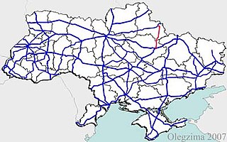
H12 is an important Ukraine national highway (H-highway) in Sumy and Poltava Oblasts, Ukraine, running mainly north–south, and connecting Sumy with Poltava in a more or less straight line. It begins in Sumy at Bandera Street and Illinska Street, and travels straight through central Sumy. It passes through Syrovatka, Boromlya, Trostyanets, Klymentove, Okhtyrka, Khukhra, Kotelva, Velyki Budyshcha, and Dykanka, and then loops around Poltava and terminates at the intersection of Highway M03 and Polovky Street.
P61 is a regional Ukraine road (P-highway) in Sumy Oblast, Ukraine, running mainly west-east and connecting Baturyn with Sumy in a more or less straight line. It begins at Highway M01/European route E101 and passes through Mytchenky, Krasne, Popivka, Konotop, Simyanivka, Dubovyazivka, Krasne, Chernecha Sloboda, Terny, Bobryk, Tuchne, Mykolaivka, Stepanivka, and ends in Sumy at Stepana Bandera Street and Illinska Street. There is also a branch road starting at Highway M03/European route E101 to Hetman's Capital National Park.
P46 is a regional Ukraine road (P-highway) in Sumy Oblast and Kharkiv Oblast, Ukraine, running mainly west–east and connecting Okhtyrka with Kharkiv in a more or less straight line. It begins at Highway H12 in Okhtyrka and passes through Khodunaivka, Kupjevakha, Hubarivka, Bohodukhiv, Musiyki, Krysynska, Maksymivka, Horkoho, Vilshany, Dvorichnyi Kut, Peresichne, Solonytsivka, Podvirky, and finally arrives to the Kholodnohirsk District of Kharkiv at Zalyutynska Street and Poltavskyi Shlyakh Street.
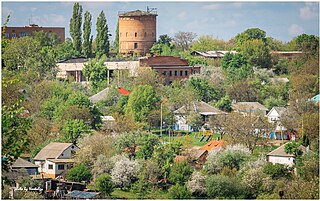
Terny is an urban-type settlement in Romny Raion of Sumy Oblast in Ukraine. It is located on the banks of the Tern, a tributary of the Sula in the drainage basin of the Dnieper. Terny belongs to Nedryhailiv settlement hromada, one of the hromadas of Ukraine. Population: 2,848
Khotin is an urban-type settlement in Sumy Raion of Sumy Oblast in Ukraine. It is located on the banks of the Oleshnia, a right tributary of the Psel in the drainage basin of the Dnieper. Khotin hosts the administration of Khotin settlement hromada, one of the hromadas of Ukraine. Population: 2,335

Nyzy is an urban-type settlement in Sumy Raion of Sumy Oblast in Ukraine. It is located on the left bank of the Psel, about 15 kilometres (9.3 mi) south of Sumy. Nyzy belongs to Sad rural hromada, one of the hromadas of Ukraine. Population: 2,745
The Battle of Romny was a series of military engagements in the Romny Municipality, Sumy Oblast which began on 24 February 2022, during the 2022 Russian invasion of Ukraine, as part of the Northeastern Ukraine offensive.

