Sumy is a city of regional significance in Ukraine, and the capital of Sumy Oblast. The city is situated on the banks of the Psel River in northeastern Ukraine with a population of 256,474 according to the 2021 census, making it the 23rd-largest in the country.

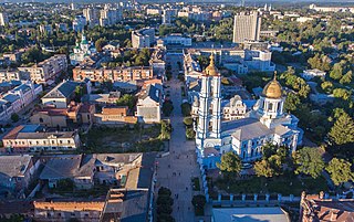
Hlukhiv or Glukhov is a small historic town on the Esman River. It is a city of regional significance in the Sumy region of Ukraine. Hlukhiv is administratively incorporated as a city of oblast significance. Hlukhiv Municipality includes Hlukhiv and the village of Sliporod. Hlukhiv also serves as administrative center of Hlukhiv Raion but does not belong to the raion. Population: 31,789.
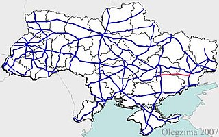
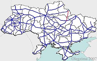
State highways in Ukraine are subdivided into three categories: international (M-network), national (H-network), and regional (P-network). The letter's indexes are in Cyrillic, standing for their respective abbreviations in Ukrainian.

Highway M02 is a Ukraine international highway (M-highway) connecting the M01 near Kipti with Bachivsk on the border with Russia, where it continues as the M3 to Moscow. The entire route is part of European route E101 and the section from Hlukhiv to the Russian border is part of European route E391.
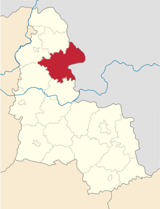
Hlukhiv Raion was a raion in Sumy Oblast in Central Ukraine. The administrative center of the raion was the town of Hlukhiv, which was administratively incorporated as a city of oblast significance and did not belong to the raion. The raion was abolished on 18 July 2020 as part of the administrative reform of Ukraine, which reduced the number of raions of Sumy Oblast to five. The last estimate of the raion population was 21,243

M26 is a Ukrainian international highway (M-highway) in western Ukraine that runs within Berehove Raion from the M23 at Vylok near the Hungarian border to the Romanian border where it continues as the DN1C into Romania. The M26 is part of European routes E81 and E58. Before 2013 the route was designated as P55.

H20 is an important Ukraine national highway (H-highway) in the Donetsk Oblast, Donbas, Ukraine, running mainly north–south and connecting Sloviansk though Donetsk with Mariupol on the shores of Taganrog Bay in the Sea of Azov near the mouth of the Kalmius River. It passes through Kramatorsk, Druzhkivka, Oleksijevo-Druzhkivka & Osykove, Kostiantynivka, Berestok, Romanivka, Kamianka in Yasynuvats’kyi, Makiivka, Donetsk, Dolya in Volnovas'kyi, Syhnal'ne-Olenivka in Marinskyi, Berezove in Marinskyi, Novotroits'ke in Volnovas'kyi, Buhas, Volnovakha, Dmytrivka, Polkove, Pryvil'ne, Hranitne, and Kasyanivka in Telmanove Raion.
Highway H15 is a Ukrainian national highway (H-highway) connecting Zaporizhzhia with Donetsk. It passes through Vil'nians'k, Mykhailo-Lukasheve, and Kolos in Vilniansk Raion, Rodyns'ke, Petropavlivka, Novomykolaivka in Novomykolaivka Raion; Kyivs'ke and Trudove in Bilmak Raion; Novokasyanivka in Novomykolaivka Raion; Zelena Dolyna, Pysantsi, Mechetne, Orly, Dibrova, and Havrylivke in Synelnykove Raion; Iskra, Piddubne-Tolstoi, Perebudova-Komar, Ordradne, Bahatyr, Kostayantynopil', Andriivka, and Ulakly in Velyka Novosilka Raion; Dachne in Marinka Raion; Kurakhove, and Maksymil'yanivka-Heorhiivka-Marinka. The H15 has a brief concurrency with highway T-04-01 in Synelnykove Raion.

Road P-65 is a highway of regional significance in Ukraine. It connects two border crossings between Russia and Ukraine, "Mykolaivka" and "Katerinovka". The road passes through the Chernihiv and Sumy regions and goes across Semenivka, Novhorod-Siverskyi, Shostka and Hlukhiv.
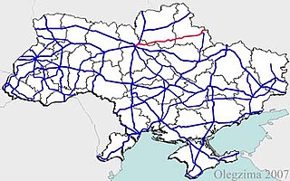
European route E 38 (E 38) is a west–east European route, running from Hlukhiv in Ukraine to Shymkent in Kazakhstan. In Ukraine, the highway runs from the intersection with European route E 101, through Hlukhiv to the Russian border near Katerynivka.

Yampil is an urban-type settlement in Sumy Oblast in Ukraine. It was formerly the administrative center of Yampil Raion, and is now administered within Shostka Raion. It is located on the Ptushok River, a tributary of the Ivotka River in the basin of the Dnieper. Population: 4,324.
H12 is an important Ukraine national highway (H-highway) in Sumy and Poltava Oblasts, Ukraine, running mainly north–south, and connecting Sumy with Poltava in a more or less straight line. It begins in Sumy at Bandera Street and Illinska Street, and travels straight through central Sumy. It passes through Syrovatka, Boromlya, Trostyanets, Klymentove, Okhtyrka, Khukhra, Kotelva, Velyki Budyshcha, and Dykanka, and then loops around Poltava and terminates at the intersection of Highway M03 and Polovky Street.
H07 is an important Ukraine national highway (H-highway) in Kyiv, Chernihiv, and Sumy Oblasts, Ukraine, running mainly west-east, and connecting Kyiv with Yunakivka in a more or less straight line. It begins in Brovary at Highway M01/Highway E95, and passes through Krasylivka, Hoholiv, Rusaniv, Peremoha, Nova Basan, Novyi Bykiv, Pohreby, Rudivka, Pryluky, Okhyrky, Sribne, Kharkove, Lavirkove, Romny, Korovyntsi, Nedryhailiv, Vylshana, Komyshanka, Shtepivka, Sula, Sad, Sumy, Stetskivka, Pysarivka, and Yunakivka, before ending at the Russian border. The road then continues as the R200 to Kursk.
P61 is a regional Ukraine road (P-highway) in Sumy Oblast, Ukraine, running mainly west-east and connecting Baturyn with Sumy in a more or less straight line. It begins at Highway M01/European route E101 and passes through Mytchenky, Krasne, Popivka, Konotop, Simyanivka, Dubovyazivka, Krasne, Chernecha Sloboda, Terny, Bobryk, Tuchne, Mykolaivka, Stepanivka, and ends in Sumy at Stepana Bandera Street and Illinska Street. There is also a branch road starting at Highway M03/European route E101 to Hetman's Capital National Park.
P45 is a regional Ukraine road (P-highway) in Sumy Oblast and Kharkiv Oblast, Ukraine, running mainly north-south and connecting Sumy with Bohodukhiv in sloped line. It begins in Sumy at Bandera Street and Illinska Street, and travels straight through central Sumy. It passes through Verkhnya Syrovatka, Stinka, Hlybne, Samotoivka, Krasnopillya, Zemlyane, Mezenivka, Slavhorod, Porozok, Pozhnya, Druzhba, Shurove, Shyrokyi Bereh, Vilne, Velyka Pysarivka, Rozsoshi, Vinnytski Ivany, Leskivka, before terminating in Bohodukhiv at Tretyakivska Street and Kharkivska Street.
P46 is a regional Ukraine road (P-highway) in Sumy Oblast and Kharkiv Oblast, Ukraine, running mainly west–east and connecting Okhtyrka with Kharkiv in a more or less straight line. It begins at Highway H12 in Okhtyrka and passes through Khodunaivka, Kupjevakha, Hubarivka, Bohodukhiv, Musiyki, Krysynska, Maksymivka, Horkoho, Vilshany, Dvorichnyi Kut, Peresichne, Solonytsivka, Podvirky, and finally arrives to the Kholodnohirsk District of Kharkiv at Zalyutynska Street and Poltavskyi Shlyakh Street.

Vorozhba is a railway station in Vorozhba, Ukraine. It is a major passenger and freight station at the junction of the Khutir-Mikhailovskyi-Konotop, Vorozhba-Konotop, Vorozhba-Volfyne, and Bilopillya-Vorozhba lines of Southwestern Railways.
Esman is an urban-type settlement in Shostka Raion of Sumy Oblast in Ukraine. It is located on the left bank of the Esman river, a right tributary of the Kleven, in the drainage basin of the Dnieper. Esman hosts the administration of Esman settlement hromada, one of the hromadas of Ukraine. Population: 1,293.
Shalyhyne is an urban-type settlement in Shostka Raion of Sumy Oblast in Ukraine. It is located on the banks of the Lapuha, a left tributary of the Kleven, in the drainage basin of the Dnieper. Shalyhyne hosts the administration of Shalyhyne settlement hromada, one of the hromadas of Ukraine. Population: 2,226.

The battle of Hlukhiv was a series of clashes that began on February 24, 2022, in the town of Hlukhiv, Hlukhiv Raion, Sumy Oblast, as part of the Russian invasion of Ukraine in 2022.