
The Fort-12 is a semi-automatic pistol which was designed in the late 1990s by Ukrainian firearms designer RPC Fort.

Highway M05 is a state international highway in Ukraine connecting the two largest cities: Kyiv and Odessa.
Bilohorodka is a village in Bucha Raion, Kyiv Oblast of north Ukraine. It hosts the administration of Bilohorodka rural hromada, one of the hromadas of Ukraine, formed on 12 June 12 2020 and including nine neighbouring villages: Bobrytsia, Horenytsia, Myzychi, Sviatopetrivske, Hnativka, Stoianka, Shevchenko, Nehrashi, and Luka.
The State Emergency Service of Ukraine, until December 24, 2012 named the Ministry of Emergencies of Ukraine is the main executive body tasked with carrying out state policy in the spheres of civil defence, rescue, creating and managing the system of insurance fund documentation, utilization of radioactive wastes, protection of population and territory in emergency situations, emergency prevention and response, liquidation in the aftermath, and the Chernobyl catastrophe.

Ukrainian driving licences are the official documents which authorize their respective holders to operate various types of motor vehicle on public roads.

M29 is a Ukrainian international highway (M-highway) in eastern Ukraine that runs from Kharkiv to Dnipro parallel to the M18. It is also known as Kharkiv – Dnipro motorway, although it does not have an official motorway designation. The entire route is part of European route E105.

Road P-65 is a highway of regional significance in Ukraine. It connects two border crossings between Russia and Ukraine, "Mykolaivka" and "Katerinovka". The road passes through the Chernihiv and Sumy regions and goes across Semenivka, Novhorod-Siverskyi, Shostka and Hlukhiv.
H33 is a Ukrainian national highway (H-highway), passing through the territory of the Odessa region. The route was previously designated as territorial road T-16-04 until 2013 and regional road P-70 from 2013 to 2017, when it was redesignated as national highway H33.

Road P-24 is a motor road of regional significance in Ukraine. Passes through the territory of Ivano-Frankivsk Oblast, Ternopil Oblast and Khmelnytskyi Oblasts.

The Kyiv Boryspil Express is an airport rail link in Ukraine between Boryspil International Airport and Kyiv, opened in November 2018. It is operated by Ukrzaliznytsia, Ukraine's state-owned rail operator.

Oleksiy Valeriyovych Honcharuk is a Ukrainian politician. He served as the Prime Minister of Ukraine from 29 August 2019 to 4 March 2020 following a landslide parliamentary election win. Honcharuk was replaced by Denys Shmyhal during the formation of the Shmyhal Government.

Natalia Boytsun is a Ukrainian government official, economist and scientist.
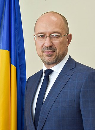
Denys Anatoliyovych Shmyhal is a Ukrainian politician and entrepreneur who is the current Prime Minister of Ukraine since 2020. Prior to his appointment as prime minister, Shmyhal was the governor of Ivano-Frankivsk Oblast and an acting vice prime minister in the Honcharuk Government.

Olha Vitaliiivna Stefanishyna is a Ukrainian lawyer and civil servant. On 4 June 2020, she was appointed as the deputy prime minister for European and Euro-Atlantic integration.
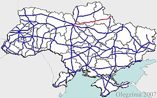
H07 is an important Ukraine national highway (H-highway) in Kyiv, Chernihiv, and Sumy Oblasts, Ukraine, running mainly west-east, and connecting Kyiv with Yunakivka in a more or less straight line. It begins in Brovary at Highway M01/Highway E95, and passes through Krasylivka, Hoholiv, Rusaniv, Peremoha, Nova Basan, Novyi Bykiv, Pohreby, Rudivka, Pryluky, Okhyrky, Sribne, Kharkove, Lavirkove, Romny, Korovyntsi, Nedryhailiv, Vylshana, Komyshanka, Shtepivka, Sula, Sad, Sumy, Stetskivka, Pysarivka, and Yunakivka, before ending at the Russian border. The road then continues as the R200 to Kursk.
P61 is a regional Ukraine road (P-highway) in Sumy Oblast, Ukraine, running mainly west-east and connecting Baturyn with Sumy in a more or less straight line. It begins at Highway M01/European route E101 and passes through Mytchenky, Krasne, Popivka, Konotop, Simyanivka, Dubovyazivka, Krasne, Chernecha Sloboda, Terny, Bobryk, Tuchne, Mykolaivka, Stepanivka, and ends in Sumy at Stepana Bandera Street and Illinska Street. There is also a branch road starting at Highway M03/European route E101 to Hetman's Capital National Park.
P46 is a regional Ukraine road (P-highway) in Sumy Oblast and Kharkiv Oblast, Ukraine, running mainly west–east and connecting Okhtyrka with Kharkiv in a more or less straight line. It begins at Highway H12 in Okhtyrka and passes through Khodunaivka, Kupjevakha, Hubarivka, Bohodukhiv, Musiyki, Krysynska, Maksymivka, Horkoho, Vilshany, Dvorichnyi Kut, Peresichne, Solonytsivka, Podvirky, and finally arrives to the Kholodnohirsk District of Kharkiv at Zalyutynska Street and Poltavskyi Shlyakh Street.

Emine Aiiarovna Dzhaparova is a Crimean Tatar-Ukrainian journalist, editor, television presenter, and politician. She was appointed the First Deputy Minister of Foreign Affairs of Ukraine in 2020.

The Ukravtodor or The State Service of Special Communications and Information Protection of Ukraine is the agency within the Ministry of Infrastructure that oversees the road signs in Ukraine.
Zolotonosha urban hromada is a hromada of Ukraine, in Zolotonosha Raion, Cherkasy Oblast. Its administrative center is the city of Zolotonosha. It was formed by the government of Ukraine on 12 June 2020. Its area is 465.5 км², and its population is 35666, 27664 of which lived in cities, and 8002 lived in rural areas.
