Kerch, also known as Keriç or Kerich, is a city of regional significance on the Kerch Peninsula in the east of Crimea. Kerch has a population of about 147,033 .

Crimea is a peninsula in Eastern Europe, on the northern coast of the Black Sea, almost entirely surrounded by the Black Sea and the smaller Sea of Azov. The Isthmus of Perekop connects the peninsula to Kherson Oblast in mainland Ukraine. To the east, the Crimean Bridge, constructed in 2018, spans the Strait of Kerch, linking the peninsula with Krasnodar Krai in Russia. The Arabat Spit, located to the northeast, is a narrow strip of land that separates the Syvash lagoons from the Sea of Azov. Across the Black Sea to the west lies Romania and to the south is Turkey. The largest city is Sevastopol. The region has a population of 2.4 million, and has been under Russian occupation since 2014.

The Kerch Strait is a strait in Eastern Europe. It connects the Black Sea and the Sea of Azov, separating the Kerch Peninsula of Crimea in the west from the Taman Peninsula of Russia's Krasnodar Krai in the east. The strait is 3.1 kilometres (1.9 mi) to 15 kilometres (9.3 mi) wide and up to 18 metres (59 ft) deep. The most important harbor, the Crimean city of Kerch, gives its name to the strait, formerly known as the Cimmerian Bosporus. It has also been called the Straits of Yenikale after the Yeni-Kale fortress in Kerch.

Port Krym is a port in Crimea. It is located on the western shore of Kerch Strait, in the north-eastern part of Kerch city near a settlement of Zhukivka. Next to the port is located the Krym railway station.

E105 is part of the International E-road network, which is a series of main roads in Europe. It is a north–south reference road, meaning it crosses Europe from north to south, and other E-road numbers have been calculated based on these reference roads.

The Crimean Bridge, also called Kerch Strait Bridge or Kerch Bridge, is a pair of parallel bridges, one for a four-lane road and one for a double-track railway, spanning the Kerch Strait between the Taman Peninsula of Krasnodar Krai in Russia and the Kerch Peninsula of Crimea. Built by the Russian Federation after its annexation of Crimea at the start of 2014, the bridge cost ₽227.92 billion (US$3.7 billion) and has a length of 19 km (12 mi), making it the longest bridge in Europe and the longest bridge ever constructed by Russia.

European route E 97 is an A-class European Route in Ukraine, Russia, Georgia, and Turkey. The highway runs for 1,360 kilometres (850 mi) in total. It connects the North Black Sea region with the South Black Sea region along the eastern shores of the sea.
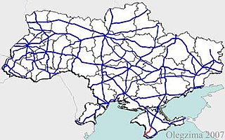
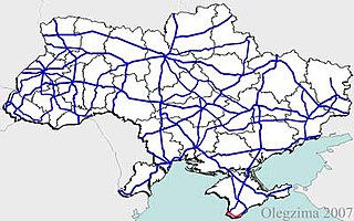
State highways in Ukraine are subdivided into four categories: international (M-network), national (H-network), regional (P-network), and territorial (Т-network). The letter's indexes are in Cyrillic, standing for their respective abbreviations in Ukrainian.

Highway M20 is the second shortest Ukraine international highway (M-highway) which connects Kharkiv to the border with Russia at Hoptivka in Kharkiv Raion in Kharkiv Oblast (Kharkivshchyna) and Nehoteevka in Belgorodsky Raion in Belgorodskaya Oblast. The section from Lisne to the Russian border is part of European route E105, known as the Crimea Highway in Russia.

The Autonomous Republic of Crimea is an administrative division of Ukraine encompassing most of Crimea that was unilaterally annexed by Russia in 2014. The Autonomous Republic of Crimea occupies most of the peninsula, while the City of Sevastopol occupies the rest.

The Republic of Crimea is a republic of Russia, comprising most of the Crimean Peninsula, but excluding Sevastopol. Its territory corresponds to the pre-2023 territory of the Autonomous Republic of Crimea, a de jure subdivision of Ukraine. Russia occupied and annexed the peninsula in 2014, although the annexation remains internationally unrecognized.

The Kerch Strait ferry line was a ferry connection across the Strait of Kerch that connected the Crimean Peninsula and Krasnodar Krai.

Highway M18 is a Ukrainian international highway (M-highway) connecting Kharkiv to the southern coast of Crimea in Yalta. The highway is also has an alternative route (M29) which runs parallel and designed as an expressway between Kharkiv and Novomoskovsk. The section from Novomoskovsk to Yalta is part of European route E105. The section from Kharkiv to Krasnohrad was previously P51.

The Crimea Railway is a railway located in Crimea, providing passenger and freight services to Sevastopol and the Republic of Crimea.

H05 is a regional road (H-Highway) in Crimea, Ukraine. It runs north-south and connects Krasnoperekopsk with Simferopol. Since the 2014 annexation of Crimea by the Russian Federation, the route was given another code 35K-001.

H06 is a regional road (H-Highway) in Crimea and Sevastopol. It runs northeast-south-southwest and connects Simferopol with Sevastopol. Since the 2014 annexation of Crimea by the Russian Federation, the route was given another code 35P-001 and 67P-1.

H19 is a regional road (H-Highway) in Crimea and Sevastopol, Ukraine. It is a western part of the so-called Yuzhnoberezhne shose. It runs east-west and connects Yalta with Sevastopol. Since the 2014, annexation of Crimea by the Russian Federation, the route was given another code 35K-002 and 67K-1.

The Tavrida Highway is a highway in Crimea, designated as A291 by the Russian administration. It is a four-lane motor road with a length of 250.7 km (155.8 mi). Construction of the road began in 2017. The project's costs exceed 150 bln rubles. The construction is funded from the federal target program for the development of the Crimea and Sevastopol.
Verkhny Lyubazh is a rural locality and the administrative center of Verkhnelyubazhsky Selsoviet Rural Settlement, Fatezhsky District, Kursk Oblast, Russia. Population: 1,674 (2010 Russian census); 1,925 (2002 Census);
The green circle is a regional nature reserve (zakaznik) located in Crimea, a territory internationally recognised as part of Ukraine but occupied by Russia since 2014.


