
Chop is a city located in Zakarpattia Oblast (province) of western Ukraine, near the borders of Slovakia and Hungary. It is separated from the Hungarian town of Záhony by the river Tisza by being situated on its right bank. Located inside Uzhhorod Raion, since 2003 it is designated as a city of oblast significance – not included in any raion (district) of the oblast. Today, the population is 8,626.

European route E 58 is a road part of the International E-road network. It begins in Vienna, Austria and ends in Rostov-on-Don, Russia. It is approximately 2,200 km (1,400 mi) long.

The D1 is a east-west motorway in Slovakia. Its route is Bratislava - Trnava - Trenčín - Púchov - Žilina - Martin - Ružomberok - Poprad - Prešov - Košice - Michalovce - SK/UA border. It is the main motorway in Slovakia as well as being the longest and busiest motorway in Slovakia.
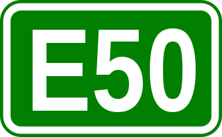
European route E 50 is an A-type east–west connection across the European continent. It connects the key naval port of Brest France with Makhachkala, on the Caspian Sea in the Russian republic Dagestan.

Uzhhorod International Airport, is an international airport located in the city of Uzhhorod, in the western Ukrainian province of Zakarpattia. The airport is situated in the westernmost part of the city, in the Chervenytsia district at 145, Sobranetska Street. It is a small airport, serving Uzhhorod and the whole oblast. The airport's runway begins 90 meters from the Ukrainian-Slovak international border, so planes must use Slovak airspace for some take-offs and landings under special treaty.

Highway M04 was a Ukraine international highway connecting Znamianka to Sorokyne on the border with Russia, where it continued into Russia as the A260.

Highway M02 is a Ukraine international highway (M-highway) connecting the M01 near Kipti with Bachivsk on the border with Russia, where it continues as the M3 to Moscow. The entire route is part of European route E101 and the section from Hlukhiv to the Russian border is part of European route E391.

Highway M03 is a Ukrainian international highway (M-highway) connecting Kyiv with Dovzhansky on the border with Russia, where it continues into Russia as the A270. It is part of European route E40 from Kyiv to Debaltseve at which it is part of European route E50 to the border with Russia. At 844 km (524 mi), the M03 is the longest international state highway in Ukraine.
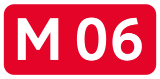
Highway M06 is a Ukrainian international highway (M-highway) connecting Kyiv to the Hungarian border near Chop, where it continues as Hungarian main road 4 to Záhony and Budapest.

Highway M07 is a Ukrainian international highway (M-highway) connecting Kyiv to Yahodyn on the border with Poland, where it continues into Poland as National Road 12 (DK12).

Highway M09 is a Ukrainian international highway (M-highway) which is part of the Warsaw - Lviv route. It starts as a split-off from the M12 near Ternopil, runs through Lviv, then turns north and heads towards the border with Poland. The highway terminates at the border checkpoint Rava-Ruska. Across the Polish border it continues as National Road 17 (DK17). The entire route is part of European route E372.

M12 was a Ukrainian international highway (M-highway) connecting Lviv Oblast to Central Ukraine, where after crossing the Dnieper it continued further as the M04. On 28 April 2021, the M12 was decommissioned and merged with the M04 to form the new M30.
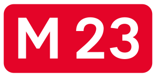
Highway M23 is one of the shortest Ukrainian international highway (M-highway) which connects Berehove with Khust and runs in the southern portion of the region next to the Hungarian and Romanian borders. From Berehove to the little settlement of Vylok, the M23 is part of European route E58 and European route E81 which drift of towards the Romanian border at the border checkpoint Okli on a regional route.
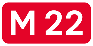
Highway M22 is a Ukrainian international highway (M-highway) which connects Oleksandriia, Kremenchuk, and Poltava across Dnieper river. The highway also connects two major transnational corridors that run along European route E50 and European route E40. Along with the M13, the M22 composes the Ukrainian portion of European route E584 that also runs from Kropyvnytskyi to the Moldovan border onto Chișinău.
Uzhhorod is a land border crossing between Ukraine and Slovakia on the Ukrainian side, near the city of Uzhhorod. The crossing is situated on autoroute E50/E58 (M08). On the Slovakian side is the village of Vyšné Nemecké. The border also forms a frontier with the European Union.

Highway M15 is a Ukrainian international highway (M-highway) connecting Odesa to Reni. The entire route is part of European route E87. The highway is also known as the highway Odesa–Reni.

Highway M16 is a Ukrainian international highway (M-highway) connecting Odesa to Kuchurhan on the border with Moldova, where it continues as national road M5. The M16 is part of European route E58 and European route E581.

E 573 is a B-class European route connecting Püspökladány in Hungary to Uzhhorod in Ukraine. The route is approximately 193 km long. Its national number in Hungary is 4. Formerly, it began in Nyíregyháza as its southern part was called E77.
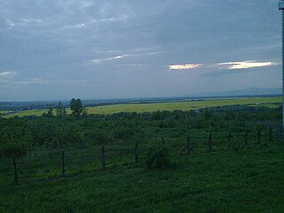
M25 is a Ukrainian international highway (M-highway) connecting the western village of Solomonovo near Chop to the southern village of Yanoshi. The route stretches along the border with Hungary and Tisa River.
M30 is a Ukrainian international highway (M-highway) formed on 28 April 2021, with the merger of the M04 and the M12. The Stryi-Debaltseve section is part of the European route E50, the section from Debaltseve to the Russian border is part of European route E40 and the section from Oleksandriia to Kropyvnytskyi is part of European route E584. The route was formed before the 30th anniversary of Ukrainian independence. It is also dubbed the Road to Unity.

