
Highway M05 is a state international highway in Ukraine connecting the two largest cities: Kyiv and Odesa.

Highway M10 is a Ukrainian international highway (M-highway) connecting Lviv to Krakovets on the border with Poland, where it continues as the A4 motorway.
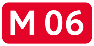
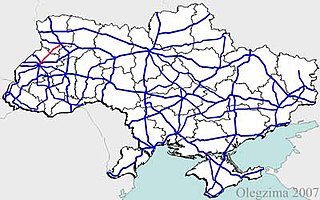
Highway M06 is a Ukrainian international highway (M-highway) connecting Kyiv to the Hungarian border near Chop, where it continues as Hungarian main road 4 to Záhony and Budapest.

Highway M08 is the shortest Ukraine international highway. It serves as a loop route bypassing the city of Uzhhorod on the northern (mountainous) side. It is part of European routes E50 and E58.

M13 is a Ukrainian international highway (M-highway) connecting Kropyvnytskyi to the border with Moldova, where before crossing the Dniester it heads towards Chişinău as the M1. The entire route is part of European route E584.

Highway M14 is a Ukrainian international highway (M-highway) connecting Odesa to the Russian border east of Mariupol, where it continues into Russia as the A280.
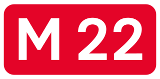
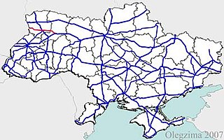
Highway M22 is a Ukrainian international highway (M-highway) which connects Oleksandriia, Kremenchuk, and Poltava across Dnieper river. The highway also connects two major transnational corridors that run along European route E50 and European route E40. Along with the M13, the M22 composes the Ukrainian portion of European route E584 that also runs from Kropyvnytskyi to the Moldovan border onto Chișinău.

M21 is a Ukrainian international highway (M-highway) which connects Zhytomyr and Vinnytsia to the border with Moldova. The highway also connects two major transnational corridors, Pan-European Corridor IX and the transportation corridor "Europe-Asia". The entire route is part of European route E583. The section from Zhytomyr to the Belarusian border was previously P28.

Highway M20 is the second shortest Ukraine international highway (M-highway) which connects Kharkiv to the border with Russia at Hoptivka in Kharkiv Raion in Kharkiv Oblast (Kharkivshchyna) and Nehoteevka in Belgorodsky Raion in Belgorodskaya Oblast. The section from Lisne to the Russian border is part of European route E105, known as the Crimea Highway in Russia.

Highway M15 is a Ukrainian international highway (M-highway) connecting Odesa to Reni. The entire route is part of European route E87. The highway is also known as the highway Odesa–Reni.

Highway M16 is a Ukrainian international highway (M-highway) connecting Odesa to Kuchurhan on the border with Moldova, where it continues as national road M5. The M16 is part of European route E58 and European route E581.

Highway M17 is a Ukrainian international highway (M-highway) connecting Kherson to the Russian border over the Kerch Strait, where it continues into Russia as the A290. The M17 is part of European route E97.

Highway M18 is a Ukrainian international highway (M-highway) connecting Kharkiv to the southern coast of Crimea in Yalta. The highway is also has an alternative route (M29) which runs parallel and designed as an expressway between Kharkiv and Novomoskovsk. The section from Novomoskovsk to Yalta is part of European route E105. The section from Kharkiv to Krasnohrad was previously P51.

Highway M19 is a Ukrainian international highway (M-highway) that completely corresponds to whole length of European route E85 that runs through Ukraine.

Highway H01 is a Ukrainian national highway (H-highway) connecting the capital of Ukraine Kyiv with the central regions. It runs through Kyiv, Kyiv Oblast, Cherkasy Oblast, and ends in Kirovohrad Oblast.
Highway H17 is a Ukrainian national highway (H-highway) connecting the city of Lviv with Lutsk.
H22 is a Ukrainian national highway (H-highway) connecting the city of Rivne with the Poland-Ukraine border.

H12 is an important Ukraine national highway (H-highway) in Sumy and Poltava Oblasts, Ukraine, running mainly north–south, and connecting Sumy with Poltava in a more or less straight line. It begins in Sumy at Bandera Street and Illinska Street, and travels straight through central Sumy. It passes through Syrovatka, Boromlya, Trostianets, Klymentove, Okhtyrka, Khukhra, Kotelva, Velyki Budyshcha, and Dykanka, and then loops around Poltava and terminates at the intersection of Highway M03 and Polovky Street.
P61 is a regional Ukraine road (P-highway) in Sumy Oblast, Ukraine, running mainly west-east and connecting Baturyn with Sumy in a more or less straight line. It begins at Highway M01/European route E101 and passes through Mytchenky, Krasne, Popivka, Konotop, Simyanivka, Dubovyazivka, Krasne, Chernecha Sloboda, Terny, Bobryk, Tuchne, Mykolaivka, Stepanivka, and ends in Sumy at Stepana Bandera Street and Illinska Street. There is also a branch road starting at Highway M03/European route E101 to Hetman's Capital National Park.
P44 is a regional road (P-highway) in Sumy Oblast, Ukraine, half of it running mainly north-south and the other half at an angle. It connects Hlukhiv with Sumy. It begins at Highway P61 and Bilopilskiy Shlyakh in Sumy and passes through Postolne, Syniak, Barylo, Peremoha, Bilopillia, Vorozhba, Pisky, Klepaly, Ihorivka, Chumakove, Zinove, Putyvl, Bobyne, Vyazenka, Banychi, and Peremoha, and ends in Hlukhiv at the intersection of Tereshchenkiv Street and Kyiv Street.

