Highway M05 is a state international highway in Ukraine connecting the two largest cities: Kyiv and Odesa.

M01 is a Ukrainian international highway (M-highway) that stretches from the state capital, Kyiv, to the northern border with Belarus.
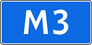
The Russian route M3 is a major trunk road that runs across a distance of about 490 kilometres from Moscow to Russia's border with Ukraine.

Highway M02 is a Ukraine international highway (M-highway) connecting the M01 near Kipti with Bachivsk on the border with Russia, where it continues as the M3 to Moscow. The entire route is part of European route E101 and the section from Hlukhiv to the Russian border is part of European route E391.

Highway M03 is a Ukrainian international highway (M-highway) connecting Kyiv with Dovzhansky on the border with Russia, where it continues into Russia as the A270. It is part of European route E40 from Kyiv to Debaltseve at which it is part of European route E50 to the border with Russia. At 844 km (524 mi), the M03 is the longest international state highway in Ukraine.
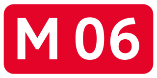
Highway M06 is a Ukrainian international highway (M-highway) connecting Kyiv to the Hungarian border near Chop, where it continues as Hungarian main road 4 to Záhony and Budapest.

M13 is a Ukrainian international highway (M-highway) connecting Kropyvnytskyi to the border with Moldova, where before crossing the Dniester it heads towards Chişinău as the M1. The entire route is part of European route E584.

Highway M14 is a Ukrainian international highway (M-highway) connecting Odesa to the Russian border east of Mariupol, where it continues into Russia as the A280.
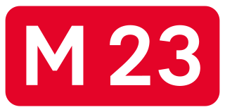
Highway M23 is one of the shortest Ukrainian international highway (M-highway) which connects Berehove with Khust and runs in the southern portion of the region next to the Hungarian and Romanian borders. From Berehove to the little settlement of Vylok, the M23 is part of European route E58 and European route E81 which drift of towards the Romanian border at the border checkpoint Okli on a regional route.
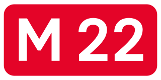
Highway M22 is a Ukrainian international highway (M-highway) which connects Oleksandriia, Kremenchuk, and Poltava across Dnieper river. The highway also connects two major transnational corridors that run along European route E50 and European route E40. Along with the M13, the M22 composes the Ukrainian portion of European route E584 that also runs from Kropyvnytskyi to the Moldovan border onto Chișinău.

Highway M16 is a Ukrainian international highway (M-highway) connecting Odesa to Kuchurhan on the border with Moldova, where it continues as national road M5. The M16 is part of European route E58 and European route E581.

Highway M17 is a Ukrainian international highway (M-highway) connecting Kherson to the Russian border over the Kerch Strait, where it continues into Russia as the A290. The M17 is part of European route E97.

Highway M18 is a Ukrainian international highway (M-highway) connecting Kharkiv to the southern coast of Crimea in Yalta. The highway is also has an alternative route (M29) which runs parallel and designed as an expressway between Kharkiv and Novomoskovsk. The section from Novomoskovsk to Yalta is part of European route E105. The section from Kharkiv to Krasnohrad was previously P51.

Highway M19 is a Ukrainian international highway (M-highway) that completely corresponds to whole length of European route E85 that runs through Ukraine.

M26 is a Ukrainian international highway (M-highway) in western Ukraine that runs within Berehove Raion from the M23 at Vylok near the Hungarian border to the Romanian border where it continues as the DN1C into Romania. The M26 is part of European routes E81 and E58. Before 2013 the route was designated as P55.

Highway M24 is a Ukrainian international highway (M-highway) connecting the city of Mukacheve to the southern village of Astei on the border with Hungary. The route is relatively short and located entirely within Zakarpattia.
H07 is an important Ukraine national highway (H-highway) in Kyiv, Chernihiv, and Sumy Oblasts, Ukraine, running mainly west-east, and connecting Kyiv with Yunakivka in a more or less straight line. It begins in Brovary at Highway M01/Highway E95, and passes through Krasylivka, Hoholiv, Rusaniv, Peremoha, Nova Basan, Novyi Bykiv, Pohreby, Rudivka, Pryluky, Okhyrky, Sribne, Kharkove, Lavirkove, Romny, Korovyntsi, Nedryhailiv, Vylshana, Komyshanka, Shtepivka, Sula, Sad, Sumy, Stetskivka, Pysarivka, and Yunakivka, before ending at the Russian border. The road then continues as the R200 to Kursk.
P61 is a regional Ukraine road (P-highway) in Sumy Oblast, Ukraine, running mainly west-east and connecting Baturyn with Sumy in a more or less straight line. It begins at Highway M01/European route E101 and passes through Mytchenky, Krasne, Popivka, Konotop, Simyanivka, Dubovyazivka, Krasne, Chernecha Sloboda, Terny, Bobryk, Tuchne, Mykolaivka, Stepanivka, and ends in Sumy at Stepana Bandera Street and Illinska Street. There is also a branch road starting at Highway M03/European route E101 to Hetman's Capital National Park.
P45 is a regional Ukraine road (P-highway) in Sumy Oblast and Kharkiv Oblast, Ukraine, running mainly north-south and connecting Sumy with Bohodukhiv in sloped line. It begins in Sumy at Bandera Street and Illinska Street, and travels straight through central Sumy. It passes through Verkhnya Syrovatka, Stinka, Hlybne, Samotoivka, Krasnopillya, Zemlyane, Mezenivka, Slavhorod, Porozok, Pozhnya, Druzhba, Shurove, Shyrokyi Bereh, Vilne, Velyka Pysarivka, Rozsoshi, Vinnytski Ivany, Leskivka, before terminating in Bohodukhiv at Tretyakivska Street and Kharkivska Street.