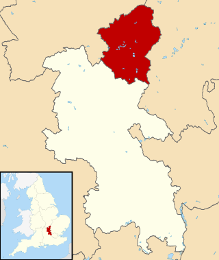
This is a list of all the settlements in Bedfordshire. Population figures are taken from the 2001 UK census and 2011 UK Census. Population figures are given for the civil parishes as well as urban areas. There is no data for some of the smallest civil parishes in the 2011 census. The ONS definition of an urban area is based on the continuously built-up area, and is as follows:-
"The definition of an urban area is an extent of at least 20 hectares and at least 1,500 residents at the time of the 2001 Census. The starting point is the identification by OS (Ordnance Survey) of areas with land use which is irreversibly urban in character. This comprises permanent structures and the land on which they are situated, including land enclosed by or closely associated with such structures; transportation corridors such as roads, railways and canals which have built up land on one or both sides, or which link built-up sites which are less than 200 metres apart; transportation features such as airports and operational airfields, railway yards, motorway service areas and car parks; mine buildings, excluding mineral workings and quarries; and any area completely surrounded by builtup sites. Areas such as playing fields and golf courses are excluded unless completely surrounded by builtup sites. The prerequisite for the recognition of an urban area is that the area of urban land should extend for 20 hectares or more. Separate areas of urban land are linked if less than 200 metres apart. Land between built-up areas is not regarded as urban unless it satisfies one of the conditions listed above." [1]
According to this definition of an Urban Area, Bedfordshire contains two urban areas that have populations over 100,000.
| Settlement | Built-Up Area 2001 [2] | Built-Up Area 2011 [3] | Parish Population | Notes | |||
|---|---|---|---|---|---|---|---|
| Population | Area (km2) | Population | Area (km2) | 2001 | 2011 | ||
| Luton | 236,318 | 48.95 | 258,018 | 50.71 | Luton is an unparished area. The Borough of Luton had a population of 225,262. [4] | ||
| Bedford | 101,928 | 23.54 | 106,940 | 24.82 | This figure is for the Bedford built-up-area. The area of the historic county town of Bedford is unparished, whilst the town of Kempston and the village of Biddenham are parished. [5] | ||
| Leighton Buzzard | 32,573 | 7.95 | 37,469 | 8.64 | 32,753 | 37,469 | The parish is named Leighton–Linslade |
| Flitwick | 19,467 | 4.43 | 20,026 | 4.84 | 12,700 | 12,998 | |
| Biggleswade | 15,383 | 3.57 | 16,551 | 3.94 | 15,383 | 16,551 | |
| Sandy | 10,887 | 2.82 | 11,657 | 3.22 | 10,887 | 11,657 | |
| Shefford | 12,052 | 6.24 | 10,816 | 3.05 | 4,928 | 5,881 | |
| Stotfold | 6,109 | 1.33 | 6,838 | 1.68 | 6,109 | 9,632 | |
| Arlesey | 4,741 | 1.23 | 5,584 | 1.35 | 4,741 | 5,584 | |
| Cranfield | 4,802 | 3.25 | 5,369 | 2.37 | 4,909 | 5,369 | |
| Barton-le-Clay | 4,793 | 1.11 | 4,992 | 1.31 | 4,793 | 4,992 | |
| Potton | 4,473 | 1.01 | 4,870 | 1.43 | 4,473 | 4,870 | |
| Bromham | 4,599 | 1.35 | 4,670 | 1.57 | 4,768 | 4,957 | |
| Toddington | 4,195 | 1.01 | 4,585 | 1.11 | 4,459 | 4,585 | |
| Clapham | 3,643 | 1.12 | 4,560 | 1.34 | 3,643 | 4,560 | |
| Wootton | 4,472 | 1.06 | 4,344 | 1.22 | 4,230 | 4,156 | |
| Eaton Bray | 4,139 | 1.13 | 3,912 | 1.44 | 2,591 | 2,585 | |
| Stondon | 3,857 | 1.44 | 1,821 | 2,295 | The built-up area population includes Henlow Camp | ||
| Marston Moretaine | 3,041 | 0.72 | 3,850 | 0.88 | 3,684 | 4,556 | |
| Caddington | 3,100 | 0.69 | 3,112 | 0.78 | 3,673 | 3,703 | |
| Langford | 2,882 | 0.78 | 3,091 | 1.03 | 2,882 | 3,091 | |
| Oakley | 2,438 | 0.69 | 2,493 | 0.86 | 2,438 | 2,493 | |
| Shortstown | 1,745 | 0.87 | 2,401 | 0.42 | Part of Eastcotts civil parish until 2019 [6] | ||
| Clophill | 1,882 | 0.60 | 2,369 | 0.78 | 1,702 | 1,738 | |
| Maulden | 2,256 | 0.61 | 2,357 | 0.84 | 2,900 | 3,132 | |
| Harlington | 2,322 | 0.66 | 2,297 | 0.68 | 2,322 | 2,297 | |
| Wilshamstead | 1,969 | 0.58 | 2,177 | 0.82 | 2,263 | 3,270 | |
| Westoning | 2,001 | 0.45 | 2,147 | 0.55 | 2,001 | 2,147 | |
| Great Barford | 1,864 | 0.59 | 2,003 | 0.74 | 1,864 | 2,003 | |
| Greenfield | 1,529 | 0.49 | 1,831 | 0.74 | 1,212 | 1,415 | |
| Sharnbrook | 1,795 | 0.83 | 1,940 | 2,293 | |||
| Silsoe | 1,729 | 0.61 | 1,791 | 0.68 | 1,729 | 1,791 | |
| Meppershall | 1,549 | 0.57 | 1,745 | 0.72 | 1,549 | 1,745 | |
| Harrold | 1,691 | 0.63 | 1,235 | 1,691 | |||
| Kensworth | 1,504 | 0.49 | 1,455 | 0.54 | 1,504 | 1,455 | |
| Shillington | 1,447 | 0.53 | 1,831 | 1,842 | |||
| Campton and Chicksands | 1,396 | 0.73 | 1,388 | 1,699 | |||
| Slip End | 1,358 | 0.51 | 1,976 | 1,831 | |||
| Heath and Reach | 1,346 | 0.40 | 1,285 | 1,346 | |||
| Houghton Conquest | 1,311 | 0.46 | 1,299 | 1,514 | |||
| Riseley | 1,286 | 0.62 | 1,284 | 1,286 | |||
| Stewartby | 1,190 | 0.96 | 1,212 | 1,190 | |||
| Lidlington | 1,185 | 0.31 | 1,145 | 1,347 | |||
| Stanbridge | 1,044 | 0.76 | 747 | 713 | |||
| Totternhoe | 982 | 0.52 | 1,180 | 1,172 | |||
| Blunham | 946 | 0.64 | 926 | 946 | |||
| Turvey | 940 | 0.34 | 1,192 | 1,225 | |||
| Haynes | 940 | 0.40 | 1,122 | 1,199 | |||
| Woburn | 933 | 0.31 | 945 | 933 | |||
| Eastcotts | 838 | 2.45 | 3,187 | 3,239 | Eastcotts parish is split between two Built-Up areas, Cotton End and Shortstown. The latter of which became its own parish in 2019. | ||
| Hockliffe | 823 | 0.29 | 730 | 823 | |||
| Milton Ernest | 761 | 0.30 | 754 | 761 | |||
| Willington | 751 | 0.52 | 782 | 751 | |||
| Cople | 722 | 0.39 | 736 | 722 | |||
| Dunton | 696 | 0.23 | 653 | 696 | |||
| Thurleigh | 694 | 0.22 | 696 | 694 | |||
| Northill | 636 | 0.48 | 2,288 | 2,270 | |||
| Moggerhanger | 620 | 0.30 | 636 | 620 | |||
| Gravenhurst | 595 | 0.32 | 581 | 595 | |||
| Tempsford | 590 | 0.26 | 564 | 590 | |||
| Pulloxhill | 569 | 0.32 | 850 | 985 | |||
| Streatley | 559 | 0.30 | 1,707 | 1,840 | |||
| Stevington | 552 | 0.32 | 581 | 552 | |||
| Chalton | 538 | 0.46 | 549 | 538 | |||
| Pavenham | 527 | 0.36 | 593 | 712 | |||
| Everton | 523 | 0.41 | 525 | 523 | |||
| Radwell | 509 | 0.20 | In the parish of Felmersham | ||||
| Studham | 492 | 0.20 | 1,125 | 1,128 | |||
| Little Staughton | 440 | 0.28 | 421 | 440 | |||
| Podington | 435 | 0.22 | 417 | 435 | |||
| Ridgmont | 411 | 0.25 | 418 | 411 | |||
| Stagsden | 363 | 0.23 | 354 | 363 | |||
| Roxton | 348 | 0.24 | 322 | 348 | |||
| Brogborough | 302 | 0.38 | 343 | 302 | |||
| Cardington | 288 | 0.30 | 316 | 288 | |||
| Whipsnade | 279 | 0.28 | 457 | 420 | |||
| Dunstable | 33,805 | 36,253 | Part of the Luton/Dunstable urban area | ||||
| Houghton Regis | 16,970 | 17,283 | Part of the Luton/Dunstable urban area | ||||
| Ampthill | 6,767 | 7,028 | Part of Flitwick's Built-up area | ||||
| Henlow | 3,084 | 3,815 | Forms part of Shefford's built-up area | ||||
| Clifton | 2,730 | 2,878 | Forms part of Shefford's built-up area | ||||
| Elstow | 2,049 | 2,702 | Forms part of Bedford's built-up area | ||||
| Renhold | 1,448 | 2,451 | |||||
| Aspley Guise | 2,185 | 2,195 | Forms part of the Milton Keynes urban area | ||||
| Ravensden | 706 | 1,961 | |||||
| Biddenham | 1,640 | 1,634 | Part of Bedford's Built-up Area | ||||
| Great Denham | 980 | 1,553 | |||||
| Southill | 1,141 | 1,192 | |||||
| Kempston | 19,375 | 1,184 | Forms part of Bedford's built-up area | ||||
| Kempston Rural | 1,286 | 1,184 | |||||
| Wyboston, Chawston and Colesden | 946 | 936 | |||||
| Wymington | 868 | 876 | |||||
| Carlton and Chellington | 827 | 874 | |||||
| Wrestlingworth and Cockayne Hatley | 737 | 744 | |||||
| Bolnhurst and Keysoe | 734 | 719 | |||||
| Aspley Heath | 573 | 578 | |||||
| Sundon | 507 | 480 | |||||
| Chalgrave | 480 | 475 | |||||
| Eversholt | 387 | 442 | |||||
| Dean and Shelton | 386 | 418 | |||||
| Wilden | 412 | 399 | |||||
| Colmworth | 367 | 393 | |||||
| Hyde | 402 | 392 | |||||
| Melchbourne and Yielden | 391 | 392 | |||||
| Sutton | 299 | 366 | |||||
| Tilsworth | 360 | 331 | |||||
| Staploe | 347 | 331 | |||||
| Old Warden | 275 | 328 | |||||
| Great Billington | 632 | 291 | |||||
| Eggington | 288 | 287 | |||||
| Odell | 260 | 287 | |||||
| Bletsoe | 281 | 260 | |||||
| Knotting and Souldrop | 269 | 238 | |||||
| Husborne Crawley | 217 | 237 | |||||
| Steppingley | 233 | 236 | |||||
| Milton Bryan | 144 | 220 | |||||
| Hulcote and Salford | 186 | 209 | |||||
| Pertenhall | 231 | 207 | |||||
| Tingrith | 149 | 153 | |||||
| Millbrook | 130 | 147 | |||||
| Swineshead | 150 | 122 | |||||
| Eyeworth | 86 | ||||||
| Edworth | 69 | ||||||
| Little Barford | 44 | ||||||
| Potsgrove | 44 | ||||||
| Battlesden | 37 | ||||||
| Astwick | 24 | ||||||