Structural basin

Last updated
Geologic provinces of the world (USGS)
.mw-parser-output .col-begin{border-collapse:collapse;padding:0;color:inherit;width:100%;border:0;margin:0}.mw-parser-output .col-begin-small{font-size:90%}.mw-parser-output .col-break{vertical-align:top;text-align:left}.mw-parser-output .col-break-2{width:50%}.mw-parser-output .col-break-3{width:33.3%}.mw-parser-output .col-break-4{width:25%}.mw-parser-output .col-break-5{width:20%}@media(max-width:720px){.mw-parser-output .col-begin,.mw-parser-output .col-begin>tbody,.mw-parser-output .col-begin>tbody>tr,.mw-parser-output .col-begin>tbody>tr>td{display:block!important;width:100%!important}.mw-parser-output .col-break{padding-left:0!important}}
.mw-parser-output .legend{page-break-inside:avoid;break-inside:avoid-column}.mw-parser-output .legend-color{display:inline-block;min-width:1.25em;height:1.25em;line-height:1.25;margin:1px 0;text-align:center;border:1px solid black;background-color:transparent;color:black}.mw-parser-output .legend-text{}
Shield
Platform
Orogen
Basin
Large igneous province
Extended crust
Oceanic crust:
0-20 Ma
20-65 Ma
>65 Ma World geologic provinces.jpg
Geologic provinces of the world (USGS)
Wilpena Pound structural basin in South Australia Wilpena Pound - Aerial View.jpg
Wilpena Pound structural basin in South Australia

A structural basin is a large-scale structural formation of rock strata formed by tectonic warping (folding) of previously flat-lying strata into a syncline fold. They are geological depressions, the inverse of domes. Elongated structural basins are a type of geological trough. Some structural basins are sedimentary basins, aggregations of sediment that filled up a depression or accumulated in an area; others were formed by tectonic events long after the sedimentary layers were deposited.

Contents

Basins may appear on a geologic map as roughly circular or elliptical, with concentric layers. Because the strata dip toward the center, the exposed strata in a basin are progressively younger from the outside in, with the youngest rocks in the center. Basins are often large in areal extent, often hundreds of kilometers across.

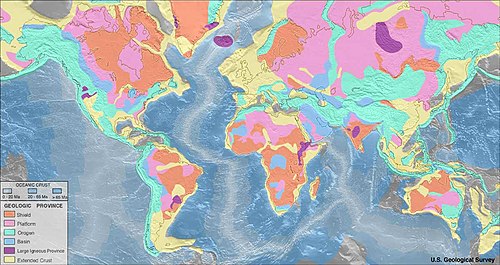
Structural basins are often important sources of coal, petroleum, and groundwater.

Examples

Europe

North America

Trinidad and Tobago

United States

Oceania

Australia

Wilpena Pound structural basin Sunrise hits Wilpena Pound, from Pugilist Hill Lookout. December 2013. Peter Neaum. - panoramio.jpg
Wilpena Pound structural basin

South America

See also

Related Research Articles

<span class="mw-page-title-main">Escarpment</span> Steep slope or cliff separating two relatively level regions

An escarpment is a steep slope or long cliff that forms as a result of faulting or erosion and separates two relatively level areas having different elevations.

<span class="mw-page-title-main">Permian Basin (North America)</span> Large sedimentary basin in the US

The Permian Basin is a large sedimentary basin in the southwestern part of the United States. It is the highest producing oil field in the United States, producing an average of 4.2 million barrels of crude oil per day in 2019. This sedimentary basin is located in western Texas and southeastern New Mexico.

<span class="mw-page-title-main">Geology of the United States</span> National geology

The richly textured landscape of the United States is a product of the dueling forces of plate tectonics, weathering and erosion. Over the 4.5 billion-year history of the Earth, tectonic upheavals and colliding plates have raised great mountain ranges while the forces of erosion and weathering worked to tear them down. Even after many millions of years, records of Earth's great upheavals remain imprinted as textural variations and surface patterns that define distinctive landscapes or provinces.

<span class="mw-page-title-main">Colorado Plateau</span> Plateau in southwestern United States

The Colorado Plateau, also known as the Colorado Plateau Province, is a physiographic and desert region of the Intermontane Plateaus, roughly centered on the Four Corners region of the southwestern United States. This province covers an area of 336,700 km2 (130,000 mi2) within western Colorado, northwestern New Mexico, southern and eastern Utah, northern Arizona, and a tiny fraction in the extreme southeast of Nevada. About 90% of the area is drained by the Colorado River and its main tributaries: the Green, San Juan, and Little Colorado. Most of the remainder of the plateau is drained by the Rio Grande and its tributaries.

<span class="mw-page-title-main">Syncline</span> Structural geology term for a fold with younger layers closer to the center of the structure

In structural geology, a syncline is a fold with younger layers closer to the center of the structure, whereas an anticline is the inverse of a syncline. A synclinorium is a large syncline with superimposed smaller folds. Synclines are typically a downward fold (synform), termed a synformal syncline, but synclines that point upwards can be found when strata have been overturned and folded.

<span class="mw-page-title-main">Morrison Formation</span> Rock formation in the western United States

The Morrison Formation is a distinctive sequence of Upper Jurassic sedimentary rock found in the western United States which has been the most fertile source of dinosaur fossils in North America. It is composed of mudstone, sandstone, siltstone, and limestone and is light gray, greenish gray, or red. Most of the fossils occur in the green siltstone beds and lower sandstones, relics of the rivers and floodplains of the Jurassic period.

<span class="mw-page-title-main">Anticline</span> In geology, an anticline is a type of fold that is an arch-like shape

In structural geology, an anticline is a type of fold that is an arch-like shape and has its oldest beds at its core, whereas a syncline is the inverse of an anticline. A typical anticline is convex up in which the hinge or crest is the location where the curvature is greatest, and the limbs are the sides of the fold that dip away from the hinge. Anticlines can be recognized and differentiated from antiforms by a sequence of rock layers that become progressively older toward the center of the fold. Therefore, if age relationships between various rock strata are unknown, the term antiform should be used.

<span class="mw-page-title-main">Denver Basin</span> Geologic structural basin in the U.S.

The Denver Basin, variously referred to as the Julesburg Basin, Denver-Julesburg Basin, or the D-J Basin, is a geologic structural basin centered in eastern Colorado in the United States, but extending into southeast Wyoming, western Nebraska, and western Kansas. It underlies the Denver-Aurora Metropolitan Area on the eastern side of the Rocky Mountains.

<span class="mw-page-title-main">Sevier orogeny</span> Mountain-building episode in North America

The Sevier orogeny was a mountain-building event that affected western North America from northern Canada to the north to Mexico to the south.

<span class="mw-page-title-main">Kaibab Limestone</span> Geologic formation in the southwestern United States

The Kaibab Limestone is a resistant cliff-forming, Permian geologic formation that crops out across the U.S. states of northern Arizona, southern Utah, east central Nevada and southeast California. It is also known as the Kaibab Formation in Arizona, Nevada, and Utah. The Kaibab Limestone forms the rim of the Grand Canyon. In the Big Maria Mountains, California, the Kaibab Limestone is highly metamorphosed and known as the Kaibab Marble.

<span class="mw-page-title-main">Monocline</span>

A monocline is a step-like fold in rock strata consisting of a zone of steeper dip within an otherwise horizontal or gently dipping sequence.

<span class="mw-page-title-main">Dome (geology)</span> Geological deformation structure

A dome is a feature in structural geology where a circular part of the Earth's surface has been pushed upward, tilting the pre-existing layers of earth away from the center. In technical terms, it consists of symmetrical anticlines that intersect each other at their respective apices. Intact, domes are distinct, rounded, spherical-to-ellipsoidal-shaped protrusions on the Earth's surface. A slice parallel to Earth's surface of a dome features concentric rings of strata. If the top of a dome has been eroded flat, the resulting structure in plan view appears as a bullseye, with the youngest rock layers at the outside, and each ring growing progressively older moving inwards. These strata would have been horizontal at the time of deposition, then later deformed by the uplift associated with dome formation.

<span class="mw-page-title-main">Geology of the Rocky Mountains</span> Discontinuous series of North American mountain ranges with distinct geological origin

The geology of the Rocky Mountains is that of a discontinuous series of mountain ranges with distinct geological origins. Collectively these make up the Rocky Mountains, a mountain system that stretches from Northern British Columbia through central New Mexico and which is part of the great mountain system known as the North American Cordillera.

<span class="mw-page-title-main">Paradox Basin</span> Sedimentary basin in the southwestern United States

The Paradox Basin is an asymmetric foreland basin located mostly in southeast Utah and southwest Colorado, but extending into northeast Arizona and northwest New Mexico. The basin is a large elongate northwest to southeast oriented depression formed during the late Paleozoic Era. The basin is bordered on the east by the tectonically uplifted Uncompahgre Plateau, on the northwest by the San Rafael Swell and extends partway into the Monument Uplift to the west.

Regional geology is the geological study of large-scale regions. Usually, it encompasses multiple geological disciplines to piece together the history of an area. It is the geologic equivalent of regional geography. The size and the borders of each region are defined by geologically significant boundaries and by the occurrence of geologic processes. Examples of geologically significant boundaries are the interfingering facies change in sedimentary deposits when discussing a sedimentary basin system, or the leading or boundary thrust of an orogen.

Living Legends, originally the Lamanite Generation, is a song and dance performing group at Brigham Young University made up of performers of Native American, Polynesian and Hispanic or Latino origin. They perform dances that originate in these cultures as well. Living Legends was formed in 1971 by Janie Thompson.

<span class="mw-page-title-main">Park City Formation</span> Geologic formation in the U.S. states of Montana, Wyoming, Idaho, and Utah

The Park City Formation is a fossiliferous sedimentary formation from the late Permian of Utah, Idaho, Wyoming, and Montana. It is defined by its cherty, gray to pinkish limestone, calcareous siltstone, and cherty sandstone. The rocks in this formation formed along a shallow marine continental shelf and were regularly interrupted by the Phosphoria Formation due to tectonic forces and sea level change.

<span class="mw-page-title-main">Geology of Germany</span> Overview of the geology of Germany

The geology of Germany is heavily influenced by several phases of orogeny in the Paleozoic and the Cenozoic, by sedimentation in shelf seas and epicontinental seas and on plains in the Permian and Mesozoic as well as by the Quaternary glaciations.

<span class="mw-page-title-main">Geology of Colorado</span> Geology of the U.S. State of Colorado

The bedrock under the U.S. State of Colorado was assembled from island arcs accreted onto the edge of the ancient Wyoming Craton. The Sonoma orogeny uplifted the ancestral Rocky Mountains in parallel with the diversification of multicellular life. Shallow seas covered the regions, followed by the uplift current Rocky Mountains and intense volcanic activity. Colorado has thick sedimentary sequences with oil, gas and coal deposits, as well as base metals and other minerals.

<span class="mw-page-title-main">Junggar Basin</span> Sedimentary basin in Xinjiang, China

The Junggar Basin, also known as the Dzungarian Basin or Zungarian Basin, is one of the largest sedimentary basins in Northwest China. It is located in Dzungaria in northern Xinjiang, and enclosed by the Tarbagatai Mountains of Kazakhstan in the northwest, the Altai Mountains of Mongolia in the northeast, and the Heavenly Mountains in the south. The geology of Junggar Basin mainly consists of sedimentary rocks underlain by igneous and metamorphic basement rocks. The basement of the basin was largely formed during the development of the Pangea supercontinent during complex tectonic events from Precambrian to late Paleozoic time. The basin developed as a series of foreland basins – in other words, basins developing immediately in front of growing mountain ranges – from Permian time to the Quaternary period. The basin's preserved sedimentary records show that the climate during the Mesozoic era was marked by a transition from humid to arid conditions as monsoonal climatic effects waned. The Junggar basin is rich in geological resources due to effects of volcanism and sedimentary deposition. According to Guinness World Records it is a land location remotest from open sea with great-circle distance of 2,648 km from the nearest open sea at 46°16′8″N86°40′2″E.

References