Winter Park, Colorado

Last updated

Winter Park, Colorado
Downtown Winter Park, Colorado 2005.jpg
Part of downtown Winter Park with the Continental Divide in the background
Motto: 
Colorado's Highest
Grand County Colorado Incorporated and Unincorporated areas Winter Park Highlighted 0885705.svg
Location of Winter Park in Grand County, Colorado.
Coordinates: 39°52′43″N105°46′58″W / 39.87861°N 105.78278°W / 39.87861; -105.78278
Country United States
State Colorado
County [1] Grand County
FoundedAugust 1, 1978
Incorporated September 1, 1979 [2]
Government
  Type Home rule municipality [1]
   Mayor Nick Kutrumbos[ citation needed ]
Area
[3]
  Total16.89 sq mi (43.74 km2)
  Land16.89 sq mi (43.74 km2)
  Water0.00 sq mi (0.00 km2)
Elevation
[4]
10,128 ft (3,087 m)
Population
 (2020) [5]
  Total1,033
  Density61/sq mi (24/km2)
Time zone UTC-7 (MST)
  Summer (DST) UTC-6 (MDT)
ZIP code [6]
80482 (PO Box)
Area code 970
FIPS code 08-85705
GNIS feature ID2413502 [4]
Website www.wpgov.com
Highest incorporated town in the U.S.

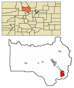
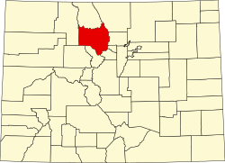
Winter Park is a home rule municipality in Grand County, Colorado, United States. The permanent population was 1,033 at the 2020 census, [5] although with 2,572 housing units within the town limits [7] the seasonal population can be much higher.

Contents

It is home to Winter Park Resort, a ski resort owned by the City of Denver and managed by Alterra Mountain Company. The town and resort are served by the Winter Park Express ski train run by Amtrak. The area also has cross-country skiing opportunities, including Devil's Thumb Ranch. In the spring and summer, Winter Park is known for mountain biking, concerts, hiking, and fishing.

Geography

Winter Park is located in southeastern Grand County at the southern end of the Fraser Valley. It is bordered to the north by the town of Fraser. U.S. Route 40 passes through the town, leading south and east over Berthoud Pass 66 miles (106 km) to Denver and northwest 20 miles (32 km) to Granby.

According to the United States Census Bureau, the town has a total area of 16.5 square miles (42.7 km2). [7]

Its elevation ranges from approximately 8,700 to 12,060 feet (2,650 to 3,680 m) above sea level, and is considered sub-alpine country. It is snow-covered for about six months a year. Although the town center is at about 9,000 feet (2,700 m) above sea level, [8] Winter Park, using administrative boundaries as a measure, became the highest incorporated town in the United States after the July 2006 annexation of 5,214 acres (21.10 km2) of Winter Park Resort to allow new on-mountain improvements. This claim is disputed since Winter Park has no residences above 9,550 feet (2,910 m), while contiguous residential neighborhoods in Leadville, Colorado, extend to 10,360 feet (3,160 m) and in Alma, Colorado, to 11,680 feet (3,560 m), and Alma's town center is at 10,361 feet (3,158 m).

Climate

According to the Köppen Climate Classification system, Winter Park has a subarctic climate, abbreviated "Dfc" on climate maps. Winters are long, bitterly cold, and very snowy with over 200 inches of snowfall yearly and in January nights average below 0. summers are mild to warm with cold, occasionally freezing nights, and have moderate precipitation. Winters are cold enough to have nights averaging below 0.

Climate data for Winter Park, Colorado, 1991–2020 normals
MonthJanFebMarAprMayJunJulAugSepOctNovDecYear
Record high °F (°C)53
(12)
53
(12)
64
(18)
67
(19)
78
(26)
88
(31)
87
(31)
86
(30)
82
(28)
78
(26)
68
(20)
65
(18)
88
(31)
Mean maximum °F (°C)45
(7)
48
(9)
55
(13)
63
(17)
73
(23)
81
(27)
83
(28)
82
(28)
76
(24)
66
(19)
55
(13)
44
(7)
74
(23)
Mean daily maximum °F (°C)30.4
(−0.9)
34.5
(1.4)
39.1
(3.9)
49.9
(9.9)
58.6
(14.8)
69.7
(20.9)
76.1
(24.5)
74.1
(23.4)
64.7
(18.2)
53.8
(12.1)
39.1
(3.9)
32.4
(0.2)
51.9
(11.0)
Daily mean °F (°C)14.8
(−9.6)
17.8
(−7.9)
22.4
(−5.3)
33.6
(0.9)
42.2
(5.7)
50.2
(10.1)
56.6
(13.7)
54.6
(12.6)
45.6
(7.6)
37.0
(2.8)
23.3
(−4.8)
16.5
(−8.6)
34.6
(1.4)
Mean daily minimum °F (°C)−0.9
(−18.3)
1.1
(−17.2)
5.7
(−14.6)
17.2
(−8.2)
25.8
(−3.4)
30.6
(−0.8)
37.0
(2.8)
35.1
(1.7)
26.5
(−3.1)
20.2
(−6.6)
7.4
(−13.7)
0.6
(−17.4)
17.2
(−8.2)
Mean minimum °F (°C)−23
(−31)
−18
(−28)
−15
(−26)
0
(−18)
12
(−11)
22
(−6)
31
(−1)
28
(−2)
17
(−8)
6
(−14)
−10
(−23)
−14
(−26)
−16
(−27)
Record low °F (°C)−33
(−36)
−27
(−33)
−25
(−32)
−20
(−29)
−2
(−19)
12
(−11)
24
(−4)
22
(−6)
2
(−17)
−10
(−23)
−15
(−26)
−24
(−31)
−33
(−36)
Average precipitation inches (mm)2.13
(54)
2.29
(58)
2.54
(65)
3.34
(85)
2.42
(61)
1.49
(38)
2.16
(55)
2.01
(51)
1.77
(45)
1.88
(48)
2.17
(55)
2.20
(56)
26.4
(671)
Average snowfall inches (cm)33.2
(84)
30.8
(78)
31.9
(81)
31.5
(80)
11.2
(28)
1.0
(2.5)
0.0
(0.0)
0.0
(0.0)
1.3
(3.3)
14.2
(36)
26.8
(68)
32.1
(82)
214
(542.8)
Average precipitation days (≥ 0.01 in)13.011.311.011.09.57.210.211.68.78.210.711.7124.1
Average snowy days (≥ 0.1 in)12.311.010.49.63.80.30.00.00.65.39.710.773.7
Source 1: NOAA [9]
Source 2: WRCC (average high, mean, low 19422015) [10]

Demographics

Historical population
CensusPop.Note
1980 480
1990 52810.0%
2000 66225.4%
2010 99950.9%
2020 1,0333.4%
U.S. Decennial Census

Notable people

See also

Related Research Articles

<span class="mw-page-title-main">Aspen, Colorado</span> City in Colorado, United States

Aspen is a home rule municipality that is the county seat and the most populous municipality of Pitkin County, Colorado, United States. The city population was 7,004 at the 2020 United States Census. Aspen is in a remote area of the Rocky Mountains' Sawatch Range and Elk Mountains, along the Roaring Fork River at an elevation just below 8,000 feet (2,400 m) above sea level on the Western Slope, 11 miles (18 km) west of the Continental Divide. Aspen is now a part of the Glenwood Springs, CO Micropolitan Statistical Area.

<span class="mw-page-title-main">Idaho Springs, Colorado</span> City in Colorado, United States

The City of Idaho Springs is the statutory city that is the most populous municipality in Clear Creek County, Colorado, United States. Idaho Springs is a part of the Denver–Aurora–Lakewood, CO Metropolitan Statistical Area. As of the 2020 census it had a population of 1,782. Idaho Springs is located in Clear Creek Canyon, in the mountains upstream from Golden, some 30 miles (50 km) west of Denver.

<span class="mw-page-title-main">Vail, Colorado</span> Town in Colorado, United States

Vail is a home rule municipality in Eagle County, Colorado, United States. The population of the town was 4,835 in 2020. Home to Vail Ski Resort, the largest ski mountain in Colorado, the town is known for its hotels, dining, and for the numerous events the city hosts annually, such as the Vail Film Festival, Vail Resorts Snow Days, and Bravo! Vail.

<span class="mw-page-title-main">Fraser, Colorado</span> Town in Colorado, United States

The Town of Fraser is a Statutory Town located in Grand County, Colorado, United States. The town population was 1,400 at the 2020 United States Census, a +14.38% increase since the 2010 United States Census. The town is situated in Middle Park in the valley of the Fraser River along U.S. Highway 40. Its location northwest of Winter Park, the location of a popular ski resort, has provided growth in recent years with new condominium and other real estate developments.

<span class="mw-page-title-main">Granby, Colorado</span> Town in Colorado, United States

The Town of Granby is the Statutory Town that is the most populous municipality in Grand County, Colorado, United States. The town population was 2,079 at the 2020 United States Census. Granby is situated along U.S. Highway 40 in the Middle Park basin, and it is about 85 miles (137 km) northwest of Denver and 14 miles (23 km) southwest of Rocky Mountain National Park.

<span class="mw-page-title-main">Hot Sulphur Springs, Colorado</span> Town in Colorado, United States

Hot Sulphur Springs is a statutory town and the county seat of Grand County, Colorado, United States. The town is located near Byers Canyon between Granby and Kremmling, 95 miles (153 km) northwest of Denver and 30 miles (48 km) northwest of Winter Park. The town population was 687 at the 2020 census. Its elevation is 7,680 feet (2,340 m).

<span class="mw-page-title-main">Alma, Colorado</span> Town in Park County, Colorado, United States

Alma is a statutory town in Park County, Colorado, United States. The town population was 296 at the 2020 United States Census. Alma is located West and South of the Denver-Aurora-Lakewood, CO Metropolitan Statistical Area and the Front Range Urban Corridor.

<span class="mw-page-title-main">Steamboat Springs, Colorado</span> City in Colorado, United States

Steamboat Springs is a home rule municipality that is the county seat and the most populous municipality of Routt County, Colorado. The population was 13,224 at the 2020 census. Steamboat Springs is the principal city of the Steamboat Springs Micropolitan Statistical Area, and it is the largest city in northwestern Colorado.

<span class="mw-page-title-main">Silverton, Colorado</span> The only incorporated Town and county seat of San Juan County, Colorado, United States

Silverton is a statutory town that is the county seat, the most populous community, and the only incorporated municipality in San Juan County, Colorado, United States. The town is located in a remote part of the western San Juan Mountains, a range of the Rocky Mountains. The first mining claims were made in mountains above the Silverton in 1860, near the end of the Colorado Gold Rush and when the land was still controlled by the Utes. Silverton was established shortly after the Utes ceded the region in the 1873 Brunot Agreement, and the town boomed from silver mining until the Panic of 1893 led to a collapse of the silver market, and boomed again from gold mining until the recession caused by the Panic of 1907. The entire town is included as a federally designated National Historic Landmark District, the Silverton Historic District.

<span class="mw-page-title-main">Breckenridge, Colorado</span> Town in Colorado, United States

Breckenridge is the home rule municipality that is the county seat and the most populous municipality of Summit County, Colorado, United States. The town population was 5,078 at the 2020 United States Census. Breckenridge is the principal town of the Breckenridge, CO Micropolitan Statistical Area. The town also has many part-time residents, as many people have vacation homes in the area. The town is located at the base of the Tenmile Range.

<span class="mw-page-title-main">Waterville Valley, New Hampshire</span> Town in New Hampshire, United States

Waterville Valley is a New England town in Grafton County, New Hampshire, United States. The population was 508 at the 2020 census, up from 247 at the 2010 census.

<span class="mw-page-title-main">Taos Ski Valley, New Mexico</span> Village in Taos County, New Mexico, United States

Taos Ski Valley is a village and alpine ski resort in the southwestern United States, located in Taos County, New Mexico. The population was 69 at the 2010 census. Until March 19, 2008, it was one of four ski resorts in America to prohibit snowboarding. The Kachina lift, constructed in 2014, serves one of the highest elevations of any triple chair in North America, to a peak of 12,481 feet (3,804 m) above sea level.

<span class="mw-page-title-main">Big Sky, Montana</span> Census-designated place in Montana, United States

Big Sky is an unincorporated census-designated place (CDP) in Gallatin and Madison counties in southwestern Montana, United States. As of the 2010 census it had a population of 2,308. It is 45 miles (72 km) southwest of Bozeman. This unincorporated community straddles both counties, is not considered a town, and does not have a town government. The primary industry of the area is tourism.

<span class="mw-page-title-main">Beech Mountain, North Carolina</span> Town in North Carolina, United States

Beech Mountain is a town in both Avery and Watauga counties in the U.S. state of North Carolina. As of the 2010 census, the town population was 320. The town is located atop Beech Mountain and is the highest town east of the Rocky Mountains at 5,506 ft in elevation. The nearest municipality at a higher elevation is Des Moines, New Mexico, some 1,220 miles away.

<span class="mw-page-title-main">Park City, Utah</span> City in Utah, United States

Park City is a city in Utah, United States. The vast majority is in Summit County with some portions extending into Wasatch County. It is considered to be part of the Wasatch Back. The city is 32 miles (51 km) southeast of downtown Salt Lake City and 20 miles (32 km) from Salt Lake City's east edge of Sugar House along Interstate 80. The population was 8,396 at the 2020 census. On average, the tourist population greatly exceeds the number of permanent residents.

<span class="mw-page-title-main">Berthoud Pass</span> Mountain pass in the state of Colorado

Berthoud Pass is a high mountain pass in central Colorado, in the Front Range of the Rocky Mountains of the western United States.

<span class="mw-page-title-main">Mount Werner</span> Mountain in Colorado, United States

Mount Werner is a mountain summit in the Park Range of the Rocky Mountains of North America. The 10,570-foot (3,222 m) peak is located in Routt National Forest, 4.6 miles (7.4 km) east-southeast of the City of Steamboat Springs in Routt County, Colorado, United States. The mountain was renamed in 1964 in honor of skier Buddy Werner.

<span class="mw-page-title-main">Winter Park Resort</span> Ski resort in Colorado, United States

Winter Park Resort is an alpine ski resort in the western United States, in the Rocky Mountains of Colorado at Winter Park. Located in Grand County just off U.S. Highway 40, the resort is about a ninety-minute drive from Denver.

<span class="mw-page-title-main">Geography of Colorado</span> Overview of the geography of the U.S. State of Colorado

The geography of the U.S. State of Colorado is diverse, encompassing both rugged mountainous terrain, vast plains, desert lands, desert canyons, and mesas. Colorado is a landlocked U.S. state. In 1861, the United States Congress defined the boundaries of the new Territory of Colorado exclusively by lines of latitude and longitude, stretching from 37°N to 41°N latitude, and from 102°02'48"W to 109°02'48"W longitude. Starting in 1868, official surveys demarcated the boundaries, deviating from the parallels and meridians in several places. Later surveys attempted to correct some of these mistakes but in 1925 the U.S. Supreme Court affirmed that the earlier demarcation was the official boundary. The borders of Colorado are now officially defined by 697 boundary markers connected by straight boundary lines. Colorado, Wyoming, and Utah are the only states that have their borders defined solely by straight boundary lines with no natural features. The southwest corner of Colorado is the Four Corners Monument at 36°59'56"N, 109°2'43"W. This is the only place in the United States where four states meet: Colorado, New Mexico, Arizona, and Utah.

<span class="mw-page-title-main">Cooke City, Montana</span> Census-designated place in Montana, United States

Cooke City is an unincorporated community and census-designated place (CDP) in Park County, Montana, United States. As of the 2020 census, it had a population of 77. Prior to 2010, it was part of the Cooke City-Silver Gate CDP.

References

  1. 1 2 "Active Colorado Municipalities". State of Colorado, Department of Local Affairs. Retrieved September 1, 2007.
  2. "Colorado Municipal Incorporations". State of Colorado, Department of Personnel & Administration, Colorado State Archives. December 1, 2004. Retrieved September 2, 2007.
  3. "2019 U.S. Gazetteer Files". United States Census Bureau. Retrieved July 1, 2020.
  4. 1 2 U.S. Geological Survey Geographic Names Information System: Winter Park, Colorado
  5. 1 2 United States Census Bureau. "Winter Park town; Colorado" . Retrieved April 23, 2023.
  6. "ZIP Code Lookup" (JavaScript/HTML). United States Postal Service . Retrieved January 9, 2008.
  7. 1 2 "Geographic Identifiers: 2010 Demographic Profile Data (G001): Winter Park town, Colorado". American Factfinder. U.S. Census Bureau. Retrieved November 18, 2016.[ dead link ]
  8. City of Winter Park official web site, Retrieved February 22, 2007.
  9. "U.S. Climate Normals Quick Access". National Oceanic and Atmospheric Administration. Retrieved September 9, 2022.
  10. "Period of Record Monthly Climate Summary". Western Regional Climate Center. Retrieved September 9, 2022.