
East Houston is a community in Houston, Texas, United States.
East Houston is a community in Houston, Texas, United States.
The City of Houston Super Neighborhood #49 East Houston opened on August 24, 2000. [1]
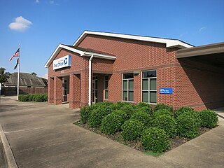
The United States Postal Service operates the East houston Post Office at 9604 Mesa Drive. [2] In July 2011 the USPS announced that the post office may close. [3]
The Houston Independent School District serves East Houston. [4] North Forest High School is the sole zoned high school.
Until July 1, 2013, [4] North Forest Independent School District served East Houston; that district was formerly named the East and Mount Houston Independent School District. [5]
Fresno is an unincorporated community and census-designated place (CDP) in Fort Bend County, Texas, United States. The local population was 24,486 as of the 2020 census, up from 19,069 at the 2010 census, and 6,603 at the 2000 census.

Humble is a city located in the Houston metropolitan area. Humble became an oil boomtown in the early 20th century when oil was first discovered there in 1904. By 1905, the Humble oilfield was the largest producing oilfield in Texas. Humble was home of The Humble Oil and Refining Company, a predecessor of Exxon.

Montrose is an area located in west-central Houston, Texas, United States and is one of the city's major cultural areas. Montrose is a 7.5 square miles (19 km2) area roughly bounded by Interstate 69/U.S. Highway 59 to the south, Allen Parkway to the north, South Shepherd Drive to the west, and Taft to Fairview to Bagby to Highway 59 to Main to the east. Montrose neighborhoods include Cherryhurst, Courtlandt Place, Hyde Park, Montrose, Vermont Commons, North and East Montrose, Mandell Place and Winlow Place. Montrose is also less well known by the moniker Neartown, encompassing Superneighborhood #24.

Spring Branch is a district in west-northwest Harris County, Texas, United States, roughly bordered by Tanner Road and Hempstead Road to the north, Beltway 8 to the west, Interstate 10 to the south, and the 610 Loop to the east; it is almost entirely within the city of Houston. Established by the Texas Legislature, the Spring Branch Management District exercises jurisdiction over the area.

Westbury is a neighborhood in the Brays Oaks district of Southwest Houston, Texas, United States. It is located east of Bob White Road, north of U.S. Highway 90 Alternate, and west of South Post Oak Road, adjacent to the Fondren Southwest and Meyerland neighborhoods, just west of the southwest corner of the 610 Loop.
Harrisburg is a community that is now located within the city of Houston, Texas, United States.
The Memorial area of Houston, Texas is located west of Downtown, northwest of Uptown, and south of Spring Branch. The Memorial Super Neighborhood, as defined by the City of Houston, is bounded by Buffalo Bayou to the south, Barker Reservoir to the west, the Katy Freeway to the north, and the Memorial Villages, a contiguous group of independent municipalities, to the east.

Upper Kirby is a commercial district in Houston, Texas, United States. It is named after Kirby Drive, so indirectly takes its name from John Henry Kirby.

Oak Forest is a large residential community in northwest Houston, Texas, United States. Oak Forest is the third largest group of subdivisions in Harris County.

Inwood Forest is a community about a 3/4 mile west of historic Acres Homes in northwest Houston, Texas, United States.
Eastwood is a historic neighborhood in the East End area of Houston, Texas, United States. Eastwood maintains Houston’s largest intact collection of Craftsman, Arts & Crafts, Foursquare and Mission style architecture.

Kashmere High School is a secondary school in Houston, Texas that serves grades 9 through 12; it is a part of the Houston Independent School District. It is located in the Trinity Gardens neighborhood, and its namesake is the nearby Kashmere Gardens neighborhood.

Park Place is a subdivision located in Houston, Texas, United States.
Fairbanks is a community along U.S. Highway 290 and the Southern Pacific Railroad in Western Houston, Texas, United States. At one point it was a distinct unincorporated area within Harris County.

Almeda is an area located along Texas State Highway 288 and the Missouri Pacific Railroad in Southwest Houston, Texas, United States that used to be a distinct unincorporated community in Harris County. Almeda is 11 miles (18 km) from Downtown Houston.
Dyersdale is an Unincorporated community in Harris County, Texas, United States.

Denver Harbor is a historic community located in eastern Houston, Texas, United States near the Houston Ship Channel. The community, bounded by Wallisville Road, the Union Pacific Railroad, and the Port Terminal Railroad Association, was first settled in the 1890s and platted in 1911 and 1913. The community includes many historic bungalow and cottage homes.

Settegast is a neighborhood in northeast Houston; it has an average population density between one and five. The community is bordered by the 610 Loop, the Union Pacific Railroad Settegast Yard, and the old Beaumont Highway. The community has many small, wood-framed houses and empty lots. Habitat for Humanity has a prominent stake in the area, and a community garden is underway. There are few commercial and industrial uses within Settegast. Also, contemporary housing has started to arise within new construction in the area. The City of Houston designated Settegast as a Houston HOPE neighborhood.
Mount Houston is a community in north central Harris County, Texas. It is east of U.S. Highway 59, near the Dyersdale oil field.

Scenic Woods is a neighborhood located in northeast Houston, Texas, United States, near Homestead Road and Parker Road. The community is populated by working class African Americans. The community is a quiet family oriented place with manicured lawns and well maintained homes.
Coordinates: 29°50′24″N95°15′18″W / 29.840°N 95.255°W
| | This Houston-related article is a stub. You can help Wikipedia by expanding it. |
 | This article about a location in Harris County, Texas is a stub. You can help Wikipedia by expanding it. |
