Ballymena is a former local government district with borough status in Northern Ireland. It was one of twenty-six districts created on 1 October 1973 and covered the town of Ballymena and the surrounding area which includes small towns including Broughshane, Cullybackey, Galgorm, Ahoghill and Portglenone. The borough had an area of 200 square miles (520 km2) and a population of 64,044 according to the 2011 census. The borough had a central location within Northern Ireland and was served by the M2 motorway and with a station on the Belfast-Derry/Londonderry railway line. Belfast International Airport itself was only 18 miles (29 km) away and the Belfast City Airport is 30 miles (48 km) from Ballymena. It was also accessible to the seaports of Larne and Belfast, 20 and 27 miles (43 km) away respectively. As of 2015 it has been replaced by Mid and East Antrim Borough Council.

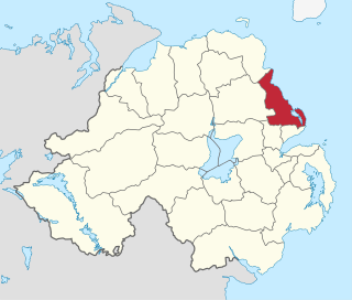
Larne is a town on the east coast of County Antrim, Northern Ireland, with a population of 18,853 at the 2021 census. It is a major passenger and freight roll-on roll-off port. Larne is administered by Mid and East Antrim Borough Council. Together with parts of the neighbouring districts of Antrim and Newtownabbey and Causeway Coast and Glens, it forms the East Antrim constituency for elections to the Westminster Parliament and Northern Ireland Assembly. The civil parish is in the historic barony of Glenarm Upper.

North Antrim is a parliamentary constituency in the United Kingdom House of Commons. The current MP is Ian Paisley Jr of the DUP.
Larne Borough Council was a Local Council in County Antrim in Northern Ireland. It merged with Ballymena Borough Council and Carrickfergus Borough Council in May 2015 under the reorganisation of local government in Northern Ireland to become Mid and East Antrim Borough Council.

Greenisland is a town in County Antrim, Northern Ireland. It lies 7 miles north-east of Belfast and 3 miles south-west of Carrickfergus. The town is on the coast of Belfast Lough and is named after a tiny islet to the west, the Green Island.

The M2 is a motorway in Belfast and County Antrim in Northern Ireland. It is in two sections, the southern section running from north Belfast to Antrim and the northern section acts as a bypass of Ballymena, with the A26 road linking the two sections. In total it is 22 miles (36.2 kilometres). The M2 has the busiest sections of any road or motorway in Northern Ireland. The M2 is one of Northern Ireland's most important motorways, forming most of the main route from Belfast city to both Belfast International Airport and less than a quarter of the way to Derry. It forms part of the unsigned European route E01, E16 and E18 roads.

The A2 is a major road in Northern Ireland, a considerable length of which is often referred to the Antrim Coast Road because much of it follows the scenic coastline of County Antrim; other parts of the road follow the coasts in Counties Down and Londonderry.
Ballyeaston, formerly spelt Ballyistin, is a small village and townland in County Antrim, Northern Ireland. It is 2–3 km north of Ballyclare, on the road to Larne. It lies on the southern hill slopes overlooking Six Mile Water. In the 2001 Census it had a population of 90 people. It is within the Antrim & Newtownabbey Borough Council area.

The A338 is a major primary route in southern England, that runs from the junction with the A35 at Poole in Dorset to the junction with the A420 at Besselsleigh in Oxfordshire, a distance of 84 miles (135 km).

The M22 is a motorway in County Antrim, Northern Ireland. It is 5.6 miles (9 km) long and connects the A6 with the M2. It forms part of the unsigned European route E16.

The A6 road in Northern Ireland runs for 71.4 miles (114.9 km) from Belfast to Derry, via County Antrim and County Londonderry. While stretches of the road before Randalstown have now been superseded by a motorway, the A6 remains one of the most important arterial routes in Northern Ireland, connecting its two largest cities and urban areas. Between Randalstown and Derry, the road forms part of European route E16.

The A26 is a road in Northern Ireland. It travels in a north–south direction from Coleraine, County Londonderry to Banbridge, County Down.

European route E1 is a series of roads in Europe, part of the United Nations International E-road network, running from Larne, Northern Ireland to Seville, Spain. There is a sea crossing between Rosslare Harbour, in Ireland, and Ferrol, but no ferry service. The road also passes through Portugal – past the city of Porto, through the capital, Lisbon, and then south to the Algarve, passing Faro before reaching the Spanish border west of Huelva.
Antrim, sometimes known as Antrim Borough to distinguish it from the former constituency of the same name, was a single-member county constituency of the Parliament of Northern Ireland.

The Ballymena and Larne Railway was a 3 ft narrow gauge railway in County Antrim, Northern Ireland. The first part opened in July 1877 and regular passenger services began in August 1878, the first on the Irish 3 ft gauge railways. Passenger services ended in 1933 and the last part of the railway closed in 1950.
The A8 in Northern Ireland is a 26.1 km route connecting the city of Belfast with the harbour town of Larne. One of the busiest routes in the region, the road forms part of the unsigned European routes E01 and E18.

Newtowncrommelin is a small village and civil parish in County Antrim, Northern Ireland. It lies 8 miles north-northeast of Ballymena and is in the Mid and East Antrim Borough Council area. The village of Newtowncrommelin was founded in the townland of Skerry.

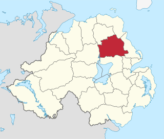
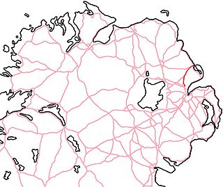
Mid and East Antrim is a local government district in Northern Ireland. The district was created on 1 April 2015 by merging the Borough of Ballymena, the Borough of Larne and the Borough of Carrickfergus. The local authority is Mid and East Antrim Borough Council.

Bleach Green is a railway junction located in Newtownabbey where the Belfast to Larne railway line diverges from the Belfast to Derry route. The Bleach Green Junction is the only burrowing junction in the whole of Ireland.

Kilwaughter is a small village in County Antrim, Northern Ireland, near the town of Larne. It is in an electoral ward situated within the Mid and East Antrim Borough Council area. Kilwaughter is a rural village or Hamlet.


