Aguirre, Salinas, Puerto Rico

Last updated
Aguirre
Barrio
Cayo Matias, Salinas, Puerto Rico.jpg
Cayo Matias
Aguirre, Salinas, Puerto Rico locator map.png
Location of Aguirre within the municipality of Salinas shown in red
Caribbean location map.svg
Red pog.svg
Aguirre
Location of Puerto Rico
Coordinates: 17°57′05″N66°15′01″W / 17.951438°N 66.250322°W / 17.951438; -66.250322 [1]
Commonwealth Flag of Puerto Rico.svg  Puerto Rico
Municipality Flag of Salinas, Puerto Rico.svg Salinas
Area
[1]
  Total36.22 sq mi (93.8 km2)
  Land19.49 sq mi (50.5 km2)
  Water16.73 sq mi (43.3 km2)
Elevation
[2]
3 ft (0.9 m)
Population
 (2010)
  Total14,005
  Density719.3/sq mi (277.7/km2)
 Source: 2010 Census
Time zone UTC−4 (AST)
ZIP code
00704

Aguirre is a barrio in the municipality of Salinas, Puerto Rico. Its population in 2010 was 14,005. [3] [4] [5]

Contents

History

Aguirre was in Spain's gazetteers [6] until Puerto Rico was ceded by Spain in the aftermath of the Spanish–American War under the terms of the Treaty of Paris of 1898 and became an unincorporated territory of the United States. In 1899, the United States Department of War conducted a census of Puerto Rico finding that the population of Aguirre barrio was 1,291. [7]

Aguirre was once a municipality, until it was merged into Salinas during the 1990s. Before that, Aguirre was Puerto Rico's smallest municipality, a distinction now held by Cataño near San Juan.

The Central Aguirre Historic District was listed on the U.S. National Register of Historic Places in 2002.

For many years, Aguirre's main economical support came from the Central Azucarera de Aguirre, a local sugar factory. Aguirre still has a "central" but this one is operated by the Autoridad de Energía Eléctrica de Puerto Rico, a government energy company. On Monday, July 25, 2016, there was a fire at the plant when there was an unnoticed petroleum leak. No one was injured, but the central's plants were unworkable for the following three weeks. [8]

Old building in Aguirre Aguirre, Salinas, Puerto Rico.jpg
Old building in Aguirre

The Central Azucarera de Aguirre was placed on the 2020 World Monuments Watch by the World Monuments Fund organization. The organization will use the site as a focal educational resource to train people in Puerto Rico on building with wood. [9]

Historical population
CensusPop.Note
1900 1,291
1910 3,996209.5%
1920 5,80745.3%
1930 6,79617.0%
1940 7,81114.9%
1950 9,15217.2%
1960 8,645−5.5%
1970 0−100.0%
1980 8,772
1990 10,63821.3%
2000 12,12814.0%
2010 14,00515.5%
U.S. Decennial Census
1899 (shown as 1900) [10] 1910-1930 [11]
1930-1950 [12] 1980-2000 [13] 2010 [14]

Transportation

Aguirre, like the rest of Salinas, is accessible by car and other wheeled vehicles through Puerto Rico Highway 1, which connects the country's two largest cities of San Juan and Ponce. The nearest commercial airport is Mercedita Airport in Ponce, while the nearest airport with multiple international flights is Luis Muñoz Marín International Airport in San Juan.

See also

Related Research Articles

<span class="mw-page-title-main">Salinas, Puerto Rico</span> Town and municipality in Puerto Rico

Salinas is a town and municipality in the southern part of Puerto Rico located in the southern coast of the island, south of Aibonito and Cayey; southeast of Coamo, east of Santa Isabel; and west of Guayama. Salinas is spread over 5 barrios and Salinas Pueblo.

<span class="mw-page-title-main">Oriente, San Juan, Puerto Rico</span> Barrio of Puerto Rico

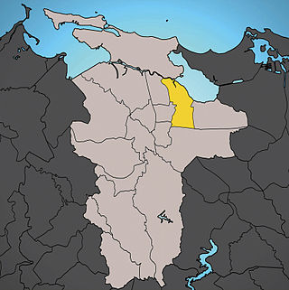
Oriente is one of the 18 barrios of the municipality of San Juan, Puerto Rico. It is composed of 3 subbarrios: Borinquen, López Sicardó, and San José. Before 1951, it was a barrio of the former municipality of Rio Piedras. In 2010, it had a population of 31,374. It is surrounded by the barrios of Sabana Llana Norte to the east, Sabana Llana Sur to the south, Hato Rey Central and Hato Rey Norte to the west, and Santurce barrio and the San Jose Lagoon to the north.

<span class="mw-page-title-main">Dajaos, Bayamón, Puerto Rico</span> Barrio of Puerto Rico

Dajaos is a barrio in the municipality of Bayamón, Puerto Rico. Its population in 2010 was 2,831.

<span class="mw-page-title-main">Minillas, Bayamón, Puerto Rico</span> Barrio of Puerto Rico

Minillas is a barrio in the municipality of Bayamón, Puerto Rico. Its population in 2010 was 39,540.

<span class="mw-page-title-main">Turabo, Caguas, Puerto Rico</span> Barrio of Puerto Rico

Turabo or Villa Turabo is a barrio in the municipality of Caguas, Puerto Rico. Its population in 2010 was 15,739.

<span class="mw-page-title-main">Sabanetas, Mayagüez, Puerto Rico</span> Barrio of Puerto Rico

Sabanetas is a barrio in the municipality of Mayagüez, Puerto Rico. Its population in 2010 was 4,005.

<span class="mw-page-title-main">Juan González, Adjuntas, Puerto Rico</span> Barrio in Puerto Rico

Juan González is a rural barrio in the municipality of Adjuntas, Puerto Rico.

<span class="mw-page-title-main">Juan Asencio, Aguas Buenas, Puerto Rico</span> Barrio of Puerto Rico

Juan Asencio is a barrio in the municipality of Aguas Buenas, Puerto Rico. Its population in 2010 was 2,819.

<span class="mw-page-title-main">Helechal, Barranquitas, Puerto Rico</span> Barrio of Puerto Rico

Helechal is a barrio in the municipality of Barranquitas, Puerto Rico. Its population in 2010 was 4,073.

<span class="mw-page-title-main">Palmas, Salinas, Puerto Rico</span> Barrio of Puerto Rico

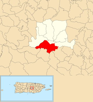
Palmas is a barrio in the municipality of Salinas, Puerto Rico. Its population in 2010 was 313.

<span class="mw-page-title-main">Juan Martín, Luquillo, Puerto Rico</span> Barrio of Puerto Rico

Juan Martín is a barrio in the municipality of Luquillo, Puerto Rico. Its population in 2010 was 874.

<span class="mw-page-title-main">Descalabrado</span> Barrio of Santa Isabel, Puerto Rico

Descalabrado is a barrio in the municipality of Santa Isabel, Puerto Rico. Its population in 2010 was 4,138.

<span class="mw-page-title-main">Algarrobo, Yauco, Puerto Rico</span> Barrio of Puerto Rico

Algarrobo is a barrio in the municipality of Yauco, Puerto Rico. Its population in 2010 was 419.

<span class="mw-page-title-main">Salinas barrio-pueblo</span> Historical and administrative center (seat) of Salinas, Puerto Rico

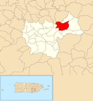
Salinas barrio-pueblo is a barrio and the administrative center (seat) of Salinas, a municipality of Puerto Rico. Its population in 2010 was 2,453.

<span class="mw-page-title-main">Jobos, Guayama, Puerto Rico</span> Barrio of Puerto Rico

Jobos is a barrio in the municipality of Guayama, Puerto Rico. Its population in 2010 was 8,286.

<span class="mw-page-title-main">Vegas, Cayey, Puerto Rico</span> Barrio of Puerto Rico

Vegas is a barrio in the municipality of Cayey, Puerto Rico. Its population in 2010 was 4,083.

<span class="mw-page-title-main">Guamaní</span> Barrio of Guayama, Puerto Rico

Guamaní is a barrio in the municipality of Guayama, Puerto Rico. Its population in 2010 was 1,455.

<span class="mw-page-title-main">Machete, Guayama, Puerto Rico</span> Barrio of Puerto Rico

Machete is a barrio in the municipality of Guayama, Puerto Rico. Its population in 2010 was 3,846.

<span class="mw-page-title-main">Cercadillo, Cayey, Puerto Rico</span> Barrio of Puerto Rico

Cercadillo is a barrio in the municipality of Cayey, Puerto Rico. Its population in 2010 was 820.

<span class="mw-page-title-main">Maresúa</span> Barrio of San Germán, Puerto Rico

Maresúa is a barrio in the municipality of San Germán, Puerto Rico. Its population in 2010 was 1,794.

References

  1. 1 2 "US Gazetteer 2019". US Census. US Government. Archived from the original on 2020-01-16. Retrieved 2020-07-07.
  2. U.S. Geological Survey Geographic Names Information System: Aguirre barrio
  3. Picó, Rafael; Buitrago de Santiago, Zayda; Berrios, Hector H. Nueva geografía de Puerto Rico: física, económica, y social, por Rafael Picó. Con la colaboración de Zayda Buitrago de Santiago y Héctor H. Berrios. San Juan Editorial Universitaria, Universidad de Puerto Rico,1969.
  4. Gwillim Law (20 May 2015). Administrative Subdivisions of Countries: A Comprehensive World Reference, 1900 through 1998. McFarland. p. 300. ISBN   978-1-4766-0447-3 . Retrieved 25 December 2018.
  5. Puerto Rico: 2010 Population and Housing Unit Counts.pdf (PDF). U.S. Dept. of Commerce, Economics and Statistics Administration, U.S. Census Bureau. 2010. Archived (PDF) from the original on 2017-02-20. Retrieved 2019-01-01.
  6. "Anuario del comercio, de la industria, de la magistratura y de la administración. 1881". Biblioteca Nacional de España (in Spanish). p. 1614. Retrieved 4 April 2023.
  7. Joseph Prentiss Sanger; Henry Gannett; Walter Francis Willcox (1900). Informe sobre el censo de Puerto Rico, 1899, United States. War Dept. Porto Rico Census Office (in Spanish). Imprenta del gobierno. p.  163.
  8. Alvarado León, Gerardo E. (July 25, 2016). "Fuego causa nueva avería en la central Aguirre". El Nuevo Día (in Spanish). Archived from the original on 2 January 2019. Retrieved 1 January 2019.
  9. "Central Aguirre Historic District". World Monuments Fund. Archived from the original on 2020-07-16. Retrieved 2020-08-26.
  10. "Report of the Census of Porto Rico 1899". War Department Office Director Census of Porto Rico. Archived from the original on July 16, 2017. Retrieved September 21, 2017.
  11. "Table 3-Population of Municipalities: 1930 1920 and 1910" (PDF). United States Census Bureau. Archived (PDF) from the original on August 17, 2017. Retrieved September 21, 2017.
  12. "Table 4-Area and Population of Municipalities Urban and Rural: 1930 to 1950" (PDF). United States Census Bureau. Archived (PDF) from the original on August 30, 2015. Retrieved September 21, 2014.
  13. "Table 2 Population and Housing Units: 1960 to 2000" (PDF). United States Census Bureau. Archived (PDF) from the original on July 24, 2017. Retrieved September 21, 2017.
  14. Puerto Rico: 2010 Population and Housing Unit Counts.pdf (PDF). U.S. Dept. of Commerce Economics and Statistics Administration U.S. Census Bureau. 2010. Archived (PDF) from the original on 2017-02-20. Retrieved 2019-08-02.