Airport Drive, Missouri | |
---|---|
Village of Airport Drive | |
Coordinates: 37°08′26″N94°30′58″W / 37.14056°N 94.51611°W | |
Country | United States |
State | Missouri |
County | Jasper |
Incorporated | 1947 [1] |
Area | |
• Total | 2.00 sq mi (5.19 km2) |
• Land | 2.00 sq mi (5.19 km2) |
• Water | 0.00 sq mi (0.00 km2) |
Elevation | 958 ft (292 m) |
Population (2020) | |
• Total | 766 |
• Density | 382.24/sq mi (147.62/km2) |
Time zone | UTC-6 (Central (CST)) |
• Summer (DST) | UTC-5 (CDT) |
FIPS code | 29-00424 [4] |
GNIS feature ID | 2397919 [3] |
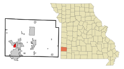
Airport Drive is a village in Jasper County, Missouri, United States. The population was 766 at the 2020 census. [5] It is part of the Joplin, Missouri Metropolitan Statistical Area. The community is still commonly referred to as "Stone's Corner," as the intersection of Route 43 and Route 171 is known.
According to the United States Census Bureau, the village has a total area of 2.00 square miles (5.18 km2), all land. [6]
Climate data for Airport Drive | |||||||||||||
---|---|---|---|---|---|---|---|---|---|---|---|---|---|
Month | Jan | Feb | Mar | Apr | May | Jun | Jul | Aug | Sep | Oct | Nov | Dec | Year |
Mean daily maximum °F (°C) | 41 (5) | 48 (9) | 57 (14) | 68 (20) | 75 (24) | 84 (29) | 89 (32) | 87 (31) | 80 (27) | 69 (21) | 55 (13) | 46 (8) | 66 (19) |
Mean daily minimum °F (°C) | 24 (−4) | 28 (−2) | 35 (2) | 46 (8) | 55 (13) | 64 (18) | 68 (20) | 66 (19) | 59 (15) | 48 (9) | 35 (2) | 28 (−2) | 46 (8) |
Average precipitation inches (mm) | 1.8 (46) | 2.3 (58) | 3.3 (84) | 4 (100) | 4.7 (120) | 5.4 (140) | 3.1 (79) | 3.9 (99) | 5 (130) | 3.7 (94) | 3.2 (81) | 2.6 (66) | 42.9 (1,090) |
Source: Weatherbase [7] |
Census | Pop. | Note | %± |
---|---|---|---|
1950 | 225 | — | |
1960 | 292 | 29.8% | |
1970 | 300 | 2.7% | |
1980 | 702 | 134.0% | |
1990 | 818 | 16.5% | |
2000 | 622 | −24.0% | |
2010 | 698 | 12.2% | |
2020 | 766 | 9.7% | |
U.S. Decennial Census |
As of the census [8] of 2010, there were 698 people, 300 households, and 203 families living in the village. The population density was 349.0 inhabitants per square mile (134.7 inhabitants/km2). There were 312 housing units at an average density of 156.0 units per square mile (60.2 units/km2). The racial makeup of the village was 95.7% White, 1.7% Native American, 0.6% Asian, 0.1% from other races, and 1.9% from two or more races. Hispanic or Latino of any race were 3.4% of the population.
There were 300 households, of which 27.0% had children under the age of 18 living with them, 55.7% were married couples living together, 9.0% had a female householder with no husband present, 3.0% had a male householder with no wife present, and 32.3% were non-families. 26.7% of all households were made up of individuals, and 11.4% had someone living alone who was 65 years of age or older. The average household size was 2.33 and the average family size was 2.77.
The median age in the village was 43.6 years. 20.2% of residents were under the age of 18; 8.5% were between the ages of 18 and 24; 23.2% were from 25 to 44; 28.7% were from 45 to 64; and 19.3% were 65 years of age or older. The gender makeup of the village was 48.6% male and 51.4% female.
As of the census [4] of 2000, there were 622 people, 248 households, and 176 families living in the village. The population density was 312.9 inhabitants per square mile (120.8 inhabitants/km2). There were 270 housing units at an average density of 135.8 units per square mile (52.4 units/km2). The racial makeup of the village was 93.41% White, 0.32% African American, 2.25% Native American, 0.48% Asian, 0.48% from other races, and 3.05% from two or more races. Hispanic or Latino of any race were 0.80% of the population.
There were 248 households, out of which 25.4% had children under the age of 18 living with them, 59.7% were married couples living together, 8.5% had a female householder with no husband present, and 29.0% were non-families. 23.0% of all households were made up of individuals, and 10.5% had someone living alone who was 65 years of age or older. The average household size was 2.40 and the average family size was 2.82.
In the village, the population was spread out, with 18.3% under the age of 18, 10.5% from 18 to 24, 21.4% from 25 to 44, 29.1% from 45 to 64, and 20.7% who were 65 years of age or older. The median age was 45 years. For every 100 females, there were 100.6 males. For every 100 females age 18 and over, there were 104.0 males.
The median income for a household in the village was $38,750, and the median income for a family was $42,083. Males had a median income of $34,167 versus $23,750 for females. The per capita income for the village was $19,678. About 3.9% of families and 6.8% of the population were below the poverty line, including 12.1% of those under age 18 and none of those age 65 or over.
Most of Airport Drive is in the Carl Junction R-I School District while an eastern portion is in the Webb City R-VII School District. [9] Webb City High School is the Webb City district's comprehensive high school.
Vandiver is a village in Audrain County, Missouri, United States. As of the 2010 census, the village population was 77.
Foster is a village in Bates County, Missouri, and part of the Kansas City metropolitan area within the United States. The population was 76 at the 2020 census.
Wardsville is a village in Cole County, Missouri, United States. The population was 1,599 at the 2020 census. It is part of the Jefferson City, Missouri Metropolitan Statistical Area.
Cedar Hill Lakes is a village in Jefferson County, Missouri, United States. The population was 203 at the 2020 census.
Novelty is a village in Knox County, Missouri, United States. As of the 2020 census, its population was 102.
North Lilbourn is a village in New Madrid County, Missouri, United States. The population was 22 at the 2020 census.
Cliff Village is a village in Newton County, Missouri, United States. The population was 40 at the 2010 census. It is part of the Joplin, Missouri Metropolitan Statistical Area.
Green Ridge is a city located along Route 127 in Pettis County, Missouri, United States. The population was 476 at the 2010 census.
Elmira is a village in northwest Ray County, Missouri, and part of the Kansas City metropolitan area within the United States. The population was 39 at the 2020 census.
Bel-Ridge is a suburban city in northern St. Louis County, Missouri, United States. The population was 2,737 at the 2010 census. Bel-Ridge is part of the Normandy Schools Collaborative. Bel-Ridge became a city in 2015 by a vote of the voters.
Bella Villa is a city in St. Louis County, Missouri, in the United States. As of the 2010 census, the city population was 729.
Grantwood Village is a town in St. Louis County, Missouri, United States. The population was 863 at the 2010 census.
Lakeshire is a city in St. Louis County, Missouri, United States. The population was 1,432 at the 2010 census.
Pasadena Hills is a city in St. Louis County, Missouri, United States. The population was 930 at the 2010 census. The entire city is listed on the National Register of Historic Places.
Sycamore Hills is a village in St. Louis County, Missouri, United States. The population is 560 at the 2020 census.
Wilbur Park is a village in St. Louis County, Missouri, United States. The population was 439 at the 2020 census.
Mineral Point is a village in Washington County, Missouri, United States. The population was 351 at the 2010 census.
Washington is a village in Washington County, Nebraska, United States. The population was 129 at the 2020 census.
Houston Lake is a city in Platte County, Missouri, and is part of the Kansas City metropolitan area within the United States. The population was 235 at the 2010 census.
Hanley Hills is a village in St. Louis County, Missouri, United States. The population was 2,101 at the 2010 census.