Alder Carr

Last updated
Alder Carr
Site of Special Scientific Interest
Alder Carr 1.jpg
Area of Search Cambridgeshire
Grid reference TL 542 489 [1]
InterestBiological
Area6.7 hectares [1]
Notification 1985 [1]
Location map Magic Map

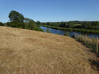
Alder Carr is a 6.7 hectare biological Site of Special Scientific Interest in Hildersham in Cambridgeshire. [1] [2]

Site of Special Scientific Interest Conservation designation denoting a protected area in the United Kingdom

A Site of Special Scientific Interest (SSSI) in Great Britain or an Area of Special Scientific Interest (ASSI) in the Isle of Man and Northern Ireland is a conservation designation denoting a protected area in the United Kingdom and Isle of Man. SSSI/ASSIs are the basic building block of site-based nature conservation legislation and most other legal nature/geological conservation designations in the United Kingdom are based upon them, including national nature reserves, Ramsar sites, Special Protection Areas, and Special Areas of Conservation. The acronym "SSSI" is often pronounced "triple-S I".

Hildersham village in the United Kingdom

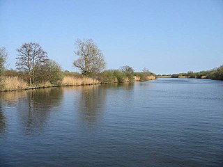
Hildersham is a small village 8 miles to the south-east of Cambridge, England. It is situated just off the A1307 between Linton and Great Abington on a tributary of the River Cam known locally as the River Granta. The parish boundary extends from the Roman Road, known in medieval times as Wool Street, north of the village, to the border with Essex to the south.The village sign was designed by Mrs D.E. Arkright, who along with her husband Mr R.B. Arkright MBE lived in the village for over 40 years.

Cambridgeshire County of England

Cambridgeshire is a county in the East of England, bordering Lincolnshire to the north, Norfolk to the north-east, Suffolk to the east, Essex and Hertfordshire to the south, and Bedfordshire and Northamptonshire to the west. The city of Cambridge is the county town. Modern Cambridgeshire was formed in 1974 as an amalgamation of the counties of Cambridgeshire and Isle of Ely and Huntingdon and Peterborough, the former covering the historic county of Cambridgeshire and the latter covering the historic county of Huntingdonshire and the Soke of Peterborough, historically part of Northamptonshire. It contains most of the region known as Silicon Fen.

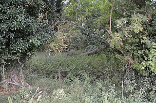
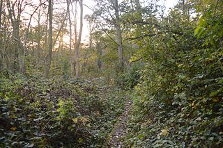
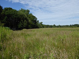
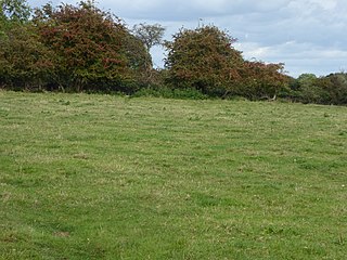
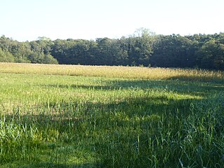
The site is a wet valley which has alder on fen peat, a type of woodland, known as carr which is now rare in East Anglia. Ground flora include angelica and meadowsweet. This habitat is very valuable to invertebrates. [3]

Carr (landform) waterlogged wooden terrain between a swamp and forest

A carr is a type of waterlogged wooded terrain that, typically, represents a succession stage between the original reedy swamp and the likely eventual formation of forest in a sub-maritime climate. The name derives from the Old Norse kjarr, meaning a swamp. The carr is one stage in a hydrosere: the progression of vegetation beginning from a terrain submerged by fresh water along a river or lake margin. In sub-maritime regions, it begins with reed-swamp. As the reeds decay, the soil surface eventually rises above the water, creating fens that allow vegetation such as sedge to grow. As this progression continues, riparian trees and bushes appear and a carr landscape is created – in effect a wooded fen in a waterlogged terrain. At this stage, overall, unlike the overwhelming acidity of decaying reeds, the pH is not too acidic and the soil is not too deficient in minerals, making a habitat for endemic and other wildlife. Characteristic trees include alder, willow and sallow.

<i>Angelica sylvestris</i> species of plant

Angelica sylvestris or wild angelica is a species of flowering plant, native to Europe and central Asia. An annual or short-lived perennial growing to a maximum of 2.5 metres (8.2 ft), it has erect purplish stems and rounded umbels of minuscule white or pale pink flowers in late summer.

The site is private land with no public access.

Related Research Articles

Thompson Water, Carr and Common

Thompson Water, Carr and Common is a 154.7-hectare (382-acre) biological Site of Special Scientific Interest north of Thetford in Norfolk. Most of it is managed by the Norfolk Wildlife Trust as Thompson Common. It is a Nature Conservation Review site, Grade I, and part of the Norfolk Valley Fens Special Area of Conservation. It is crossed by the Great Eastern Pingo Trail Local Nature Reserve.

Newbourne Springs Suffolk Wildlife Trust nature reserve

Newbourne Springs is a 15.7 hectare biological Site of Special Scientific Interest in Newbourne in Suffolk. It is owned by Anglian Water and managed by the Suffolk Wildlife Trust.

Wangford Warren and Carr Suffolk Wildlife Trust nature reserve

Wangford Warren and Carr is a 67.8 hectare biological Site of Special Scientific Interest between Brandon and Lakenheath in Suffolk. It is a Nature Conservation Review site, Grade I, and part of the Breckland Special Area of Conservation, and Special Protection Area An area of 15 hectares is managed as a nature reserve by the Suffolk Wildlife Trust

Old Rectory Meadows

Old Rectory Meadows is a 7.9 hectare Site of Special Scientific Interest in Denham in Buckinghamshire.

Thriplow Peat Holes

Thriplow Peat Holes is a 12.2 hectare biological Site of Special Scientific Interest north-east of Thriplow in Cambridgeshire.

Whitewater Valley English Site of Special Scientific Interest

Whitewater Valley is a 4.3 hectare biological Site of Special Scientific Interest north-west of Wittering in Cambridgeshire.

Dernford Fen

Dernford Fen is a 10.3 hectare biological Site of Special Scientific Interest north-west of Sawston in Cambridgeshire.

Brackland Rough nature reserve in the United Kingdom

Brackland Rough is a 10.7 hectare biological Site of Special Scientific Interest in Fordham in Cambridgeshire. It is managed by the Wildlife Trust for Bedfordshire, Cambridgeshire and Northamptonshire as Fordham Woods.

Alder Wood and Meadow

Alder Wood and Meadow is a 13.2 hectare biological Site of Special Scientific Interest south-west of Corby in Northamptonshire.

Sprats Water and Marshes, Carlton Colville

Sprat's Water and Marshes, Carlton Colville is a 57.1 hectare biological Site of Special Scientific Interest on the western outskirts of Lowestoft in Suffolk. It is part of the Broadland Ramsar internationally important wetland site, and Special Protection Area under the European Union Directive on the Conservation of Wild Birds, and part of The Broads Special Area of Conservation. The northern part of the site is Carlton Marshes, which is part of Carlton and Oulton Marshes, a nature reserve managed by the Suffolk Wildlife Trust.

Barton Mills Valley

Barton Mills Valley is a 10.7 hectare Local Nature Reserve in Mildenhall in Suffolk. It is owned and managed by Forest Heath District Council. The site is in Breckland Forest biological Site of Special Scientific Interest.

Bourne Alder Carr

Bourne Alder Carr is a 13.4-hectare (33-acre) biological Site of Special Scientific Interest east of Sevenoaks in Kent.

Bure Broads and Marshes

Bure Broads and Marshes is a 741.1-hectare (1,831-acre) biological Site of Special Scientific Interest north-east of Norwich in Norfolk. Most of it is a Nature Conservation Review site, Grade I and National Nature Reserve. Two areas are nature reserves managed by the Norfolk Wildlife Trust, Cockshoot Broad and Ranworth Broad. It is part of the Broadland Ramsar site and Special Protection Area and The Broads Special Area of Conservation,

Cantley Marshes

Cantley Marshes is a 272.1-hectare (672-acre) biological Site of Special Scientific Interest south-east of Norwich in Norfolk. It is managed by the Royal Society for the Protection of Birds, It is part of the Broadland Ramsar site and Special Protection Area, The Broads Special Area of Conservation and the Mid-Yare National Nature Reserve.

Crostwick Marsh

Crostwick Marsh is a 11.6-hectare (29-acre) biological Site of Special Scientific Interest in Crostwick, north of Norwich in Norfolk. It is part of the Broadland Ramsar site and Special Protection Area, and The Broads Special Area of Conservation.

Stanley and Alder Carrs, Aldeby

Stanley and Alder Carrs, Aldeby is a 42.7-hectare (106-acre) biological Site of Special Scientific Interest east of Gillingham in Norfolk. It is part of the Broadland Ramsar site and Special Protection Area, and The Broads Special Area of Conservation.

Potters Carr, Cranworth

Potter's Carr, Cranworth is a 6.3-hectare (16-acre) biological Site of Special Scientific Interest south of Dereham in Norfolk.

Hooks Well Meadows, Great Cressingham

Hooks Well Meadows, Great Cressingham is a 15.6-hectare (39-acre) biological Site of Special Scientific Interest near Great Cressingham] in Norfolk.

Dereham Rush Meadow biological Site of Special Scientific Interest north-west of Dereham in Norfolk

Dereham Rush Meadow is a 22.2-hectare (55-acre) biological Site of Special Scientific Interest north-west of Dereham in Norfolk.

Smallburgh Fen

Smallburgh Fen is a 7.6-hectare (19-acre) biological Site of Special Scientific Interest in Smallburgh in Norfolk. It is part of the Broadland Ramsar site and Special Protection Area, and The Broads Special Area of Conservation. It is also a Nature Conservation Review site, Grade 2.

References

  1. 1 2 3 4 "Designated Sites View: Alder Carr". Sites of Special Scientific Interest. Natural England. Retrieved 4 September 2016.
  2. "Map of Alder Carr". Sites of Special Scientific Interest. Natural England. Retrieved 4 September 2016.
  3. "Alder Carr citation" (PDF). Sites of Special Scientific Interest. Natural England. Archived from the original (PDF) on 4 March 2016. Retrieved 4 September 2016.

Coordinates: 52°07′01″N0°15′04″E / 52.117°N 0.251°E / 52.117; 0.251

Geographic coordinate system Coordinate system

A geographic coordinate system is a coordinate system that enables every location on Earth to be specified by a set of numbers, letters or symbols. The coordinates are often chosen such that one of the numbers represents a vertical position and two or three of the numbers represent a horizontal position; alternatively, a geographic position may be expressed in a combined three-dimensional Cartesian vector. A common choice of coordinates is latitude, longitude and elevation. To specify a location on a plane requires a map projection.