Ames, Illinois | |
|---|---|
 Ames  Ames | |
| Coordinates: 38°08′48″N90°03′16″W / 38.14667°N 90.05444°W | |
| Country | United States |
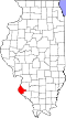
| State | Illinois |
| County | Monroe |
| Precinct | 9 |
| Elevation | 469 ft (143 m) |
| Time zone | UTC-6 (CST) |
| • Summer (DST) | UTC-5 (CDT) |
| Postal code | 62279 |
| Area code | 618 |
Ames is an unincorporated community in the Renault Precinct of Monroe County, Illinois, United States. [1]