Monroe City, Illinois

Last updated
Monroe City, Illinois
Etymology: James Monroe, 5th President
USA Illinois location map.svg
Red pog.svg
Monroe City
Usa edcp location map.svg
Red pog.svg
Monroe City
Coordinates: 38°15′21″N90°15′57″W / 38.25583°N 90.26583°W / 38.25583; -90.26583 Coordinates: 38°15′21″N90°15′57″W / 38.25583°N 90.26583°W / 38.25583; -90.26583
CountryUnited States
StateIllinois
County Monroe
Precinct 15
Elevation
449 ft (137 m)
Time zone UTC-6 (CST)
  Summer (DST) UTC-5 (CDT)
Postal code
62298
Area code 618

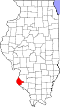
Monroe City is a small unincorporated community in the historic Bluff Precinct of Monroe County, Illinois, United States. [1] As of 2016, the population is approximately 45 people, living in 23 homes. The community is generally considered to comprise the platted towns of Monroe City (1856), Woodville (1857), and the area immediately adjacent to those towns. The core community is located in a valley, or colloquial "hollow," commonly known as the Monroe City Hollow. The central natural feature of the Hollow is the all-season Monroe City Creek. [2] Governmental functions are provided by Monroe County. Electric utilities are provided by the Monroe County Electric Cooperative and public water is offered by the Fountain Water District.

Contents

History

The Monroe City Mill in 1894.The two story section at right would have been built in 1827 by Thomas James. The lean-to and smokestack would have been built in 1851when the mill was converted to steam power. 1894 Mill Best.jpg
The Monroe City Mill in 1894.The two story section at right would have been built in 1827 by Thomas James. The lean-to and smokestack would have been built in 1851when the mill was converted to steam power.

In 1790, a man named Golden built a blockhouse in the hollow to protect local settlers. [3] In 1798, Josia Ryan built a mill near the blockhouse. At that time, the creek was known as "Ryan's Creek." In 1800, Andrew Kinney built a grist mill on the creek. The area became known as "Kinney's Mill." In 1823, General Thomas James purchased Kinney's mill and the area became known as "James' Mill." [3]

By 1883, the community was a thriving frontier town. The mill was the economic engine that drove the community. It was supported by a complement of businesses, schools, churches, and social organizations. [3] Approximately 300 people lived in the general trading area. [2]

The hardwood forests that surrounded Monroe City supported a variety of timber-related businesses. Sawmills were established to provide lumber to the growing community. In 1851, the mill was converted to steam power which drove demand for firewood. Steam boats on the nearby Mississippi River were also supplied with firewood from Monroe City.

The Foster family of Monroe City were early coopers who made flour barrels and sold them to the grist mill operators. The original cooper shed is preserved intact on lot 8 of Woodville. [2]

When the railroads came through Monroe County in the early 20th century, [4] wooden railroad ties were hewn in Monroe City. Harold G. Baum paid woodcutters 15 cents for each tie they could cut from the trees on the family farm. He sold those ties to the railroad in bulk.

In 1933, Harold G. Baum established a woodworking shop at the family farm in Monroe City. His signature item was the "HUCKABAY & BAUM" brand baseball bats, made from hickory and ash harvested on the farm. [5]

Both the milling and timber businesses declined in the early 20th century as production shifted to centralized operations. In 1956, the last school in Monroe City closed. The population has continued to decline as people follow jobs to more urban areas.

Founding

Monroe City was platted in 1856 by J.B. Harlow, consisting of approximately 117 lots, 9 named streets and 7 named alleys. It was laid out as part of the southwest corner of Survey 489, Township 3 South 11 West of the 3rd Principal Meridian. In 1857, Woodville was platted by H. Wetzel, consisting of 27 lots with 1 named street. It was laid out as part of the southeast corner of Survey 567, Township 3 South 11 West. The platted towns are separated by approximately 75 feet. [6]

Geology

The underlying Karst geology has influenced much of the economic and social development of Monroe City. Water flows from underground karst waterways, coming to the surface at more than 24 springs in The Monroe City Creek system, [7] resulting in an all-weather water source.

Related Research Articles

<span class="mw-page-title-main">Carrier Mills, Illinois</span> Village in Illinois, United States

Carrier Mills, formerly Carrier's Mills and Morrilsville, also known as Catskin, is a village in Saline County, Illinois, United States. The population was 1,672 at the 2020 census. Carrier Mills was named after George Washington Carrier's saw and grist mills, and was one of the early Cairo and Vincennes Railroad boomtowns. Founded as a mill town, and then a coal mining community, Carrier Mills has slowly lost 44% of its population since the 1920 census high of 3,000, due to the shuttering of the local coal industry. The village has primarily become a bedroom community, located seven miles (11 km) southwest of Harrisburg, which is the village's main source of employment, entertainment, and shopping. It is the third largest community in the Harrisburg Micropolitan Statistical Area outside of Eldorado and Harrisburg, and included in the Illinois-Indiana-Kentucky Tri-State Area. Carrier Mills also has a large African American population at 15%, compared to its neighbors, due to migration from the nearby community of Lakeview, the oldest African American settlement in the state of Illinois.

<span class="mw-page-title-main">Genesee Township, Michigan</span> Charter township in Michigan, United States

The Charter Township of Genesee, or Genesee Township, is a charter township of Genesee County in the U.S. state of Michigan. In the Public Land Survey System, the township is survey area township 8 north, range 7 east. The population was 21,581 at the 2010 census, down from 24,125 at the 2000 census.

<span class="mw-page-title-main">Maybee, Michigan</span> Village in Michigan, United States

Maybee is a village in Monroe County in the U.S. state of Michigan. The population was 545 at the 2020 census. The village is located within Exeter Township. Maybee was established in 1873 and incorporated as a village in 1899.

<span class="mw-page-title-main">Waverly, Minnesota</span> City in Minnesota, United States

Waverly is a city in Wright County, Minnesota, United States. The population was 1,357 at the 2010 census.

<span class="mw-page-title-main">Ozarks</span> Highland region in central-southern United States

The Ozarks, also known as the Ozark Mountains, Ozark Highlands or Ozark Plateau, is a physiographic region in the U.S. states of Missouri, Arkansas, Oklahoma and the extreme southeastern corner of Kansas. The Ozarks cover a significant portion of northern Arkansas and most of the southern half of Missouri, extending from Interstate 40 in central Arkansas to Interstate 70 in central Missouri.

<span class="mw-page-title-main">Greenbrier River</span> River in West Virginia, United States

The Greenbrier River is a tributary of the New River, 162 miles (261 km) long, in southeastern West Virginia, in the United States. Via the New, Kanawha and Ohio rivers, it is part of the watershed of the Mississippi River, draining an area of 1,656 square miles (4,290 km2). It is one of the longest rivers in West Virginia.

<span class="mw-page-title-main">Beanblossom, Indiana</span> Unincorporated community in Indiana, United States

Beanblossom, also spelled Bean Blossom, is an unincorporated community in Jackson Township, Brown County, in the U.S. state of Indiana. The town was named for the nearby Beanblossom Creek, which was in turn named for a person whose surname was Beanblossom.

<span class="mw-page-title-main">Collamer, Indiana</span> Place in Indiana, United States

Collamer is an unincorporated community in Cleveland Township, Whitley County, Indiana, United States, located on the Eel River and at the intersection of Indiana State Road 14 and Whitley County road 900 W. Smith Rambo platted the town February 9, 1846. Collamer is named after Jacob Collamer, 13th United States Postmaster General.

<span class="mw-page-title-main">Rushland, Pennsylvania</span> Unincorporated community in Pennsylvania, United States

Rushland is an unincorporated community located in the northwestern corner of Wrightstown Township, Bucks County, Pennsylvania, United States.

<span class="mw-page-title-main">Millville, Illinois</span> Archaeological site in Illinois, United States

Millville is a defunct settlement in Jo Daviess County, Illinois, United States, located within the boundaries of Apple River Canyon State Park. Founded in 1835 and platted in 1846, the community was washed away completely by a flood in 1892. No visible remnants of its structures remain today. The site of Millville was added to the U.S. National Register of Historic Places as the Millville Town Site in 2003.

<span class="mw-page-title-main">Paint Bank, Virginia</span> Unincorporated community in Virginia, United States

Paint Bank is an unincorporated community in northern Craig County, Virginia, United States. It is located at the intersection of State Route 18 and State Route 311 northwest of the town of New Castle, the county seat. The village is located between Potts Mountain and Peters Mountain. It is one of the westernmost communities of the Roanoke metropolitan area.

Brandon is an unincorporated community located in Hill County in Central Texas. It is located at the intersection of State Highway 22 and FM 1243, approximately ten miles east of Hillsboro.

<span class="mw-page-title-main">Greenbrier River Watershed Association</span> Nonprofit organization in West Virginia, U.S.

The Greenbrier River Watershed Association (GRWA) is one of the oldest watershed associations in the state of West Virginia, founded in 1990. It has supported the creation of other watershed associations throughout the state and maintains a policy of "upstream courtesy" and "downstream courtesy" with its neighbors.

<span class="mw-page-title-main">Dilley, Oregon</span> Unincorporated community in the state of Oregon, United States

Dilley is an unincorporated community in Washington County, Oregon, United States. It is located south of Forest Grove and north of the city of Gaston on Oregon Route 47 in the Portland metropolitan area. Settled in the late 1840s, the community was platted in 1874 after the arrival of the railroad. The population of the area in 2000 was approximately 2,000.

Turtle Creek is a 13.7-mile-long (22.0 km) tributary of the Little Miami River in Turtlecreek Township, Warren County, Ohio, which takes its name from this creek. Turtle Creek is named for Chief Little Turtle, of the Miami Indian Tribe Turtle Creek is a tributary within the Little Miami and Ohio River watersheds.

<span class="mw-page-title-main">Monroe City Mill</span>

The Monroe City Mill was a grist mill located in Monroe City, Illinois, an unincorporated community in the historic Bluff Precinct of Monroe County, Illinois, United States. Monroe County was founded in 1816. Prior to that, the area was part of St. Clair County in the Illinois Territory.

Carico is an unincorporated community in Stone County, in the U.S. state of Missouri. Carico is located at the junction of Railey Creek and Carico Hollow, approximately 3.5 miles east-southeast of Galena and 6.5 miles northwest of Reeds Spring along the Missouri Pacific Railroad.

<span class="mw-page-title-main">Oaks Creek</span> River in New York State

Oaks Creek is a river that drains Canadarago Lake, which is situated in the north central region of Otsego County, New York. The creek begins by the Hamlet of Schuyler Lake and flows southeast approximately 9.32 miles (15.00 km), dropping only 105 feet (32 m) in elevation, before converging with the Susquehanna River south of the Village of Cooperstown, by the Hamlet of Index. From the source to Oaksville the creek flows along Panther Mountain. Fly Creek is a main tributary, that converges with Oaks Creek south of the Hamlet of Fly Creek.

<span class="mw-page-title-main">Jeffrey, Kentucky</span> Unincorporated community in Kentucky, United States

Jeffrey is an unincorporated community located near Peter/s Creek on Bethlehem Church Road, approximately eight miles (13 km) northwest of Tompkinsville, Monroe County, Kentucky, United States.

References

  1. "Monroe City, Illinois". Geographic Names Information System . United States Geological Survey, United States Department of the Interior.
  2. 1 2 3 Craig Baum private census, May 2016.
  3. 1 2 3 Combined History of Randolph, Monroe and Perry Counties, Illinois, J. L. McDonough & Co., Philadelphia, 1883
  4. Knobloch, Dennis M. (2009). Centennial History of Valmeyer, Illinois. p. 30.
  5. "History of HUCKABAY & BAUM Brand Baseball Bats".
  6. Historical Atlas Map of Monroe County Ills. W.R. Brink & Company of Illinois. 1875. p. 33.
  7. W.T. Frankie; D.A. Grimley; R.J. Jacobson; R.D. Norby; S.V. Panno & M.A. Phillips (1997). Guide to the Geology of the Columbia and Waterloo Area, Monroe County, Illinois. Illinois State Geological Survey.