Andyville, Minnesota | |
|---|---|
 Andyville  Andyville | |
| Coordinates: 43°43′26″N92°59′23″W / 43.72389°N 92.98972°W | |
| Country | United States |
| State | Minnesota |
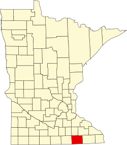
| County | Mower |
| Township | Lansing |
| Elevation | 1,243 ft (379 m) |
| Time zone | UTC-6 (Central (CST)) |
| • Summer (DST) | UTC-5 (CDT) |
| Area code | 507 |
| GNIS feature ID | 639369 [1] |
Andyville is an unincorporated community in Mower County, Minnesota, United States. [1]