Brownsdale, Minnesota

Last updated

Brownsdale, Minnesota
Motto: 
"Garden Spot of Mower County"
Mower County Minnesota Incorporated and Unincorporated areas Brownsdale Highlighted.svg
Location in Mower County and the state of Minnesota
Coordinates: 43°44′25″N92°52′15″W / 43.74028°N 92.87083°W / 43.74028; -92.87083
Country United States
State Minnesota
County Mower
Area
[1]
  Total0.40 sq mi (1.0 km2)
  Land0.40 sq mi (1.0 km2)
  Water0.0 sq mi (0 km2)
Elevation
[2]
1,293 ft (394 m)
Population
 (2020) [3]
  Total633
  Density1,566.83/sq mi (604.23/km2)
Time zone UTC-6 (Central (CST))
  Summer (DST) UTC-5 (CDT)
ZIP code
55918
Area code 507
FIPS code 27-08164 [4]
GNIS feature ID2393440 [2]
Website www.brownsdalemn.com

Brownsdale is a city in Mower County, Minnesota, United States. The population was 633 at the 2020 census. [3]

Contents

History

Brownsdale was platted in 1856, and named for Andrew D. Brown, a businessman in the lumber industry. [5] A post office has been in operation at Brownsdale since 1857. [6] Brownsdale was incorporated in 1876. [5]

Geography

Brownsdale is in northwestern Mower County, 9 miles (14 km) northeast of Austin, the county seat. It is surrounded by Red Rock Township but is independent from it. Minnesota State Highway 56 passes through the center of Brownsdale, leading north 6 miles (10 km) to Waltham and south 4.5 miles (7.2 km) to Interstate 90 near Nicolville.

According to the U.S. Census Bureau, Brownsdale has an area of 0.40 square miles (1.04 km2), all land. [1] The north side of the city drains to Roberts Creek, while the south side drains to Wolf Creek; both creeks are west-flowing tributaries of the Cedar River.

Demographics

Historical population
CensusPop.Note
1880 346
1890 282−18.5%
1900 261−7.4%
1910 2641.1%
1920 2712.7%
1930 2730.7%
1940 35530.0%
1950 49338.9%
1960 62226.2%
1970 6250.5%
1980 69110.6%
1990 6950.6%
2000 7183.3%
2010 676−5.8%
2020 633−6.4%
U.S. Decennial Census [7]

2010 census

As of the census [8] of 2010, there were 676 people, 286 households, and 190 families living in the city. The population density was 1,438.3 inhabitants per square mile (555.3/km2). There were 315 housing units at an average density of 670.2 per square mile (258.8/km2). The racial makeup of the city was 98.1% White, 0.1% African American, 1.3% from other races, and 0.4% from two or more races. Hispanic or Latino of any race were 5.5% of the population.

There were 286 households, of which 30.1% had children under the age of 18 living with them, 48.6% were married couples living together, 13.3% had a female householder with no husband present, 4.5% had a male householder with no wife present, and 33.6% were non-families. 25.2% of all households were made up of individuals, and 14.7% had someone living alone who was 65 years of age or older. The average household size was 2.36 and the average family size was 2.83.

The median age in the city was 41.4 years. 24.6% of residents were under the age of 18; 5% were between the ages of 18 and 24; 24.1% were from 25 to 44; 28.5% were from 45 to 64; and 17.8% were 65 years of age or older. The gender makeup of the city was 46.7% male and 53.3% female.

2000 census

As of the census [4] of 2000, there were 718 people, 290 households, and 198 families living in the city. The population density was 1,574.4 inhabitants per square mile (607.9/km2). There were 312 housing units at an average density of 684.1 per square mile (264.1/km2). The racial makeup of the city was 95.40% White, 3.48% from other races, and 1.11% from two or more races. Hispanic or Latino of any race were 3.48% of the population.

There were 290 households, out of which 30.7% had children under the age of 18 living with them, 55.9% were married couples living together, 8.3% had a female householder with no husband present, and 31.7% were non-families. 26.9% of all households were made up of individuals, and 13.4% had someone living alone who was 65 years of age or older. The average household size was 2.48 and the average family size was 2.97.

In the city, the population was spread out, with 26.3% under the age of 18, 8.9% from 18 to 24, 26.0% from 25 to 44, 20.8% from 45 to 64, and 18.0% who were 65 years of age or older. The median age was 37 years. For every 100 females, there were 102.8 males. For every 100 females age 18 and over, there were 98.9 males.

The median income for a household in the city was $32,857, and the median income for a family was $43,864. Males had a median income of $31,842 versus $22,031 for females. The per capita income for the city was $15,778. About 4.5% of families and 7.4% of the population were below the poverty line, including 4.3% of those under age 18 and 10.3% of those age 65 or over.

See also

Related Research Articles

<span class="mw-page-title-main">McGregor, Minnesota</span> City in Minnesota, United States

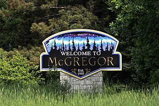
McGregor is a city in Aitkin County, Minnesota, United States. The population was 391 at the 2010 census.

<span class="mw-page-title-main">Hitterdal, Minnesota</span> City in Minnesota, United States

Hitterdal is a city in Clay County, Minnesota, United States. The population was 199 at the 2020 census.

<span class="mw-page-title-main">Mabel, Minnesota</span> City in Minnesota, United States

Mabel is a city in Fillmore County, Minnesota, United States. The population was 780 at the 2010 census.

<span class="mw-page-title-main">Trimont, Minnesota</span> City in Minnesota, United States

Trimont is a city in Martin County, Minnesota, United States. The population was 705 at the 2020 census. The small community is located in southern Minnesota between Sherburn and St. James on Minnesota State Highway 4.

<span class="mw-page-title-main">Brownton, Minnesota</span> City in Minnesota, United States

Brownton is a city in McLeod County, Minnesota, United States. The population was 731 at the 2020 census.

<span class="mw-page-title-main">Adams, Minnesota</span> City in Minnesota, United States

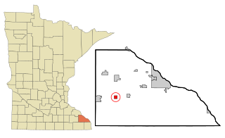
Adams is a city in Adams Township, Mower County, Minnesota, United States. The population was 683 at the 2020 census, down from 787 in 2010.

<span class="mw-page-title-main">Dexter, Minnesota</span> City in Minnesota, United States

Dexter is a city Mower County, Minnesota, United States. The population was 324 at the 2020 census.

<span class="mw-page-title-main">Le Roy, Minnesota</span> City in Minnesota, United States

Le Roy is a city in Mower County, Minnesota, United States, surrounded by Le Roy Township. The population was 957 at the 2020 census. Lake Louise State Park is just outside the town.

<span class="mw-page-title-main">Lyle, Minnesota</span> City in Minnesota, United States

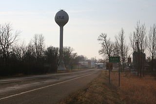
Lyle is a city in Mower County, Minnesota, United States. The city lies within a mile of the Iowa border, which also is its southern city limit. Lyle Township adjoins the city on its east, north, and west sides. The population was 551 at the 2010 census.

<span class="mw-page-title-main">Racine, Minnesota</span> City in Minnesota, United States

Racine is a city in Racine Township, Mower County, Minnesota, United States. The population was 442 at the 2010 census.

<span class="mw-page-title-main">Sargeant, Minnesota</span> City in Minnesota, United States

Sargeant is a city in Sargeant Township, Mower County, Minnesota, United States. The population was 61 at the 2010 census.

<span class="mw-page-title-main">Taopi, Minnesota</span> City in Minnesota, United States

Taopi is a city in Lodi Township, Mower County, Minnesota, United States. The population was 58 at the 2010 census. It is located near the source of the Wapsipinicon River.

Udolpho Township is a township in Mower County, Minnesota, United States. The population was 458 at the 2000 census. There are no recognized cities or towns and the whole township is an unincorporated area. Blooming Prairie is only about a quarter of a mile away in Steele County to the north. The township's name is taken from a gothic novel titled The Mysteries of Udolpho by the English author Ann Radcliffe.

<span class="mw-page-title-main">Waltham, Minnesota</span> City in Minnesota, United States

Waltham is a city in Waltham Township, Mower County, Minnesota, United States. The population was 151 at the 2010 census.

<span class="mw-page-title-main">Courtland, Minnesota</span> City in Minnesota, United States

Courtland is a city in Nicollet County, Minnesota, United States. The population was 734 at the 2020 census. It is part of the Mankato-North Mankato Metropolitan Statistical Area.

<span class="mw-page-title-main">Denham, Minnesota</span> City in Minnesota, United States

Denham is a city in Pine County, Minnesota, United States. The population was 37 at the 2020 census.

<span class="mw-page-title-main">Sturgeon Lake, Minnesota</span> City in Minnesota, United States

Sturgeon Lake is a city in Pine County, Minnesota, United States. The population was 439 at the 2010 census.

<span class="mw-page-title-main">Iron Junction, Minnesota</span> City in Minnesota, United States

Iron Junction is a city in Saint Louis County, Minnesota, United States. The population was 110 at the 2020 census.

<span class="mw-page-title-main">Newport, Minnesota</span> City in Minnesota, United States

Newport is a city in Washington County, Minnesota, United States. The population was 3,797 at the 2020 census. According to 2022 census estimates, the city is estimated to have a population of 4,820.

<span class="mw-page-title-main">Utica, Minnesota</span> City in Minnesota, United States

Utica is a city in Winona County, Minnesota, United States. The population was 266 at the 2020 census.

References

  1. 1 2 "2023 U.S. Gazetteer Files: Minnesota". United States Census Bureau. Retrieved February 8, 2024.
  2. 1 2 U.S. Geological Survey Geographic Names Information System: Brownsdale, Minnesota
  3. 1 2 "P1. Race – Brownsdale city, Minnesota: 2020 DEC Redistricting Data (PL 94-171)". U.S. Census Bureau. Retrieved February 8, 2024.
  4. 1 2 "U.S. Census website". United States Census Bureau . Retrieved January 31, 2008.
  5. 1 2 Upham, Warren (1920). Minnesota Geographic Names: Their Origin and Historic Significance. Minnesota Historical Society. p.  360.
  6. "Mower County". Jim Forte Postal History. Retrieved July 22, 2015.
  7. "Census of Population and Housing". Census.gov. Retrieved June 4, 2015.
  8. "U.S. Census website". United States Census Bureau . Retrieved November 13, 2012.

43°44′25″N92°52′10″W / 43.74028°N 92.86944°W / 43.74028; -92.86944