Lansing, Minnesota | |
|---|---|
 Lansing  Lansing | |
| Coordinates: 43°44′53″N92°57′57″W / 43.74806°N 92.96583°W | |
| Country | United States |
| State | Minnesota |
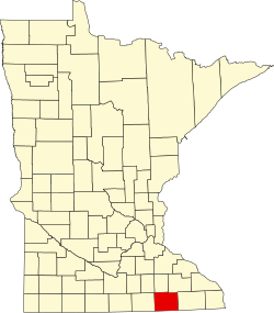
| County | Mower |
| Township | Lansing |
| Area | |
• Total | 0.79 sq mi (2.03 km2) |
| • Land | 0.79 sq mi (2.03 km2) |
| • Water | 0.00 sq mi (0.00 km2) |
| Elevation | 1,227 ft (374 m) |
| Population | |
• Total | 132 |
| • Density | 168.15/sq mi (64.91/km2) |
| Time zone | UTC-6 (Central (CST)) |
| • Summer (DST) | UTC-5 (CDT) |
| ZIP Code | 55950 |
| Area code | 507 |
| GNIS feature ID | 2628683 [2] |
| FIPS code | 27-35558 |
Lansing is an unincorporated community and census-designated place (CDP) in Lansing Township, Mower County, Minnesota, United States. Its population was 132 as of the 2020 census. [1]