Nicolville, Minnesota | |
|---|---|
 Nicolville  Nicolville | |
| Coordinates: 43°40′29″N92°52′42″W / 43.67472°N 92.87833°W | |
| Country | United States |
| State | Minnesota |
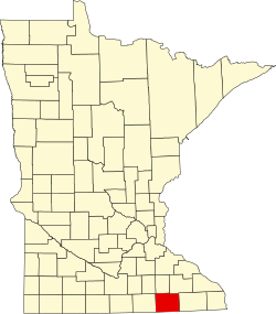
| County | Mower |
| Townships | Red Rock, Windom |
| Elevation | 1,243 ft (379 m) |
| Time zone | UTC-6 (Central (CST)) |
| • Summer (DST) | UTC-5 (CDT) |
| Area code | 507 |
| GNIS feature ID | 648549 [1] |
Nicolville is an unincorporated community in Mower County, Minnesota, United States. [1] The community is on a side road off of 220th St/ County Road 46, approximately one quarter mile north of I-90 and approximately three miles east of Austin. [2]