Arnettsville | |
|---|---|
 Arnettsville Location within the state of West Virginia  Arnettsville Arnettsville (the United States) | |
| Coordinates: 39°35′8″N80°5′32″W / 39.58556°N 80.09222°W | |
| Country | |
| State | |
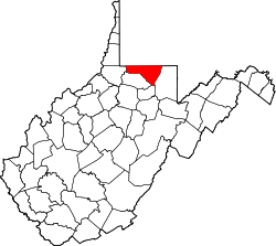
| County | |
| Time zone | UTC-5 (Eastern (EST)) |
| • Summer (DST) | UTC-4 (EDT) |
Arnettsville is an unincorporated community in Monongalia County, West Virginia, United States. It lies south of Georgetown on U.S. Route 19. Arnettsville was originally known as Yukon. It is included in the Morgantown, West Virginia Metropolitan Statistical Area.
Arnettsville was named for a pioneer merchant named Arnett. [1]