Chestnut Ridge, West Virginia

Last updated
Chestnut Ridge
USA West Virginia location map.svg
Red pog.svg
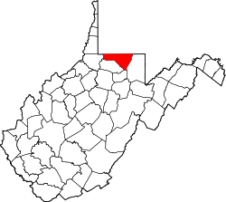
Chestnut Ridge
Location within the state of West Virginia
Usa edcp location map.svg
Red pog.svg
Chestnut Ridge
Chestnut Ridge (the United States)
Coordinates: 39°38′57″N79°56′30″W / 39.64917°N 79.94167°W / 39.64917; -79.94167 Coordinates: 39°38′57″N79°56′30″W / 39.64917°N 79.94167°W / 39.64917; -79.94167
Country Flag of the United States.svg  United States
State Flag of West Virginia.svg  West Virginia
County Flag of Monongalia County, West Virginia.svg Monongalia
Elevation
1,207 ft (368 m)
Time zone UTC-5 (Eastern (EST))
  Summer (DST) UTC-4 (EDT)
GNIS ID 1554127 [1]

Chestnut Ridge is an unincorporated community in Monongalia County, West Virginia, United States, adjacent to the city of Morgantown.

Related Research Articles

Appalachian Mountains Mountain range in the eastern United States and Canada

The Appalachian Mountains, often called the Appalachians, are a system of mountains in eastern to northeastern North America. The Appalachians first formed roughly 480 million years ago during the Ordovician Period. They once reached elevations similar to those of the Alps and the Rocky Mountains before experiencing natural erosion. The Appalachian chain is a barrier to east–west travel, as it forms a series of alternating ridgelines and valleys oriented in opposition to most highways and railroads running east–west.

Southwest Mountains Mountain range in Virginia, U.S.

The Southwest Mountains of Virginia are a mountain range centered on Charlottesville, parallel to and geologically associated with the Blue Ridge Mountains, which lie about 30 miles (50 km) to the west. Some of the more prominent peaks include Carters Mountain, Fan Mountain, Brush Mountain, Peters Mountain, Walton's Mountain, and Hightop Mountain.

Fort Mill Ridge Civil War Trenches United States historic place

The Fort Mill Ridge Civil War Trenches are battle trenches in West Virginia that were originally dug between 1861 and 1862 to be later used in 1863 for the civil war. These trenches lined with chestnut logs by the Confederate artillery during the American Civil War to defend the approaches to Romney on the Northwestern Turnpike and the South Branch Potomac River. The trenches were then refurbished between March and June 1863 by the 54th Pennsylvania Infantry and the 1st West Virginia Infantry. When Colonel Jacob M. Campbell garrisoned Union forces at Romney, camps were set up at nearby at Mechanicsburg Gap. The Confederates might have created these trenches but all throughout the war the Union had control of these trenches.

West Virginia Route 705 is a short east–west state highway partially located within the Monongalia County city of Morgantown in the U.S. state of West Virginia. The western terminus of the route is at U.S. Route 19 and West Virginia Route 7, directly in front of the WVU Coliseum. The eastern terminus is at U.S. Route 119 near the Morgantown Municipal Airport. The route is major road in northern Morgantown. It is maintained by the West Virginia Department of Transportation.

Environment of West Virginia

The Environment of West Virginia encompasses terrain and ecosystems ranging from plateaus to mountains. Most of West Virginia lies within the Appalachian mixed mesophytic forests ecoregion, while the higher elevations along the eastern border and in the panhandle lie within the Appalachian-Blue Ridge forests.

Little Cacapon Mountain

Little Cacapon Mountain is a mountain ridge of the Ridge-and-valley Appalachians in Hampshire County, West Virginia, United States. The mountain takes its name from the Little Cacapon River, a Potomac River tributary that lies on its western flanks. Little Cacapon Mountain reaches its highest point of 1,575 feet (480 m) in the vicinity of Barnes Mill. It spans from the Frenchburg area, where it is joined by Chestnut Oak Ridge, to the Slanesville Pike where Crooked Run forms a gap between Little Cacapon Mountain and Queens Ridge near Higginsville.

Bearwallow Creek is a 4.3-mile-long (6.9 km) tributary stream of Tearcoat Creek, itself a tributary of the North River, making it a part of the Potomac River and Chesapeake Bay watersheds. Bearwallow Creek is located in Hampshire County, West Virginia. It rises on Chestnut Oak Ridge, from which it flows southwest along the ridge's eastern flanks and then begins its course southeast along Bear Wallow Hollow Road and U.S. Route 50 until its confluence with Tearcoat Creek at Pleasant Dale.

Virginia State Route 89

State Route 89 is a primary state highway in the U.S. state of Virginia. The state highway runs 7.85 miles (12.63 km) from the North Carolina state line, where the highway continues as North Carolina Highway 89, north to U.S. Route 58 and US 221 in Galax.

The Chestnut Ridge people (CRP) are a mixed-race community concentrated in an area northeast of Philippi, Barbour County in north-central West Virginia, with smaller related communities in the adjacent counties of Harrison and Taylor. They are often referred to as "Mayles", or "Guineas".

Appalachian–Blue Ridge forests Temperate broadleaf and mixed forests ecoregion of the United States

The Appalachian–Blue Ridge forests are an ecoregion in the Temperate broadleaf and mixed forests Biome, in the Eastern United States. The ecoregion is located in the central and southern Appalachian Mountains, including the Ridge-and-Valley Appalachians and the Blue Ridge Mountains. It covers an area of about 61,500 square miles (159,000 km2) in: northeast Alabama and Georgia, northwest South Carolina, eastern Tennessee, western North Carolina, Virginia, Maryland, and central West Virginia and Pennsylvania; and small extensions into Kentucky, New Jersey, and New York.

Chestnut Ridge may refer to:

Allegheny Mountain (West Virginia – Virginia)

Allegheny Mountain is a major mountain ridge in the southern range of the Allegheny Mountains, part of the Appalachian Mountains. It forms the Eastern Continental Divide along part of its course and also serves as part of the Virginia-West Virginia state line.

U.S. Route 219 (US 219) is a part of the U.S. Highway System that runs from Rich Creek, Virginia to West Seneca, New York. In the U.S. state of Maryland, the U.S. Highway runs 48.40 miles (77.89 km) from the West Virginia state line near Redhouse to the Pennsylvania state line near Grantsville. Known as Garrett Highway for much of its length in Maryland, US 219 is the primary north–south route in Garrett County, connecting Interstate 68 (I-68) and Oakland. The highway also provides the main access to the resort area of Deep Creek Lake, which includes Maryland's only ski area, Wisp Ski Resort.

Chestnut Ridge Church is a nondenominational, evangelical megachurch in Morgantown, West Virginia. The church spawned two sister churches: South Ridge Church, in Fairmont, West Virginia and River Ridge in Charleston, West Virginia.

Mountain Lake Wilderness is a U.S. Wilderness Area in the George Washington and Jefferson National Forests. The wilderness area is located next to privately owned Mountain Lake, and consists of 8,314 acres (3,365 ha) in Virginia and 2,721 acres (1,101 ha) in West Virginia.

Chestnut Ridge Natural Area Preserve is a Natural Area Preserve located in Giles County, Virginia. A 821-acre (332 ha) tract of old-growth forest, it is dominated by northern red oak and chestnut oak. The extent of unbroken forest on the property is unusual for southwestern Virginia; many of the trees, including cucumber magnolia and American basswood, are between three and four hundred years old.

Shenandoah National Park 195,000 acres in Virginia (US) maintained by the National Park Service

Shenandoah National Park is an American national park that encompasses part of the Blue Ridge Mountains in the Commonwealth of Virginia. The park is long and narrow, with the Shenandoah River and its broad valley to the west, and the rolling hills of the Virginia Piedmont to the east. Skyline Drive is the main park road, generally traversing along the ridgeline of the mountains. Almost 40% of the park's land—79,579 acres —has been designated as wilderness areas and is protected as part of the National Wilderness Preservation System. The highest peak is Hawksbill Mountain at 4,051 feet (1,235 m).

Keyser Formation

The Late Silurian to Early Devonian Keyser Formation is a mapped limestone bedrock unit in Pennsylvania, Maryland, Virginia, and West Virginia.

Chestnut Ridge (Laurel Highlands)

Chestnut Ridge is the westernmost ridge of the Allegheny Mountains in Pennsylvania. It is located primarily within the Laurel Highlands region of southwestern Pennsylvania, extending into northern West Virginia.

James River Face Wilderness

The James River Face Wilderness is an 8,907-acre area located near Natural Bridge, Virginia that is protected by the Eastern Wilderness Act of Congress to maintain its present, natural condition. As part of the National Wilderness Preservation System, it helps to preserve a variety of natural life forms and contributes to a diversity of plant and animal gene pools. Over half of the ecosystems in the United States exist within designated wilderness.

References