Fort Grand, West Virginia

Last updated
Fort Grand
USA West Virginia location map.svg
Red pog.svg
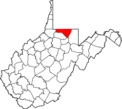
Fort Grand
Location within the state of West Virginia
Usa edcp location map.svg
Red pog.svg
Fort Grand
Fort Grand (the United States)
Coordinates: 39°34′31″N80°5′7″W / 39.57528°N 80.08528°W / 39.57528; -80.08528 Coordinates: 39°34′31″N80°5′7″W / 39.57528°N 80.08528°W / 39.57528; -80.08528
Country Flag of the United States.svg  United States
State Flag of West Virginia.svg  West Virginia
County Flag of Monongalia County, West Virginia.svg Monongalia
Elevation
981 ft (299 m)
Time zone UTC-5 (Eastern (EST))
  Summer (DST) UTC-4 (EDT)
GNIS ID 1554492 [1]

Fort Grand is an unincorporated community in Monongalia County, West Virginia, United States.

Related Research Articles

Ohio River Major river in the midwestern United States

The Ohio River is a 981-mile (1,579 km) long river in the United States. It is located at the boundary of the Midwestern and Southern United States, flowing southwesterly from western Pennsylvania to its mouth on the Mississippi River at the southern tip of Illinois. It is the third largest river by discharge volume in the United States and the largest tributary by volume of the north-south flowing Mississippi River that divides the eastern from western United States. It is also the 6th oldest river on the North American continent. The river flows through or along the border of six states, and its drainage basin includes parts of 14 states. Through its largest tributary, the Tennessee River, the basin includes several states of the southeastern U.S. It is the source of drinking water for five million people.

Harpers Ferry, West Virginia Town in West Virginia, United States

Harpers Ferry is a historic town in Jefferson County, West Virginia, United States, in the lower Shenandoah Valley. The population was 285 at the 2020 census. Situated at the confluence of the Potomac and Shenandoah rivers, where the U.S. states of Maryland, Virginia, and West Virginia meet, it is the easternmost town in West Virginia and during the Civil War was the northernmost point of Confederate-controlled territory. It has been called "the best strategic point in the whole South."

Hampshire County, West Virginia County in West Virginia, United States

Hampshire County is a county in the U.S. state of West Virginia. As of the 2010 census, the population was 23,964. Its county seat is Romney, West Virginia's oldest town (1762). The county was created by the Virginia General Assembly in 1754, from parts of Frederick and Augusta Counties (Virginia) and is the state's oldest county. The county lies in both West Virginia's Eastern Panhandle and Potomac Highlands regions.

Berkeley County, West Virginia County in West Virginia, United States

Berkeley County is located in the Shenandoah Valley in the Eastern Panhandle region of West Virginia in the United States. The county is part of the Hagerstown-Martinsburg, MD-WV Metropolitan Statistical Area. As of the 2020 census, the county population was 122,076, making it the second-most populous of West Virginia's 55 counties, behind Kanawha County. The City of Martinsburg is the county seat.

Ridgeley, West Virginia Town in West Virginia, United States

Ridgeley is a town in Mineral County, West Virginia, United States, and part of the Cumberland Metropolitan Statistical Area. The population was 590 at the 2020 census.

Wheeling, West Virginia City in West Virginia, United States

Wheeling is a city in Ohio and Marshall counties in the U.S. state of West Virginia. Located almost entirely in Ohio County, of which it is the county seat, it lies along the Ohio River in the foothills of the Appalachian Mountains. Wheeling is located about 60 miles west of Pittsburgh and is the principal city of the Wheeling metropolitan area. As of the 2020 census, the metro area had a population of 145,205, and the city itself had a population of 27,062.

Illinois Country Historical French colony in what became the Midwestern United States

The Illinois Country —sometimes referred to as Upper Louisiana —was a vast region of New France claimed in the 1600s in what is now the Midwestern United States. While these names generally referred to the entire Upper Mississippi River watershed, French colonial settlement was concentrated along the Mississippi and Illinois Rivers in what is now the U.S. states of Illinois and Missouri, with outposts in Indiana. Explored in 1673 from Green Bay to the Arkansas River by the Canadien expedition of Louis Jolliet and Jacques Marquette, the area was claimed by France. It was settled primarily from the Pays d'en Haut in the context of the fur trade, and in the establishment of missions by French Catholic religious orders. Over time, the fur trade took some French to the far reaches of the Rocky Mountains, especially along the branches of the broad Missouri River valley. The French name, Pays des Ilinois, means "Land of the Illinois [plural]" and is a reference to the Illinois Confederation, a group of related Algonquian native peoples.

Ohio Company British land speculation company in colonial North America

The Ohio Company, formally known as the Ohio Company of Virginia, was a land speculation company organized for the settlement by Virginians of the Ohio Country and to trade with the Native Americans. The company had a land grant from Britain and a treaty with Indians, but France also claimed the area, and the conflict helped provoke the outbreak of the French and Indian War.

Duluth, Winnipeg and Pacific Railway

The Duluth, Winnipeg and Pacific Railway is a subsidiary railroad of Canadian National Railway (CN) operating in northern Minnesota, United States. A CN system-wide rebranding beginning in 1995 has seen the DWP logo and name largely replaced by its parent company. The DWP line is CN's connection between International Falls and Duluth, Minnesota, where the railroad connects to a short stretch of the former Duluth, Missabe and Iron Range Railway before following the former Wisconsin Central to Chicago, Illinois.

Grand Portage National Monument United States historic place

Grand Portage National Monument is a United States National Monument located on the north shore of Lake Superior in northeastern Minnesota that preserves a vital center of fur trade activity and Anishinaabeg Ojibwe heritage. The area became one of the British Empire's four main fur trading centers in North America, along with Fort Niagara, Fort Detroit, and Michilimackinac.

West Virginia Route 28

West Virginia Route 28 is a north–south route through the Potomac Highlands of the U.S. state of West Virginia. The southern terminus of the route is at West Virginia Route 39 in Huntersville. The northern terminus is at the Maryland state line in Wiley Ford, where the route continues into Cumberland as Canal Parkway upon crossing the North Branch Potomac River.

Fort Mill Ridge Wildlife Management Area State Wildlife Management Area in Hampshire County, West Virginia

The Fort Mill Ridge Wildlife Management Area is located on 217 acres (0.88 km2) two miles (3 km) southwest of Romney in Hampshire County, West Virginia. Fort Mill Ridge WMA is owned by the West Virginia Division of Natural Resources. The Fort Mill Ridge Civil War Trenches are located at the top of the Fort Mill Ridge access road.

Fort Mill Ridge Civil War Trenches United States historic place

The Fort Mill Ridge Civil War Trenches are battle trenches in West Virginia that were originally dug between 1861 and 1862 to be later used in 1863 for the civil war. These trenches lined with chestnut logs by the Confederate artillery during the American Civil War to defend the approaches to Romney on the Northwestern Turnpike and the South Branch Potomac River. The trenches were then refurbished between March and June 1863 by the 54th Pennsylvania Infantry and the 1st West Virginia Infantry. When Colonel Jacob M. Campbell garrisoned Union forces at Romney, camps were set up at nearby at Mechanicsburg Gap. The Confederates might have created these trenches but all throughout the war the Union had control of these trenches.

Pricketts Fort State Park State Park in Marion County, West Virginia

Prickett's Fort State Park is a 188-acre (76.1 ha) West Virginia state park north of Fairmont, near the confluence of Prickett's Creek and the Monongahela River. The park features a reconstructed refuge fort and commemorates life on the Virginia frontier during the late 18th century.

The following radio stations broadcast on FM frequency 90.7 MHz:

Solar eclipse of September 14, 2099 Future total solar eclipse

A total solar eclipse will occur on September 14, 2099. A solar eclipse occurs when the Moon passes between Earth and the Sun, thereby totally or partly obscuring the image of the Sun for a viewer on Earth. A total solar eclipse occurs when the Moon's apparent diameter is larger than the Sun's, blocking all direct sunlight, turning day into darkness. Totality occurs in a narrow path across Earth's surface, with the partial solar eclipse visible over a surrounding region thousands of kilometres wide.

References