Canyon, West Virginia

Last updated
Canyon
USA West Virginia location map.svg
Red pog.svg
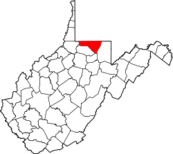
Canyon
Location within the state of West Virginia
Usa edcp location map.svg
Red pog.svg
Canyon
Canyon (the United States)
Coordinates: 39°40′35″N79°53′29″W / 39.67639°N 79.89139°W / 39.67639; -79.89139 Coordinates: 39°40′35″N79°53′29″W / 39.67639°N 79.89139°W / 39.67639; -79.89139
Country Flag of the United States.svg  United States
State Flag of West Virginia.svg  West Virginia
County Flag of Monongalia County, West Virginia.svg Monongalia
Elevation
1,063 ft (324 m)
Time zone UTC-5 (Eastern (EST))
  Summer (DST) UTC-4 (EDT)
GNIS ID 1554063 [1]

Canyon is an unincorporated community in Monongalia County, West Virginia, United States.

Related Research Articles

Canyon Deep ravine between cliffs

A canyon, or gorge, is a deep cleft between escarpments or cliffs resulting from weathering and the erosive activity of a river over geologic time scales. Rivers have a natural tendency to cut through underlying surfaces, eventually wearing away rock layers as sediments are removed downstream. A river bed will gradually reach a baseline elevation, which is the same elevation as the body of water into which the river drains. The processes of weathering and erosion will form canyons when the river's headwaters and estuary are at significantly different elevations, particularly through regions where softer rock layers are intermingled with harder layers more resistant to weathering.

Texas Panhandle Region in Texas, United States

The Texas Panhandle is a region of the U.S. state of Texas consisting of the northernmost 26 counties in the state. The panhandle is a rectangular area bordered by New Mexico to the west and Oklahoma to the north and east. It is adjacent to the Oklahoma Panhandle. The Handbook of Texas defines the southern border of Swisher County as the southern boundary of the Texas Panhandle region.

Allegheny Mountains Mountain range in the northeastern United States

The Allegheny Mountain Range, informally the Alleghenies, is part of the vast Appalachian Mountain Range of the Eastern United States and Canada and posed a significant barrier to land travel in less developed eras. The Allegheny Mountains have a northeast–southwest orientation, running for about 400 miles (640 km) from north-central Pennsylvania, southward through western Maryland and eastern West Virginia.

Cheat River River in West Virginia, United States

The Cheat River is a 78.3-mile-long (126.0 km) tributary of the Monongahela River in eastern West Virginia and southwestern Pennsylvania in the United States. Via the Ohio River, the Cheat and Monongahela are part of the Mississippi River watershed. Owing to the ruggedness of the surrounding Allegheny Mountains, the Cheat remains largely remote with few settlements or developments along its banks. Its headwaters are in the Cheat-Potomac Ranger District of the Monongahela National Forest.

New River Gorge National Park and Preserve American national park and nature preserve

The New River Gorge National Park and Preserve is a unit of the United States National Park Service (NPS) designed to protect and maintain the New River Gorge in southern West Virginia in the Appalachian Mountains. Established in 1978 as a national river and redesignated in 2020, the park and preserve stretches for 53 miles (85 km) from just downstream of Hinton to Hawks Nest State Park near Ansted. The park is rich in cultural and natural history, and offers an abundance of scenic and recreational opportunities. New River Gorge is home to some of the country's best whitewater rafting, mainly from the Cunard put-in to the Fayette Station take-out, and is also one of the most popular climbing areas on the East Coast. The New River itself flows from North Carolina north into Virginia, and west through the mountains into West Virginia as the New_River_(Kanawha_River_tributary).

The Potomac Highlands of West Virginia centers on five West Virginian counties in the upper Potomac River watershed in the western portion of the state's Eastern Panhandle, bordering Maryland and Virginia. Because of geographical proximity, similar topography and landscapes, and shared culture and history, the Potomac Highlands region also includes Pocahontas, Randolph, and Tucker counties, even though they are in the Monongahela River or New River watersheds and not that of the Potomac River.

Bluestone National Scenic River 4,310 acres in West Virginia (US) managed by the National Park Service

The Bluestone National Scenic River protects a 10.5-mile (16.9 km) section of the Bluestone River in Summers and Mercer counties of southern West Virginia. It was created 26 October 1988 under the Wild and Scenic Rivers Act and is protected by the National Park Service.

Carnifex Ferry Battlefield State Park State park in Nicholas County, West Virginia

Carnifex Ferry Battlefield State Park is an American Civil War battle site that commemorates the Battle of Carnifex Ferry. It is located on the rim of the Gauley River Canyon near Summersville, a town in Nicholas County, West Virginia. The 156-acre (0.63 km2) park features Patterson House Museum, three views of the Gauley River, hiking trails and picnic facilities. It is one of the oldest state parks in the United States. A Civil War re-enactment takes place on a weekend after Labor Day. As Carnifex Ferry State Park, it was listed on the National Register of Historic Places in 1974.

Coconino Sandstone Geologic formation

Coconino Sandstone is a geologic formation named after its exposure in Coconino County, Arizona. This formation spreads across the Colorado Plateau province of the United States, including northern Arizona, northwest Colorado, Nevada, and Utah.

Spruce Knob-Seneca Rocks National Recreation Area

Spruce Knob-Seneca Rocks National Recreation Area is a national recreation area in the Monongahela National Forest of eastern West Virginia, USA.

Blackwater Falls State Park State park in Tucker County, West Virginia

Blackwater Falls State Park is located in the Allegheny Mountains of Tucker County, West Virginia, US. The centerpiece of the park is Blackwater Falls, a 62-foot (19 m) cascade where the Blackwater River leaves its leisurely course in Canaan Valley and enters rugged Blackwater Canyon. It is among the most photographed venues in the state and appears on calendars, stationery, and advertisements. The river is named for its tannin-darkened water.

Coopers Rock State Forest State Forest in Monongalia and Preston counties, West Virginia

Coopers Rock State Forest is a 12,747-acre (52 km2) state forest in Monongalia and Preston counties in the U.S. state of West Virginia. Its southern edge abuts Cheat Lake and the canyon section of Cheat River, a popular whitewater rafting river in the eastern United States.

Blackwater Canyon

Blackwater Canyon is a rugged, heavily wooded, eight-mile (13 km) long gorge carved by the Blackwater River in the Allegheny Mountains of eastern West Virginia, USA. For many years, it has been the object of controversy as environmental activists have contended with industrial interests over its ultimate status.

Snake Hill Wildlife Management Area Protected area in West Virginia, USA

The Snake Hill Wildlife Management Area is a hill area covering 3,092 acres (1,251 ha) along the Cheat canyon (78.3-mile-long) in Monongalia and Preston Counties, West Virginia. The wildlife management area mostly lies directly south of Coopers Rock State Forest, protecting the southern side of Cheat Canyon. The canyon has been the object of controversy as environmental activists contended with timber and development interests over the years of its preservation status.

Olson Observation Tower Fire towers in Monongahela National Forest

Olson Observation Tower is one of the few remaining fire towers in Monongahela National Forest. Olson is located at the southern end of Backbone Mountain northeast of Parsons in Tucker County, West Virginia.

Smoke Hole Canyon

Smoke Hole Canyon — traditionally called The Smoke Holes and later simply Smoke Hole — is a rugged 20 miles (32 km) long gorge carved by the South Branch Potomac River in the Allegheny Mountains of eastern West Virginia, United States. The area is rather isolated and remote with parts accessible only by boat or on foot.

Muav Limestone Geologic strata in Southwestern United States

The Cambrian Muav Limestone is a geologic unit within the 5-member Tonto Group. It is about 650 feet (198 m) thick at its maximum. It is a resistant cliff-forming unit. The Muav consists of dark to light-gray, brown, and orange red limestone with dolomite and calcareous mudstone. The Muav Limestone is overlain in the western Grand Canyon by the late Cambrian Frenchman Mountain Dolostone. Eastward, the Frenchman Mountain Dolostone pinches out and the Mississippian Redwall Limestone, which forms prominent vertical cliffs, directly lies upon the Muav Limestone. The Devonian Temple Butte Formation fill deep paleovalleys that have been cut through the Frenchman Mountain Dolostone and into the Muav Limestone.

Nankoweap Formation Neoproterozoic geologic sequence of the Grand Canyon Supergroup

The Neoproterozoic Nankoweap Formation, is a thin sequence of distinctive red beds that consist of reddish brown and tan sandstones and subordinate siltstones and mudrocks that unconformably overlie basaltic lava flows of the Cardenas Basalt of the Unkar Group and underlie the sedimentary strata of the Galeros Formation of the Chuar Group. The Nankoweap Formation is slightly more than 100 m in thickness. It is informally subdivided into informal lower and upper members that are separated and enclosed by unconformities. Its lower (ferruginous) member is 0 to 15 m thick. The Grand Canyon Supergroup, of which the Nankoweap Formation is part, unconformably overlies deeply eroded granites, gneisses, pegmatites, and schists that comprise Vishnu Basement Rocks.

Cheat Canyon Wildlife Management Area is located on 3,836 acres (1,552 ha) northwest of Albright in Preston County, West Virginia. The wildlife management area is centered on the Cheat River canyon.

2018 NCAA Division I Mens Soccer Tournament

The 2018 NCAA Division I Men's Soccer Tournament was the 60th edition of the NCAA Division I Men's Soccer Tournament, a postseason tournament to determine the national champion of NCAA Division I men's college soccer. The first four rounds of the competition were held at the home ground of the higher seed, while the College Cup were held at Harder Stadium on the campus of University of California, Santa Barbara. The championship match was held on December 10, 2018 with the Maryland Terrapins defeating the Akron Zips 1–0 to claim their fourth title in program history.

References