
Point of Rocks is an unincorporated community and census-designated place (CDP) in Frederick County, Maryland, United States. As of the 2010 census it had a population of 1,466. It is named for the striking rock formation on the adjacent Catoctin Mountain, which was formed by the Potomac River cutting through the ridge in a water gap, a typical formation in the Appalachian Mountains. The formation is not visible from the town and can only be seen from boats on the river, or from the southern bank of the river in Virginia.

The Blue Ridge Mountains are a physiographic province of the larger Appalachian Mountains range. The mountain range is located in the eastern United States, and extends 550 miles southwest from southern Pennsylvania through Maryland, West Virginia, Virginia, North Carolina, South Carolina, Tennessee, and Georgia. This province consists of northern and southern physiographic regions, which divide near the Roanoke River gap. To the west of the Blue Ridge, between it and the bulk of the Appalachians, lies the Great Appalachian Valley, bordered on the west by the Ridge and Valley province of the Appalachian range.

The South Branch Potomac River has its headwaters in northwestern Highland County, Virginia near Hightown along the eastern edge of the Allegheny Front. After a river distance of 139 miles (224 km), the mouth of the South Branch lies east of Green Spring in Hampshire County, West Virginia where it meets the North Branch Potomac River to form the Potomac.

Wappocomo is an unincorporated community in Hampshire County in the U.S. state of West Virginia. The community is located south of Springfield on West Virginia Route 28 at Hanging Rocks along the South Branch Potomac River. Wappocomo has also historically been referred to as The Rocks, Wapocoma, and Wapocomo.
Hanging Rocks are perpendicular cliffs rising nearly 300 feet (91 m) above the South Branch Potomac River in Hampshire County in the U.S. state of West Virginia. Hanging Rocks are located four miles (6 km) north of Romney at Wappocomo on West Virginia Route 28. Hanging Rocks has also been known throughout its history as Painted Rocks and Blue's Rocks. When distinguished from the "Lower Hanging Rocks" along the South Branch at Blues Beach to the north, Hanging Rocks is referred to as Upper Hanging Rocks.

West Virginia Route 28 is a north–south route through the Potomac Highlands of the U.S. state of West Virginia. The southern terminus of the route is at West Virginia Route 39 in Huntersville. The northern terminus is at the Maryland state line in Wiley Ford, where the route continues into Cumberland as Canal Parkway upon crossing the North Branch Potomac River.

Seneca Rocks is a large crag and local landmark in Pendleton County in the Eastern Panhandle of West Virginia, United States. The south peak is one of a small number of peaks inaccessible except by technical rock climbing techniques on the East Coast of the United States. One of the best-known scenic attractions in West Virginia, the sheer rock faces are a popular challenge for rock climbers.
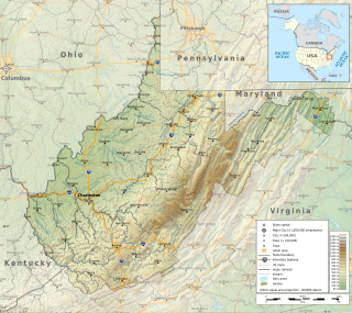
The Potomac Highlands of West Virginia centers on five West Virginian counties in the upper Potomac River watershed in the western portion of the state's Eastern Panhandle, bordering Maryland and Virginia. Because of geographical proximity, similar topography and landscapes, and shared culture and history, the Potomac Highlands region also includes Pocahontas, Randolph, and Tucker counties, even though they are in the Monongahela River or New River watersheds and not that of the Potomac River.
The Environment of West Virginia encompasses terrain and ecosystems ranging from plateaus to mountains. Most of West Virginia lies within the Appalachian mixed mesophytic forests ecoregion, while the higher elevations along the eastern border and in the panhandle lie within the Appalachian-Blue Ridge forests.

Spruce Knob-Seneca Rocks National Recreation Area is a national recreation area in the Monongahela National Forest of eastern West Virginia, USA.

Seneca Creek is a 19.6-mile-long (31.5 km) tributary of the North Fork of the South Branch of the Potomac River located entirely within Pendleton County, West Virginia, USA.
Ice Mountain is a mountain ridge and algific talus slope that is part of a 149-acre (60 ha) preserve near the community of North River Mills in Hampshire County, West Virginia, United States. It was designated a National Natural Landmark in 2012.

The Silurian Tuscarora Formation — also known as Tuscarora Sandstone or Tuscarora Quartzite — is a mapped bedrock unit in Pennsylvania, Maryland, West Virginia, and Virginia, USA.
For other "River Knobs", see River Knobs (disambiguation).

Hu Maxwell was a local historian, novelist, editor, poet, and author of several histories of West Virginia counties.

West Virginia's geologic history stretches back into the Precambrian, and includes several periods of mountain building and erosion. At times, much of what is now West Virginia was covered by swamps, marshlands, and shallow seas, accounting for the wide variety of sedimentary rocks found in the state, as well as its wealth of coal and natural gas deposits. West Virginia has had no active volcanism for hundreds of millions of years, and does not experience large earthquakes, although smaller tremors are associated with the Rome Trough, which passes through the western part of the state.

Champe Rocks are a pair of large crags in Pendleton County in the Eastern Panhandle of West Virginia, USA. Easily visible from West Virginia Route 28, they are situated within the Spruce Knob-Seneca Rocks National Recreation Area. They are — along with the nearby and more celebrated Seneca Rocks — the most imposing examples in eastern West Virginia of several formations of the white/gray Tuscarora quartzite and are a popular challenge for rock climbers.

Indian Rocks Dining Hall is a historic building located near Reedsville, Preston County, West Virginia. The dining hall was built in 1928, and 1+1⁄2 stories, with a hip porch on three sides. The front facade is of brown fieldstone with a large fireplace at the center front of the building. It is in the rustic Adirondack style. Also on the property are a contributing tourist cabin, ice / spring house (1928), and ice pond. The property was developed in the late-1920s, by John Henry Hunt, Sr, who was a pioneer in African American entrepreneurship and worked for the advancement of African Americans in West Virginia.

The West Virginia lunar sample displays are two commemorative plaques consisting of small fragments of Moon specimen brought back with the Apollo 11 and Apollo 17 lunar missions and given in the 1970s to the people of the state of West Virginia by United States President Richard Nixon as goodwill gifts.


