Ashland Municipal Airport

Last updated

Ashland Municipal Airport

Sumner Parker Field
Ashland Municipal Airport.PNG
orthophoto of Ashland Municipal Airport
Summary
Airport typePublic
OwnerCity of Ashland
Serves Ashland, Oregon
Elevation  AMSL 1,889 ft / 576 m
Coordinates 42°11′25″N122°39′38″W / 42.19028°N 122.66056°W
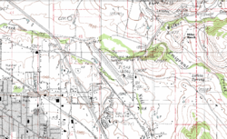
 / 42.19028; -122.66056
Map
USA Oregon location map.svg
Airplane silhouette.svg
S03
Ashland Municipal Airport
Runways
Direction LengthSurface
ftm
12/303,6031,098Asphalt
Statistics (2021)
Aircraft operations (year ending 5/11/2021)26,050
Based aircraft62

Ashland Municipal Airport (Sumner Parker Field) ( IATA : AHM [2] , FAA LID : S03) is two miles east of Ashland, in Jackson County, Oregon. [1] The National Plan of Integrated Airport Systems for 2011 through 2015 categorized it as a general aviation facility. [3]

Contents

Facilities

Ashland Municipal Airport runway Ashland Municipal Airport runway.jpg
Ashland Municipal Airport runway

The airport covers 94 acres (38 ha) at an elevation of 1,889 feet (576 m). Its one runway, 12/30, is 3,603 by 75 feet (1,098 x 23 m). [1]

In the year ending May 11, 2021, the airport had 26,050 aircraft operations, average 71 per day: 94% general aviation, 6% air taxi, and <1% military. 60 aircraft were then based at the airport: 52 single-engine, 5 helicopter, 1 multi-engine, 1 jet, and 1 glider. [1]

References

  1. 1 2 3 4 FAA Airport Form 5010 for S03 PDF . Federal Aviation Administration. Effective August 14, 2021.
  2. "Airline and Airport Code Search (AHM: Sumner Parker Field, Ashland)". International Air Transport Association (IATA). Retrieved September 27, 2012.
  3. "2011–2015 NPIAS Report, Appendix A" (PDF). National Plan of Integrated Airport Systems. Federal Aviation Administration. October 4, 2010. Archived from the original (PDF, 2.03 MB) on 2012-09-27.