Auburn, Georgia | |
---|---|
Motto: "Old southern charm with a vision for the future" | |
Coordinates: 34°00′56″N83°49′55″W / 34.01556°N 83.83194°W | |
Country | United States |
State | Georgia |
Counties | Barrow, Gwinnett |
Area | |
• Total | 6.80 sq mi (17.61 km2) |
• Land | 6.77 sq mi (17.54 km2) |
• Water | 0.03 sq mi (0.07 km2) |
Elevation | 1,024 ft (312 m) |
Population (2020) | |
• Total | 7,495 |
• Density | 1,106.76/sq mi (427.30/km2) |
Time zone | UTC-5 (Eastern (EST)) |
• Summer (DST) | UTC-4 (EDT) |
ZIP code | 30011 |
Area code | 770 |
FIPS code | 13-04140 [3] |
GNIS feature ID | 2403134 [2] |
Website | www |
Auburn is a city in Barrow and Gwinnett counties in the U.S. state of Georgia. As of the 2020 census, the city had a population of 7,495.
Auburn incorporated in 1892 soon after the railroad was extended to that point. [4]
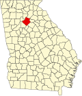
Auburn is located in western Barrow County and is 42 miles (68 km) northeast of downtown Atlanta and 27 miles (43 km) west of Athens.
According to the United States Census Bureau, the town has a total area of 6.5 square miles (16.8 km2), of which 6.4 square miles (16.7 km2) is land and 0.03 square miles (0.07 km2), or 0.39%, is water. [3]
Census | Pop. | Note | %± |
---|---|---|---|
1900 | 161 | — | |
1910 | 217 | 34.8% | |
1920 | 290 | 33.6% | |
1930 | 230 | −20.7% | |
1940 | 286 | 24.3% | |
1950 | 301 | 5.2% | |
1960 | 374 | 24.3% | |
1970 | 361 | −3.5% | |
1980 | 692 | 91.7% | |
1990 | 3,139 | 353.6% | |
2000 | 6,904 | 119.9% | |
2010 | 6,887 | −0.2% | |
2020 | 7,495 | 8.8% | |
2023 (est.) | 9,688 | [5] | 29.3% |
U.S. Decennial Census [6] |
Race | Num. | Perc. |
---|---|---|
White (non-Hispanic) | 5,325 | 71.05% |
Black or African American (non-Hispanic) | 493 | 6.58% |
Native American | 14 | 0.19% |
Asian | 307 | 4.1% |
Pacific Islander | 3 | 0.04% |
Other/Mixed | 420 | 5.6% |
Hispanic or Latino | 933 | 12.45% |
As of the 2020 United States census, there were 7,495 people, 2,436 households, and 1,849 families residing in the city.
As of 2022, 6,678 people in Auburn lived in Barrow County while 209 people lived in Gwinnett County. [8]
The portion in Barrow County is in Barrow County Schools. [9] The Barrow district operates Auburn Elementary School, which feeds into Westside Middle School and Apalachee High School. [10] [11]
The portion in Gwinnett County is in Gwinnett County Public Schools. [12] That portion's zoned schools are Mulberry Elementary School, Dacula Middle School, and Dacula High School. [13]
Walton County is a county located in the Middle Georgia portion of the U.S. - State of Georgia. As of the 2020 census, the population was 96,673. It is located about 30 miles east of the state capital, the city of Atlanta. Monroe is the county seat; Loganville is another major city.
Jackson County is a county located in the northeastern part of the U.S. state of Georgia. As of the 2020 census, the population was 75,907. The county seat is Jefferson. Jackson County comprises the Jefferson, GA Micropolitan Statistical Area, which is included in the Atlanta-Athens-Clarke County-Sandy Springs, GA Combined Statistical Area.
Hall County is a county located in the northeast portion of the U.S. state of Georgia. As of the 2020 census, the population was 203,136, up from 179,684 at the 2010 census. The county seat is Gainesville. The entirety of Hall County comprises the Gainesville, Georgia, Metropolitan Statistical Area, which is also part of the Atlanta-Athens-Clarke County-Sandy Springs, Combined Statistical Area.
Gwinnett County is located in the north central portion of the U.S. state of Georgia. It forms part of the Atlanta metropolitan area, being located about 9 miles (14 km) northeast of Atlanta city limits. In 2020, the population was 957,062, making it the second-most populous county in Georgia. Its county seat is Lawrenceville. The county is named for Button Gwinnett, one of the signatories of the Declaration of Independence.
Barrow County is a county located in the north central portion of the U.S. state of Georgia. As of the 2020 census, its population was 83,505. Its county seat is Winder. Barrow County is included in the Atlanta–Sandy Springs–Roswell metropolitan statistical area.
Braselton is a town in Barrow, Gwinnett, Hall, and Jackson counties in the U.S. state of Georgia, approximately 43 miles (69 km) northeast of Atlanta. As of the 2020 census, the town had a population of 13,403, and in 2023 the estimated population was 15,538.
Carl is a town in Barrow County, Georgia, United States. The population was 269 at the 2016 census.
Statham is a city in Barrow County, Georgia, United States. The population was 2,408 at the 2010 census, and 2,813 in 2020.
Winder is a city and the county seat of Barrow County, Georgia, United States. It is located east of Atlanta and is part of the Atlanta metropolitan area. The population was 18,338 at the 2020 census.
Allentown is a city in Bleckley, Laurens, Twiggs, and Wilkinson counties in the U.S. state of Georgia, primarily in Wilkinson County. As of the 2010 census, the city had a population of 169, down from 287 at the 2000 census. In 2020, its population was 195. The Twiggs County portion is part of the Macon metropolitan statistical area, while the Laurens County portion is part of the Dublin micropolitan statistical area. The remaining Wilkinson and Bleckley County portions are not part of any metropolitan or micropolitan area.
Temple is a city in Carroll and Haralson counties in the U.S. state of Georgia. The population was 5,089 at the 2020 census, up from 4,228 in 2010, a 20.36% increase.
Berkeley Lake is a city in Gwinnett County, Georgia, United States. It is a northern suburb of Atlanta. From its 1956 origins as a summer retreat, Berkeley Lake has grown into a thriving community centered on its 88-acre (360,000 m2) namesake lake. As of the 2020 census, the city had a population of 2,054. It has been named a Tree City USA for 18 years.
Lawrenceville is a city in and the county seat of Gwinnett County, Georgia, United States. It is a suburb of Atlanta, located approximately 30 miles (50 km) northeast of downtown. It was incorporated on December 15, 1821. As of the 2020 census, the population of Lawrenceville was 30,629.
Loganville is a city in Walton and Gwinnett counties, Georgia, United States. The population was 14,127 in 2020. Loganville is located about 36 mi (58 km) east of Atlanta and is part of the Atlanta metropolitan area.
Norcross is a city located in Gwinnett County, Georgia, United States. According to the 2010 census, the population was 9,116, while in 2020, the population increased to 17,209. Norcross is part of the Atlanta-Sandy Springs-Marietta metropolitan statistical area.
Suwanee is a city in Gwinnett County and a part of the Atlanta metropolitan area in the U.S. state of Georgia. As of the 2010 census, the population was 15,355; this had grown to an estimated 20,907 as of 2019. In 2020, its population was 20,786.
The Gwinnett County Public Schools is a school district operating in Gwinnett County, Georgia, United States. GCPS is the largest school system in Georgia, with over 140 school buildings and an estimated enrollment of over 182,000 students for the 2023–2024 school year. GCPS is estimated to be the 14th largest school district in the U.S. The district has its headquarters near Suwanee.
State Route 324 (SR 324) is a 9.6-mile-long (15.4 km) west-to-east state highway located in portions of Gwinnett and Barrow counties in the northeastern part of the U.S. state of Georgia. It connects Buford and Auburn. It also has an interchange with Interstate 85 (I-85). Before it was renamed, Carl Bethlehem Road was once part of SR 324.
Dacula High School is a high school in Dacula, Georgia, United States, serving students in grades 9–12. It is operated by Gwinnett County Public Schools. It is a part of the Dacula cluster and is fed from Dacula Middle School.