
Drellingore is a village in South East Kent, England. It lies in the Alkham Valley, an area of outstanding natural beauty between Folkestone and Dover. Although the Alkham Valley is a dry valley most of the surrounding land forms a water catchment area. Water is extracted from the chalk aquifer for use in the Dover to Folkestone area of Kent. The population is included in the civil parish of Aylsham.

Maxton, Kent was once a rural parish to the west of Dover, in England. Maxton also served as the terminus of the tramway system serving the town until its closure in 1938.

Martin is a hamlet north-east of Dover in the county of Kent in England. The nearby village of Martin Mill is situated on the railway between Dover and Deal. The population of the village is included in the civil parish of Langdon.

Aston Mullins is a hamlet in the parish of Dinton, in Buckinghamshire, England. At the 2011 Census the population of the hamlet was included in the civil parish of Dinton-with-Ford and Upton

Blackwell is a village in the Derbyshire Dales local government district of Derbyshire, England, on the A6 main road between Bakewell and Buxton.

Ballidon is a village and civil parish in the Derbyshire Dales district of Derbyshire, England, on the edge of the Peak District National Park. According to the 2001 census it had a population of 79. The population at the 2011 Census remained less than 100. Details are maintained in the civil Parish of Aldwark, Derbyshire. Ballidon was listed in the Domesday Book of 1086 and was a much larger village than seen today. That area now devastated by the Tilcon Quarry was a deep valley and the site of an ambush of troops of the Jacobean Rebellion, skulls and weaponry were recovered on the left bank.

Biggin is a village in the Derbyshire Dales district of Derbyshire, England. It is part of the Hartington Nether Quarter parish, and is in the Peak District National Park.

Brushfield is a hamlet and civil parish in the Derbyshire Dales district of Derbyshire, England, in the Peak District National Park. It is about 8 miles east of Buxton. According to the 2001 census it had a population of 13. In 2007 it had just three houses. Several holiday lets are run by two separate families. One of these cottages is called the 'Old School House', a small 1 bed house of stone.
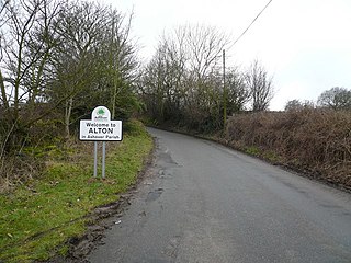
Alton is a very small village in Derbyshire, England. Alton is in the civil parish of Ashover, and is around 2 miles away from Clay Cross although it is not part of the town. The village does not have a church, a school or a public house; the nearest public house is in Ashover. Being a rural community, Alton is surrounded by several farms.

Brabourne Lees is a village in the civil parish of Brabourne, within the Ashford borough of Kent, England. The village (centre) is just under 5 miles (8 km) east of Ashford town centre itself geographically. By road this is a journey of about 6 miles (10 km).
Boythorpe is a small suburb to the south-west of Chesterfield town centre in Derbyshire, England. It also borders Birdholme to its east, and Walton to its west. The area mainly consists of social housing, although Chesterfield's cricket ground is within the largest park, Queens' Park, which is located in Boythorpe on the edge of the town centre. Boythorpe has a large secondary school, Parkside Community School, which serves students aged 11–16, located on the district's main thoroughfare, Hunloke Avenue.

Ashley is a hamlet located in the parish of Sutton, some five miles (8 km) north of Dover on the summit of Gaggs Hill in Kent, England. Ashley runs almost seamlessly into the neighbouring village of Studdal. The A256 road passes to the west of Ashley. The population of the hamlet is included in the civil parish of Tilmanstone.

Westmarsh is a village in the Ash civil parish of East Kent, England. It is situated 8 miles (13 km) east of Canterbury and 7 miles (11 km) west of Ramsgate.

Barnsole is a village in East Kent, England, between Canterbury and Deal. The population of the village is included in the civil parish of Wingham.

Church Whitfield is a village in the civil parish of Whitfield, and just north of Dover, in Kent, England. Village population is included in Whitfield civil parish. Part of the village is called Pineham.

Bretton, Derbyshire is a hamlet in Derbyshire, England. Set on a ridge with a panoramic view, it has few inhabitants but boasts a pub called the Barrel Inn, and the Bretton youth hostel.
Brightgate is a village in Derbyshire, England. The population is recorded in the civil parish of Bonsall, Derbyshire.

Godfreyhole is a hamlet in Derbyshire, England. It is located at the junction of the B5035 and West End roads, 2 miles (3.2 km) west of Wirksworth, the population taken at the 2011 Census also included in the civil parish of the same name.

Crowdecote is a small village in Derbyshire, England. It is situated on the border between Derbyshire and Staffordshire about 6 miles (9.7 km) south of Buxton. Crowdecote is part of Hartington Middle Quarter civil parish. It is thought that the name Crowdecote derives from Cruda’s Cot. Crowdecote is popular with walkers and ramblers because of its proximity to Chrome Hill, High Wheeldon and Parkhouse Hill to the north and Dovedale to the south.

Ordnance Survey (OS) is the national mapping agency of the United Kingdom which covers the island of Great Britain. Since 1 April 2015 part of Ordnance Survey has operated as Ordnance Survey Ltd, a government-owned company, 100% in public ownership. The Ordnance Survey Board remains accountable to the Secretary of State for Business, Energy and Industrial Strategy. It is also a member of the Public Data Group.


