Langdon, Kent

Last updated

Langdon
East Langdon - geograph.org.uk - 624974.jpg
Church Lane, East Langdon
Kent UK location map.svg
Red pog.svg
Langdon
Location within Kent
Population558 (2011) [1]
Civil parish
  • Langdon
District
Shire county
Region
Country England
Sovereign state United Kingdom
Post town Dover
Postcode district CT15
Dialling code 01304
Police Kent
Fire Kent
Ambulance South East Coast
List of places
UK
England
Kent
51°10′30″N1°19′44″E / 51.175°N 1.329°E / 51.175; 1.329 Coordinates: 51°10′30″N1°19′44″E / 51.175°N 1.329°E / 51.175; 1.329

Langdon is a civil parish in the Dover district of Kent, England, and contains the villages of East Langdon and West Langdon, and the hamlets of Martin and Martin Mill. Langdon was the site of Langdon Abbey which was dissolved in 1535. [2]

Contents

History

Carved stone corbel from monastic cellars of Langdon Abbey Corbel West Langdon.jpg
Carved stone corbel from monastic cellars of Langdon Abbey

The word Langdon comes from the original Old English meaning, 'Long Down' or 'Long Hill'. The name 'Langdon' is an Anglo-Saxon origin and one of the oldest names recorded. It is a common surname, as well as a locational name from places in Devon, Dorset, Warwickshire, Essex and Kent. However, East and West Langdon in Kent is the earliest recorded use of the place name Langdon, at the time of the 861 Saxon Charters the place was recorded as "Langandune". [3] The original meaning of Langdon suggests that the parish lies along a 'long hill' or 'long down' between Deal and Whitfield. [4]

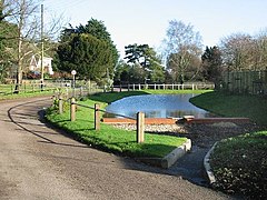
The remains of the historical Langdon Abbey lie between West Langdon and East Langdon. The abbey was founded in 1198 by Sir William de Auberville of Westenhanger and dissolved in 1535. Historic England describes the Premonstratensian abbey remains as "... abbey buildings survive partly as ruins incorporated within a later house, Listed Grade II*, and also within the Grade II Listed, north eastern wall of a 19th-century agricultural barn. Elsewhere, the abbey survives in buried form and as earthworks." [5]

In the 1870s John Marius Wilson described East Langdon as a village and its own parish "in Dover district, Kent... near the Deal and Dover railway, 3½ miles NNE of Dover. The parish contains also the hamlet of Marten; and its post-town is Dover. Acres, 1,065. Real property, £2,228. Pop., 362. Houses, 72. The property is divided among a few. The living is a rectory in the diocese of Canterbury. Value, £126. * Patron, the Earl of Guilford. The church comprises nave, small aisle, and chancel." [6]

In 19th- and early 20th-century directories, today's Langdon comprised two parishes: East Langdon and West Langdon. East Langdon parish included the hamlet of Martin, and Martin Mill station on the Dover and Deal Railway. In 1882 and 1913 both parishes were part of the Union poor relief and joint parish workhouse provision set up under the Poor Law Amendment Act 1834 county court and county police district of Dover, and in part of the Bewborough and Cornilo hundred, the Lathe of St. Augustine (county subdivision), the rural deanery of Sandwich, and the Archdeaconry and diocese of Canterbury. [7] [8]

Langdon, East and West, in Kelly's Directory of Kent 1913 p.419. See also 1882. Langdon Kellys Kent 1913 p.419.jpg
Langdon, East and West, in Kelly's Directory of Kent 1913 p.419. See also 1882.

St Augustine's Church at East Langdon, is described as of Early English style with Norman remains, and a "small unpretending structure of rough flints" comprising chancel, nave, south aisle, a north porch, and a western wooden turret with four bells. The south aisle of the nave extends partly through to the south of the chancel, with a separating arch repeating that of the chancel arch, both arches originally containing an Early English rood screen. Kelly's particularly highlighted the crimson velvet pulpit cloth, "richly embroidered, with a representation of the Annunciation to the Virgin, accompanied by various elegant devices and scrolls". St Mary's Church at West Langdon was rebuilt in 1869 to the Early English style and restored in 1906, and comprises a chancel and nave, with seating at the time for about 100. The register for St Augustine's dates to 1560, that of St Mary's, 1650. The living for St Augustine's was a rectory, and included a residence, in the gift of Dudley Francis North, 7th Earl of Guilford in 1882 until 1885 and Frederick George North, 8th Earl, from then until at least 1913; that of St Mary's a vicarage, united with that at Whitfield from 1872, and under the rectory of Waldershare, and in the gift of the Archbishop and the Dean and Chapter of Canterbury. A Primitive Methodist chapel, built in 1875, also existed at East Langdon from 1882 to at least 1913. A National School was built at East Langdon in 1872 for 66 children, enlarged in 1905 for 74, and by 1913 had become a mixed non-provided school—defined by the 1902 Education Act as church schools not funded by rates—with a schoolmistress and her assistant, with an average attendance of 61. Children at West Langdon attended school at East Langdon and Waldershare. In 1913 there was a Post and Telegraph Office at Martin Mill Station, run by a sub-postmaster; telegrams for the parish were delivered only to the station. Letters to East and West Langdon were routed through Dover, and then through Ringwould which was the nearest money order office. [7] [8]

The lord of the manor of East Langdon was Sir Walter Charles James, 1st Baron Northbourne of Betteshanger in 1882 and Walter James, 2nd Baron in 1913; that of West Langdon in 1882, a Benjamin James Taylor, and in 1913 a William Powell Hampton who was also the principal landowner. The three principal landowners of East Langdon in 1882 included the Earl of Guilford. The Earl remained a principal landowner in 1913, along with Major Herbert Delamar Banks, of Oxney. Land area of East Langdon was just over 1,046 acres (423 hectares) in 1882, and 1,086 acres (439 hectares) in 1913, that of West Langdon, just over 690 acres (280 hectares) in 1882 and 706 acres (286 hectares) in 1913. The land of both parishes was of clay and chalk, over a subsoil of chalk, on which was grown wheat, oats, turnips and barley. Population of East Langdon in 1881 was 307, that of West Langdon in 1881 and 1913, 105. The population of the ecclesiastical parish of West Langdon, which was combined with Whitfield, was 417 in 1913. [7] [8]

Parish population for East Langdon in 1881 was 307 and in 1911, 353; that for West Langdon in 1881 was 105 and in 1911, 110. Recorded occupations and trades in 1882 included, for East Langdon, six farmers, a miller, carpenter, blacksmith, wheelwright, bricklayer, shopkeeper, a beer retailer, and the licensee of the Four Bells public house. Also resident was the parish vestry clerk, a collector of rates, the station master of Martin Mill railway station, and the schoolmistress for the parish' National School. At West Langdon there were recorded the parish clerk, two farmers, a shoemaker, and a beer retailer. By 1913 at West Langdon a shoemaker was not listed. East Langdon in 1913 showed four farmers, one of whom was a landowner, and another the clerk to the civil parish council. A beer retailer and a blacksmith was still listed in 1913, the miller was at a windmill, there was the licensee of the Four Bells, a licensee of the Station Inn at Martin Mill, and a manager of the East Kent District Water Company at Martin. [7] [8]

Demography

Occupations of males and females in Langdon, 1881. Occupation of males and females in Langdon in 1881..jpg
Occupations of males and females in Langdon, 1881.
Total population time series of Langdon, Kent, 1801-2011. Langdon population time series from 1801-2011.jpg
Total population time series of Langdon, Kent, 1801-2011.

The population time series of Langdon from 1801 to 2011 shows how the population fluctuated over the years between 1801 and 1961. [10] In more recent years the population appears to have levelled off at almost 560 in 2001 and 2011. [11]

Maps of 19th-century Langdon show that the area was mainly rural. In 1881 the total population of Langdon was 307. [12] At the time 70 people, mainly male, were working in the predominant occupation of agriculture. Other occupations for men at this time included carpentry, mechanics, plate-laying, blacksmithing, labouring on the railway, and careers in the navy. Women were mainly engaged in domestic positions and services, such as indoor servants and charwomen, or working for a washing and bathing service; a total of 10 females were working in this type of employment. [13]

The 2011 census recorded 281 males and 277 females, and 424 residents aged 16–74 who were employed. [14] The number of women engaging in economic activity has significantly increased since 1881, in 2011 a total of 216 women were in employment. [15] The number of males engaging in economic activity in 2011 was 208, employment between males and females in Langdon is now very similar, compared to the 1881 statistics where economic activity was mainly dominated by males. [16]

Amenities

Langdon is a rural civil parish 4.6 miles north-east of Dover, and contains the villages of East Langdon and West Langdon, and the hamlets of Martin, and Martin Mill; parish population includes these settlements. [4] [17]

There is a local post office in East Langdon, with services including mail, identity provision and licences, travel, and finances. [18] The village has a small primary school called Langdon Primary School, in the 2016 Ofsted report there was a total of 78 pupils. [19]

A local bus serves the parish, with bus stops at East Langdon, Martin and Martin Mill, with connections to Dover and Deal. [20] [ failed verification ] The local train station at Martin Mill provides Southeastern Trains connections to Dover and St Pancras International.

Churches

St Augustine's Church

St Augustine's Church, East Langdon St Augustine's Church, East Langdon.jpg
St Augustine's Church, East Langdon

St Augustine's, a medieval church in East Langdon, is dedicated to Saint Augustine, and is a Grade II listed building. It was completed in the 12th century by the Normans, with later additions including and a north porch added between the 14th and 16th centuries. In the late 19th century, Victorian architect Loftus Brock restored parts of the church, mainly the tower. [21]

John E Vigar in his web site blog describes St Augustine's Church as "a little-visited gem... rescued from neglect in the late nineteenth century", with chancel stained glass by Powell, an unusual font, a royal arms, and "what is probably the best hourglass stand in Kent". [22]

St Mary's Church, West Langdon St Mary's Church, West Langdon.gif
St Mary's Church, West Langdon

The 1851 census details on St Augustine's church record that morning service attendance was 151 people with a total seating capacity of 121. There was a morning service but none in the afternoon or evening. [22]

St Mary the Virgin's Church

St Mary's in West Langdon is dedicated to Saint Mary the Virgin. It is said that the church was built by Monks in the early 12th century, near the site of Langdon Abbey. However, in the 16th century when Langdon Abbey was dissolved, this led to the church being neglected and in need of restoration. Attempts were made to repair the church by Sir Thomas Peyton of Knowlton Court in 1660. [23]

Memorials

Both St Augustine's and St Mary's Church have war memorials in memory of those from the parish who lost their lives fighting in the First and Second World Wars; those who lost their lives during the First is higher than those in the Second. [24]

Related Research Articles

Aston Abbotts Human settlement in England

Aston Abbotts or Aston Abbots is a village and civil parish in Buckinghamshire, England. It is about 4 miles (6.4 km) north of Aylesbury and 2.5 miles (4 km) south-west of Wing. The parish includes the hamlet of Burston and had a population of 366 at the 2011 Census.

Little Missenden Human settlement in England

Little Missenden is a village and civil parish on the River Misbourne in Buckinghamshire, England. It is in the Chiltern Hills, about 3 miles (5 km) southeast of Great Missenden and 3 miles (5 km) west of Amersham. The village lies on the River Misbourne in the Misbourne valley.

Turweston Human settlement in England

Turweston is a village and civil parish in north-west Buckinghamshire, England. The village is beside the River Great Ouse, which bounds the parish to the north, west and south. Turweston is the most northwesterly parish in Buckinghamshire: the Ouse here forms the county boundary with Northamptonshire to the north and west and Oxfordshire to the south. Across the river, the Northamptonshire market town of Brackley is just west of Turweston, with the town centre about 1 mile (1.6 km) west of the village. The parish has an area of 1,295 acres (524 ha) and had a population of 211 at the 2011 Census.

East Langdon Human settlement in England

East Langdon is a village in the Dover district of Kent, England, and 3 miles (5 km) northeast from Dover town. The population is included in the civil parish of Langdon

Chartham Village and civil parish in Kent, England

Chartham is a village and civil parish in the Canterbury district of Kent, England. It is situated on the Ashford side of the city, and is in the North Downs area of Outstanding Natural Beauty, 2.3 mi (4 km) south west of Canterbury, England. The Great Stour Way path passes through the village. A paper mill in the village has specialised in the production of tracing paper since 1938. There are numerous arable farms and orchards in the parish. The village has an unmanned station, Chartham, and a manned level crossing. It has an outlying locality sharing in many of the community resources, Chartham Hatch.

Friston Human settlement in England

Friston is a village and civil parish in the East Suffolk district, in the county of Suffolk, England. It is 3 miles (5 km) southeast of Saxmundham, its post town, and 4 miles (6 km) northwest of Aldeburgh. The River Alde bounds the village on the south. The surrounding land is chiefly arable. The soil becomes partly marshy in the lower grounds. The village is noted for its early nineteenth century post mill. It is located next to the village of Knodishall.

Sunningwell Human settlement in England

Sunningwell is a village and civil parish about 3+12 miles (6 km) south of Oxford, England. The parish includes the village of Bayworth and the eastern part of Boars Hill. The parish was part of Berkshire until the 1974 boundary changes transferred it to Oxfordshire. The 2011 Census recorded the parish population as 904.

East Hagbourne Human settlement in England

East Hagbourne is a village and civil parish about 1 mile (1.6 km) south of Didcot and 11 miles (18 km) south of Oxford. It was part of Berkshire until the 1974 boundary changes transferred it to Oxfordshire. The 2011 Census recorded the parish's population as 1,882.

River, Kent Human settlement in England

River is a village and civil parish in Kent, England, situated between the historic town of Dover and the neighbouring village of Temple Ewell. The 2011 census recorded a population of 3,876 in the village. River is 1 mile south west of the A2 and 2 miles north of the A20, and a railway station at Kearsney provides direct access to London.

Kingston is a village and civil parish between Canterbury and Dover in Kent, South East England. The parish contains the hamlet of Marley.

Guston, Kent Human settlement in England

Guston is a village and civil parish in the Dover district of Kent, in South East England. The village lies about a quarter of a mile north of the campus of the Duke of York's Royal Military School, near Martin Mill. In the 1950s the village was the site of a public house, a post office, a Saxon church and approximately one-hundred homes. There is also a windmill present, which has been converted into a house. Nearby villages include Whitfield, East Langdon, Pineham and Buckland. The River Dour is approximately 2.71 km away from Guston, and there is easy access to main roads, with the A2 and A258 running around and through the village.

Coldred Small settlement in Kent, England

Coldred is a settlement in the Shepherdswell with Coldred civil parish in the Dover District of Kent, England. The main part of the village is Coldred Street which lies 12 mile (0.80 km) to the south-west.

<span class="mw-page-title-main">Sutton, Kent</span> Village in Kent, England

Sutton is a village and civil parish near Dover in Kent, England. In 1935 this village became a parish when the small settlements of Studdal, Sutton, Ashley, Little Mongeham and Maydensole joined to become the Parish of Sutton-by-Dover. Prior to this Sutton has had a vast history of agricultural practices, which has helped sustain the village into the parish it is today. The quoted population includes the villages of East and West Studdal plus Swingate and the hamlet of Little Mongeham.

Stodmarsh Human settlement in England

Stodmarsh is a small village 5 miles to the east of Canterbury in east Kent, England, overlooking the valley of the River Stour.

Sydenham, Oxfordshire Human settlement in England

Sydenham is a village and civil parish about 3 miles (5 km) southeast of Thame in Oxfordshire. To the south the parish is bounded by the ancient Lower Icknield Way, and on its other sides largely by brooks that merge as Cuttle Brook, a tributary of the River Thame. The 2011 Census recorded the parish's population as 451.

Sandford St Martin Human settlement in England

Sandford St Martin is a village and civil parish in West Oxfordshire about 7 miles (11 km) east of Chipping Norton and about 12 miles (19 km) south of Banbury. The 2011 Census recorded the parish's population as 209.

Westcott Barton Human settlement in England

Westcott Barton, also spelt Wescot Barton or Wescote Barton, is a village and civil parish on the River Dorn in West Oxfordshire about 7 miles (11 km) east of Chipping Norton and about 9+12 miles (15 km) south of Banbury. The parish is bounded to the north by Cockley Brook, a tributary of the River Dorn. A minor road to Kiddington forms part of the eastern boundary, another minor road forms part of the western boundary and the remainder of the parish boundaries are field boundaries. Westcott Barton's main area of housing is on the eastern boundary of the parish and contiguous with the village of Middle Barton in the neighbouring parish of Steeple Barton. The 2011 Census recorded the parish's population as 244.

St Mary and St Peters Church, Wilmington Church in East Sussex , England

St Mary and St Peter's Church is in the village of Wilmington, East Sussex, England. It is an active Anglican parish church on the deanery of Lewes and Seaford, the archdeaconry of Lewes and Hastings, and the diocese of Chichester. Founded in the late 11th century to serve villagers in a rural area at the foot of the South Downs, it also functioned as a priory church for the monks from the adjacent Wilmington Priory, to which it was physically connected. The building has "benefited from sympathetic restoration" over the centuries—including a series of works by prominent architects Paley and Austin in the Victorian era, and internal renovation after a fire in the early 21st century. The church is recorded in the National Heritage List for England as a designated Grade I listed building.

St Martins Church, St Martin-by-Looe Church in Cornwall, England

St Martin's Church is a parish church in the hamlet of St Martin, Looe, Cornwall, in the Church of England Diocese of Truro.

References

  1. "Parish population 2011" . Retrieved 4 October 2015.
  2. Historic England. "Langdon Abbey (467498)". Research records (formerly PastScape). Retrieved 27 February 2017.
  3. "Last Name: Langdon". The Internet Surname Database. The Internet Surname Database. Retrieved 23 March 2017.
  4. 1 2 "Kent Parishes, Landon Parish Council". Langdon Parish Council. Langdon Parish Council. Retrieved 14 March 2017.
  5. Historic England. "Premonstratensian monastery and associated fishponds at West Langdon (1012966)". National Heritage List for England . Retrieved 23 March 2017.
  6. Wilson, John Marius (1870–72). Imperial Gazetteer of England and Wales. Edinburgh: A. Fullerton & co.
  7. 1 2 3 4 Kelly's Directory of Kent 1882, pp. 306, 307
  8. 1 2 3 4 Kelly's Directory of Kent 1913, p.419
  9. Kelly's Directory of Kent 1882, entry.
  10. "East Langdon CP/AP through time | Population Statistics | Population Change". A Vision of Britain through Time. GB Historical GIS / University of Portsmouth. Retrieved 28 February 2017.
  11. "Langdon: Key Figures for 2011 Census: Key Statistics". Neighbourhood Statistics. Office for National Statistics. Retrieved 2 February 2017.
  12. "East Langdon CP/AP through time | Population Statistics | Total Population". A Vision of Britain through Time. GB Historical GIS | University of Portsmouth. Retrieved 28 February 2017.
  13. "East Langdon CP/AP | 1881 Census Table | Occupation of Males and Females". A Vision of Britain through Time. GB Historical GIS / University of Portsmouth. Retrieved 28 February 2017.
  14. "Economic Activity, 2011, Langdon (Parish)". Neighbourhood Statistics. Office for National Statistics. Retrieved 12 April 2017.
  15. "Economic Activity, Females 2011, Langdon (Parish)". Neighbourhood Statistics. Office of National Statistics. Retrieved 12 April 2017.
  16. "Economic Activity, males 2011, Langdon (Parish)". Neighbourhood Statistics. Office for National Statistics. Retrieved 12 April 2017.
  17. "Langdon to Dover in miles, Google Maps". Google Maps. Retrieved 17 March 2017.
  18. "Branch Finder, Langdon". The Post Office. The Post Office. Retrieved 19 March 2017.
  19. "Welcome to Langdon Primary School, Ofsted Reports". Langdon Primary School. Langdon Primary School. Retrieved 19 March 2017.
  20. "Bus routes and maps, Kent". Kent County Council. Kent County Council. Retrieved 16 March 2017.
  21. "The History of Kent, History of East Langdon". Kent Past. Kent Past. Retrieved 23 March 2017.
  22. 1 2 Vigar, John. "St Augustine East Langdon". John E Vigar's Kent Churches. Kent Churches. Retrieved 23 March 2017.
  23. "The History of Kent, History of West Langdon". Kent Past. Kent Past. Retrieved 23 March 2017.
  24. "East and West Langdon, Church war memorials". The Dover War Memorial Project. The Dover War Memorial Project. Retrieved 23 March 2017.

Commons-logo.svg Media related to Langdon, Kent at Wikimedia Commons