Backup Corners, Pennsylvania | |
|---|---|
 Backup Corners, Pennsylvania  Backup Corners, Pennsylvania | |
| Coordinates: 41°55′02″N79°09′00″W / 41.91722°N 79.15000°W | |
| Country | United States |
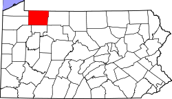
| State | Pennsylvania |
| County | Warren County |
| Elevation | 1,247 ft (380 m) |
| Time zone | UTC-5 (EST) |
| • Summer (DST) | UTC-4 (EDT) |
| GNIS feature ID | 1168563 [1] |
Backup Corners is an unincorporated community in Warren County, Pennsylvania, United States. [1]
Conewango Creek flows on the eastern boundary of the settlement.
A now-abandoned track of the Dunkirk, Allegheny Valley and Pittsburgh Railroad, completed in the early 1870s, passes through the settlement. [2] [3]