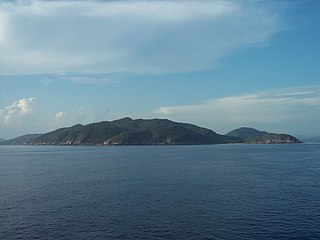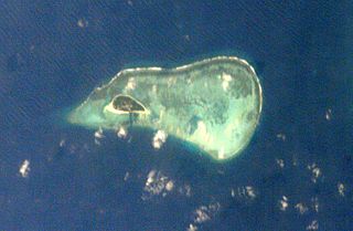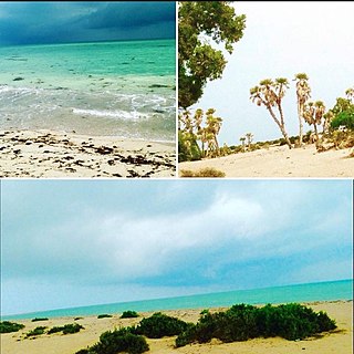
Natuna Regency is an islands regency located in the northernmost part of the Province of Riau Islands, Indonesia. It contains at least 154 islands, of which 127 of them are reported as uninhabited. This archipelago, with 264,198.37 km2 area, contains 15 sub-districts, including the island district of Pulau Laut, Bunguran/Greater Natuna Island, the island district of Pulau Tiga, the island district of Midai, the island district of Subi, and the island district of Serasan.

The Bunguran Islands are an archipelago in Riau Islands province, Indonesia, located in the Natuna Sea, the southern portion of the South China Sea. The archipelago forms the central part of the Natuna Regency, an archipelago of 272 islands in total, which is in turn included in the Tudjuh Archipelago, off the northwest coast of Borneo. The largest island of the archipelago is Bunguran or Pulau Natuna Besar, situated in the Middle Natuna Archipelago. The group covers a land area of 1,698.6 km2 and had a population of 52,013 at the 2010 Census. It is divided into nine districts (kecamatan) – seven of which are tabulated below from north to south with their areas and 2010 Census populations, plus the number of administrative villages within that district and the postcode:

Anambas Islands Regency is a small archipelago of Indonesia, located 150 nautical miles northeast of Batam Island in the North Natuna Sea between the Malaysian mainland to the west and the island of Borneo to the east. Geographically part of the Tudjuh Archipelago, it is administratively a regency within the Riau Islands Province. It covers a land area of 590.14 square kilometres (227.85 sq mi) and had a population of 37,411 at the 2010 Census and 47,402 at the 2020 Census. The administrative centre is at Tarempa on Siantan Island.
Rutland Island is an island of the Andaman Islands. It belongs to the South Andaman administrative district, part of the Indian union territory of Andaman and Nicobar Islands. The island is located 20 km (12 mi) south from Port Blair.

The Batu Islands are an archipelago of Indonesia located in the Indian Ocean, off the west coast of Sumatra, between Nias and Siberut. The three primary islands, of approximately equal size, are Pini, Tanahmasa, and Tanahbala. There are seventy-five smaller islands, of which the largest are Sipika, Tello and Sigata, Simuk and Bojo ; less than half are inhabited. The total land area of the seven administrative districts is 1,201.1 km2. The islands are governed as a part of South Nias regency within North Sumatra province. In Indonesian and Malay, batu means rock or stone.

Bintan Regency is an administrative area in the Riau Islands Province of Indonesia. Bintan Regency includes all of Bintan Island and also includes many outlying islands including the Tambelan Archipelago and Badas Islands situated between Bintan and West Kalimantan.
Tambelan archipelago is a group of 68 islands off the west coast of West Kalimantan, (Borneo), Indonesia, just north of the equator. The archipelago is located on the north opening of Karimata Strait which separates Borneo and Belitung island. Geographically it is part of the Tudjuh Archipelago, and administratively forms a district (kecamatan) of Bintan Regency within the Riau Islands Province. It covers a land area of 90.4 km2 and had a population of 4,975 at the 2010 Census. Major islands include Big Tambelan, Mendarik, Uwi, Benua, and Pejantan. The islands are divided into eight administrative villages (kelurahan) - Batu Lepuk, Kampung Hilir, Kampung Melayu, Kukup, Pengikik, Pulau Mentebung, Pulau Pinang and Teluk Sekuni.
South Natuna is an archipelago off the west coast of the island of Borneo, the southernmost group of the Natuna Islands in the South China Sea. Geographically it is part of the Tudjuh Archipelago, and administratively part of the Riau Islands province of Indonesia.
The Tudjuh Archipelago is a large group of islands in north-western Indonesia, off the west and north-west coast of the island of Borneo in the South China Sea. Administratively the islands belong to the Riau Islands province of Indonesia. The Tudjuh Archipelago consists of four island groups, the Badas Islands, the Tambelan Islands, the Natuna Islands, and the Anambas Islands. The south-westernmost extent of the archipelago is 1°4′S105°10′E.

Kanmaw Kyun or Kanmaw Island is an island in the Andaman Sea along the coast of southeastern Burma (Myanmar), and is part of the Mergui Archipelago. Administratively, it is located in Kyunsu Township, Myeik District, in the Taninthayi Region. On the northeastern side of the island is the town of Kyunsu, which is the administrative seat for the township. The island covers a total area of 409 km2.

Money Island is the southwesternmost island in the Crescent Group of the Paracel Islands archipelago. It rises to a height of 6 metres and is covered with brush. At the eastern side of the island lies an extensive reef, which contains a central lagoon, but the reef is mostly submerged at high tide. Inside the lagoon, the open areas range in depth from 7 to 20 metres. The sand cay at the southeastern extremity of reef is the reef's highest point. The channel between Money Island's reef and Antelope Reef is about 1.5 miles (2.4 km) wide. The reef continues around to the north side of the island. There is a small reef on the south side with a man-made channel cut through it to the beach.
Money Island or Ngwe Kyun is an island in the Mergui Archipelago of Taninthayi Region, Myanmar.
Sabi Island is an island in the Mergui Archipelago of Taninthayi Region, Burma (Myanmar). It lies between Money Island to the south and Parker Island to the north. The narrow channel between Sabi island and Money Island is rather shallow, but the half-mile wide channel between Sabi Island and Parker Island is quite deep. The island is heavily forested and has small bays with sandy beaches on the west side. The highest point is 326 m above the sea. Whaleback Reef, which lies about three-quarters of mile off the northeast part of the island, is exposed about 8 ft. at low tide.

Tabuan Island is an island of southern Sumatra, under the jurisdiction of Lampung province. It is administered as part of the Cukuh Balak district of Tanggamus Regency.
Little Karimun is an island in the Strait of Malacca, about 58 kilometres (36 mi) west of Batam and 35 km south-west of Singapore. It belongs to the Karimun Regency of the Riau Islands Province of Indonesia. It is located just off the east coast of Sumatra.
Kabo (Kabusgan) Island is a small island off the coast of the main island of Mindanao; administratively it is in Surigao del Norte of the Caraga Region of the Mindanao island group of the Philippines. The island is owned by the Calderon Family in Surigao.

The Kuala Penyu District is an administrative district in the Malaysian state of Sabah, part of the Interior Division which includes the districts of Beaufort, Keningau, Kuala Penyu, Nabawan, Sipitang, Tambunan and Tenom. The capital of the district is in Kuala Penyu Town.

Aibat is the second-largest of the six islands of the Zeila Archipelago. It has a lighthouse. It is a low and sandy island, with bushes, that is around 1.75 miles in length and around 0.55 miles in breadth. It is mostly surrounded by a reef. The island has an area of 1.58 square kilometers and is located 1.9 kilometers north of Sacadin Island, the largest of the group, and about 21 kilometers east of the Djibouti border.


