Banksia, New South Wales

Last updated

Banksia
Sydney,  New South Wales
Banksia NSW Shops (Princes Highway) JUL2019.jpg
Princes Highway at Banksia
Banksia, New South Wales
Population3,388 (2016 census) [1]
Established1906
Postcode(s) 2216
Elevation18 m (59 ft)
Location12 km (7 mi) south of Sydney CBD
LGA(s) Bayside Council
State electorate(s) Rockdale
Federal division(s) Barton
Suburbs around Banksia:
Bardwell Valley Arncliffe Arncliffe
Bexley Banksia Kyeemagh
Rockdale Rockdale Brighton-Le-Sands

Banksia is a suburb in southern Sydney, in the state of New South Wales, Australia. Banksia is located 12 kilometres south of the Sydney central business district, in the local government area of the Bayside Council and is part of the St George area.

Contents

History

Banksia is named for Joseph Banks, a botanist on the Voyage of Discovery of James Cook which visited the nearby Botany Bay in 1770. [2]

The suburb was part of land owned by Simeon Pearce (1821–86) and his brother James Pearce in the 1850s, which extended from Rockdale to Brighton-Le-Sands. Until the late nineteenth century, the area was heavily timbered but residential development began in the 1880s. One of the leading developers was Frederick Jamison Gibbes, a Member of Parliament, after whom Gibbes Street in the suburb is named. The area developed more rapidly after the railway station opened on 21 October 1906. Many names for the suburb were suggested but the final choice came from David George Stead, father of novelist Christina Stead. The post office opened in August 1924. [3]

Heritage listings

Banksia has a number of heritage-listed sites, including:

Landmarks

St Savvas of Kalymnos Orthodox Church Banksia (Formerly the Historical Banksia Free Church) St Savvas Kalymnos Orthodox Church Banksia.jpg
St Savvas of Kalymnos Orthodox Church Banksia (Formerly the Historical Banksia Free Church)

Commercial area

Shops on Railway Street Banksia NSW Shops (Railway Street) JUL2019.jpg
Shops on Railway Street

Banksia is mainly residential with a few commercial developments. It features mostly low density houses and some medium density blocks of flats. Banksia shopping centre consists of a small group of shops on Railway Street beside Banksia railway station. It includes Banksia Bakery, a take-away shop, a convenience store, chemist, Australia Post and a number of hairdressers.

More shops and commercial developments are located on the Princes Highway. This commercial area extends to the adjacent suburbs of Arncliffe and Rockdale. Many of the commercial developments are part of an automotive precinct featuring car yards, auto accessory retailers, tyre shops and auto repairers, other businesses include hotels and various take away food shops.

A market garden is located on the eastern side of West Botany Street, close to St George Soccer Stadium. Located next to St George Stadium on the grounds of Barton Park lies the Rockdale Ilinden Sports Centre, the former home grounds of the Rockdale Ilinden Football Club, a largely Macedonian supported NSWPL soccer club.

Transport

Banksia railway station on the Eastern Suburbs & Illawarra Line of the Sydney Trains network. Banksia is also serviced by Transit Systems route 420 that runs between Burwood and Eastgardens via Sydney Airport. [5]

Population

According to the 2016 census, there were 3,388 residents in Banksia. 49.9% of people were born in Australia. The next most common countries of birth were Macedonia 7.0% and China 4.6%. 42.4% of people only spoke English at home. Other languages spoken at home included Macedonian 10.8%, Arabic 5.9%, Cantonese 5.2%, Greek 4.8% and Mandarin 3.1%. The most common responses for religion were Catholic 23.8%, No Religion 18.2% and Eastern Orthodox 16.5%. [1]

Houses

Related Research Articles

<span class="mw-page-title-main">Beverly Hills, New South Wales</span> Suburb of Sydney, New South Wales, Australia

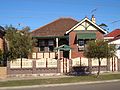
Beverly Hills is a southern suburb of Sydney, in the state of New South Wales, Australia. Beverly Hills is located 15 kilometres southwest of the Sydney central business district and is part of the St George area and is split between the local government areas of the Georges River Council and the City of Canterbury-Bankstown. The postcode is 2209, which it shares with neighbouring Narwee.

<span class="mw-page-title-main">Arncliffe, New South Wales</span> Suburb of Sydney, New South Wales, Australia

Arncliffe is a suburb in southern Sydney, in the state of New South Wales, Australia. Arncliffe is located 11 kilometres south of the Sydney central business district, in the local government area of the Bayside Council.
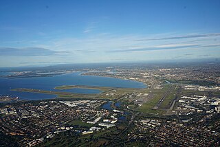
<span class="mw-page-title-main">Botany, New South Wales</span> Suburb of Sydney, New South Wales, Australia

Botany is a suburb in the Eastern Suburbs of Sydney, in the state of New South Wales, Australia. Botany is located 11 kilometres south of the Sydney central business district and is part of the Bayside Council.

<span class="mw-page-title-main">Brighton-Le-Sands, New South Wales</span> Suburb of Sydney, New South Wales, Australia

Brighton Le Sands, is a suburb in southern Sydney, in the state of New South Wales, Australia. Brighton Le Sands is located 13 kilometres south of the Sydney central business district, on the western shore of Botany Bay. Brighton Le Sands is in the local government area of the Bayside Council and is part of the St George area.

<span class="mw-page-title-main">St George, Sydney</span> Region in New South Wales, Australia

The St George region of Sydney is part of the southern suburbs of Sydney, in the state of New South Wales, Australia. The area includes all the suburbs in the local government area of Georges River Council and the part of Bayside Council which was Rockdale City prior to 2016. This is everything within the boundaries of Salt Pan Creek to the west, The Georges River to the south, Botany Bay to the east and the M5 Motorway and Wolli Creek to the north. This area corresponds to the southern portion of the cadastral Parish of St George, from which the region derives its name and the area was later covered by the St George County Council, the electricity supplier for the councils in this region. This southern portion of the parish below The M5 and Wolli Creek is the more contemporary definition of The St George Region that is considered part of Southern Sydney.

<span class="mw-page-title-main">Rockdale, New South Wales</span> Suburb of Sydney, New South Wales, Australia

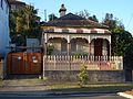
Rockdale is a suburb in southern Sydney, in the state of New South Wales, Australia. Rockdale is located 13 kilometres south of the Sydney central business district and is part of the St George area. Rockdale is one of the administrative centres for the local government area of the Bayside Council. Since 1985 Rockdale has been a twinned city with Bitola, in the Republic of Macedonia.

<span class="mw-page-title-main">Tempe, New South Wales</span> Suburb of Sydney, New South Wales, Australia

Tempe is a suburb in the Inner West of Sydney, in the state of New South Wales, Australia. Tempe is located 9 kilometres south of the Sydney central business district in the local government area of Inner West Council.

<span class="mw-page-title-main">Sans Souci, New South Wales</span> Suburb of Sydney, New South Wales, Australia

Sans Souci is a Southern Sydney suburb in the state of New South Wales, Australia. Sans Souci is 17 kilometres south of the Sydney central business district and lies across the local government areas of the Bayside Council and the Georges River Council. It is part of the St George area.

<span class="mw-page-title-main">Turrella, New South Wales</span> Suburb of Sydney, New South Wales, Australia

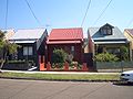
Turrella (;) is a suburb in southern Sydney, in the state of New South Wales, Australia. Turrella is located 10 km south-west of the Sydney central business district on the southern bank of Wolli Creek in the local government area of Bayside Council.

<span class="mw-page-title-main">Monterey, New South Wales</span> Suburb of Sydney, New South Wales, Australia

Monterey is a suburb in southern Sydney, in the state of New South Wales, Australia 15 km south of the Sydney central business district and is part of the St George area. Monterey is in the local government area of the Bayside Council.

<span class="mw-page-title-main">Kingsgrove</span> Suburb of Sydney, New South Wales, Australia

Kingsgrove is a suburb in Southern Sydney, New South Wales, Australia. Kingsgrove is 13 kilometres (8.1 mi) south-west of the Sydney central business district and lies across the local government areas of the City of Canterbury-Bankstown, Bayside Council and the Georges River Council.

<span class="mw-page-title-main">Kyeemagh</span> Suburb of Sydney, New South Wales, Australia

Kyeemagh is a suburb in southern Sydney, in the state of New South Wales, Australia. It is 12 kilometres south of the Sydney central business district, on the western shore of Botany Bay. Kyeemagh is in the local government area of the Bayside Council and is part of the St George area.

<span class="mw-page-title-main">Wolli Creek, New South Wales</span> Suburb of Sydney, New South Wales, Australia

Wolli Creek is a suburb in southern Sydney, in the state of New South Wales, Australia. It sits beside the Wolli Creek and Cooks River waterways. Wolli Creek is situated between the suburbs of Arncliffe and Tempe, 10 kilometres south of the Sydney central business district and is part of the St George area. Wolli Creek is in the local government area of Bayside Council.

<span class="mw-page-title-main">Bexley North, New South Wales</span> Suburb of Sydney, New South Wales, Australia

Bexley North is a suburb in southern Sydney, in the state of New South Wales, Australia, 13 kilometres south-west of the Sydney CBD. It is part of the St George area. Bexley North is in the local government area of the Bayside Council.

<span class="mw-page-title-main">Croydon Park, New South Wales</span> Suburb of Sydney, New South Wales, Australia

Croydon Park is a suburb in the Inner West of Sydney, in the state of New South Wales, Australia. Croydon Park is 10 kilometres south-west of the Sydney central business district and is divided between the local government areas of the City of Canterbury-Bankstown, Municipality of Burwood and Inner West Council. Croydon is a separate suburb, to the north.

<span class="mw-page-title-main">Bexley, New South Wales</span> Suburb of Sydney, New South Wales, Australia

Bexley is a suburb in southern Sydney, in the state of New South Wales, Australia. Bexley is located 14 kilometres (8.7 mi) south-west of the Sydney central business district, in the local government area of the Bayside Council and is part of the St George area.

<span class="mw-page-title-main">Rockdale Ilinden FC</span> Australian soccer club

Rockdale Ilinden Football Club is an Australian semi-professional soccer club based in Sydney suburb of Rockdale. Founded in 1969, by Macedonian Australians, the club competes in the highest men's competition in New South Wales, the National Premier League NSW. The club's home ground is Ilinden Sports Centre, located in the suburb of Rockdale, New South Wales.

Macedonian Australians are Australian citizens of Macedonian descent. Many arrived in the 1920s and 1930s, although larger numbers came to Australia after World War II and the Greek Civil War. By far the largest wave of immigration was during the 1960s and 1970s. As of the 2021 Australian census, Macedonian is the most-spoken Eastern European language in Australia.

<span class="mw-page-title-main">Rockdale Ilinden Sports Centre (Arncliffe, New South Wales)</span>

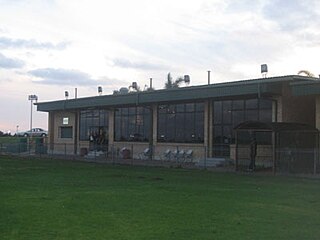
Rockdale Ilinden Sports Centre was located on the grounds of Barton Park in Arncliffe, New South Wales in Australia. It was the home ground of the Rockdale Ilinden Football Club, who played in the New South Wales Super League.

<span class="mw-page-title-main">Rockdale Bicentennial Park</span>

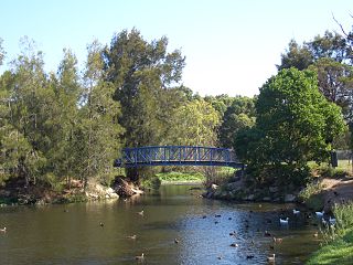
Bicentennial Park is a recreational area in Rockdale, a suburb of Sydney in New South Wales, Australia. It features a bike track, athletics facilities and soccer and rugby league grounds. The park is divided into three sections known as Bicentennial Park North, Bicentennial Park South and Bicentennial Park East. Two ponds are linked by a creek to more wetlands in Scarborough park, to the south. A footbridge over the ponds links Bicentennial Park East to the rest of the recreational area.

References

  1. 1 2 Australian Bureau of Statistics (27 June 2017). "Banksia (State Suburb)". 2016 Census QuickStats. Retrieved 3 March 2018. OOjs UI icon edit-ltr-progressive.svg
  2. The Book of Sydney Suburbs, Compiled by Frances Pollon, Angus & Robertson Publishers, 1990, ISBN   0-207-14495-8, page 17
  3. Pictorial Memories ST. GEORGE: Rockdale, Kogarah, Hurstville Joan Lawrence, Kingsclear Books, 1996, Published in Australia ISBN   0-908272-45-6
  4. "Arncliffe Market Gardens". New South Wales State Heritage Register . Department of Planning & Environment. H01395. Retrieved 18 May 2018. CC BY icon.svg Text is licensed by State of New South Wales (Department of Planning and Environment) under CC-BY 4.0 licence .
  5. "Transit Systems route 420". Transport for NSW.

33°56′52″S151°08′53″E / 33.94776°S 151.14806°E / -33.94776; 151.14806