Barkby Thorpe

Last updated
Barkby Thorpe
Welcome to Barkby Thorpe - geograph.org.uk - 497106.jpg
Leicestershire UK location map.svg
Red pog.svg
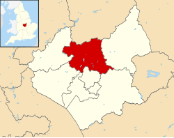
Barkby Thorpe
Location within Leicestershire
Population50 
Civil parish
  • Barkby Thorpe
District
Shire county
Region
Country England
Sovereign state United Kingdom
Post town Leicester
Postcode district LE7
Police Leicestershire
Fire Leicestershire
Ambulance East Midlands
UK Parliament
List of places
UK
England
Leicestershire
52°40′34″N1°03′43″W / 52.676°N 1.062°W / 52.676; -1.062

Barkby Thorpe is a hamlet and civil parish in the Charnwood district of Leicestershire, England. The hamlet has a population of around 50, and is close to the Leicester urban sprawl in Thurmaston. Nearby villages are Barkby, Beeby, Hamilton, Hamilton Lea and the abandoned village of Hamilton.

The name Barkby has an Old Norse origin meaning "Barki's farm/settlement". [1]

Related Research Articles

<span class="mw-page-title-main">Borough of Charnwood</span> Borough and non-metropolitan district in England

Charnwood is a local government district with borough status in the north of Leicestershire, England. It is named after Charnwood Forest, much of which lies within the borough. The council is based in Loughborough, the area's largest town. The borough also contains the towns of Shepshed and Syston, along with numerous villages and surrounding rural areas. In the south of the borough it includes parts of the Leicester Urban Area, notably at Birstall and Thurmaston.

<span class="mw-page-title-main">Thurmaston</span> Village in Leicestershire, England

Thurmaston is a village and civil parish in Leicestershire, England, located within the Borough of Charnwood. At the 2011 census, it had a population of 9,668.

<span class="mw-page-title-main">Norwich North (UK Parliament constituency)</span> Parliamentary constituency in the United Kingdom, 1950 onwards

Norwich North is a constituency represented in the House of Commons of the UK Parliament since 2009 by Conservative Chloe Smith.

<span class="mw-page-title-main">Thorpe Thewles</span>

Thorpe Thewles is a village which had history dating back to the 12th century. The village shares a parish with Grindon and is in the Borough of Stockton-on-Tees, County Durham, Northern England. It lies near the A177 road between Stockton-on-Tees and Sedgefield.

<span class="mw-page-title-main">Beeby</span> Village and civil parish in the Charnwood district of Leicestershire, England

Beeby is a village and civil parish in the Charnwood district of Leicestershire, England, with a population of 115 according to the 2011 census. It is situated north-east of Leicester, nearer to the villages of Keyham and Hungarton in the neighbouring district of Harborough and lies along the Barkby Brook. This small rural hamlet can be succinctly described as "a series of scattered houses that remain of the shrunken medieval village". The parish also includes the hamlet of Little Beeby, which consists of several houses within the settlement and is located 200m south east of the All Saints Church.

<span class="mw-page-title-main">Barkby</span> Human settlement in England

Barkby is a village and civil parish in the Charnwood district of Leicestershire, England. It is situated north-east of Leicester, and only a short way from Leicester's urban sprawl in Thurmaston and Syston. Nearby villages are Beeby and Barkby Thorpe. Barkby Brook is the main watercourse which flows through Barkby. The parish has a population of around 300.

<span class="mw-page-title-main">Aunsby and Dembleby</span> Civil parish in the North Kesteven district of Lincolnshire, England

Aunsby and Dembleby is a civil parish in the North Kesteven district of Lincolnshire, England. According to the 2001 Census it had a population of 125. The parish includes Aunsby and Dembleby, which were separate parishes until 1931, and the hamlet of Scott Willoughby.

<span class="mw-page-title-main">Cheswick Green</span>

Cheswick Green is a village and civil parish within the Metropolitan Borough of Solihull in the English county of West Midlands, incorporating the nearby hamlet of Illshaw Heath. The settlement lies approximately 3 miles (4.8 km) south west of Solihull town centre. The civil parish population as taken at the 2011 census was 2,197. It borders Dickens Heath and Monkspath to the north, and Earlswood and Warings Green to the south. The northernmost part of Warings Green lies in the parish of Cheswick Green.

<span class="mw-page-title-main">Thorpe in the Glebe</span> Hamlet and civil parish in Nottinghamshire, England

Thorpe in the Glebe was a village in Nottinghamshire to the south of Wysall on the Leicestershire border. It was sometimes called Thorpe in the Clottes. Tradition has it that the village was destroyed either at the Battle of Willoughby Field or alternatively by a hail-storm. However, at the time of the English Civil War, there had been no village at Thorpe in the Glebe for nearly 200 years.

Elkington is a civil parish in the East Lindsey district of Lincolnshire, England. It comprises the village of South Elkington, and the hamlets of North Elkington, Boswell, and Thorpe, and is situated approximately 3 miles (5 km) north-west from the market town of Louth.

<span class="mw-page-title-main">Brailsford</span> Human settlement in England

Brailsford is a small red-brick village and civil parish in Derbyshire on the A52 midway between Derby and Ashbourne. The parish also includes Brailsford Green. The civil parish population at the 2011 Census was 1,118. The village has a pub, a golf club, a post office and a school. There are many fine houses in the district including two 20th-century country houses: Brailsford Hall built in 1905 in Jacobean style, and Culland Hall.

<span class="mw-page-title-main">Edenham</span> Village and civil parish in the South Kesteven district of Lincolnshire, England

Edenham is a village and civil parish in the South Kesteven district of Lincolnshire, England. It is approximately 3 miles (5 km) north-west of Bourne, and on the A151 road. While the civil parish is called 'Edenham', the parish council is called Edenham, Grimsthorpe, Elsthorpe & Scottlethorpe Parish Council. The population of the civil parish at the 2011 census was 291.

<span class="mw-page-title-main">Thorpe, North Yorkshire</span> Hamlet and civil parish in North Yorkshire, England

Thorpe is a hamlet and civil parish in the Wharfedale valley, in North Yorkshire, England. It is 2 miles (3 km) south of Grassington and 6 miles (10 km) north of Skipton. At the 2011 census the population remained less than 100, so the details were included in the civil parish of Burnsall. However in 2015, North Yorkshire County Council estimated the population to be 50.

<span class="mw-page-title-main">A607 road</span> Road in England

The A607 is an A road in England that starts in Belgrave, Leicester and heads northeastwards through Leicestershire and the town of Grantham, Lincolnshire, terminating at Bracebridge Heath, a village on the outskirts of Lincoln. It is a primary route from Thurmaston to the A1 junction at Grantham.

<span class="mw-page-title-main">Hollington, Staffordshire</span> Human settlement in England

Hollington is a village in the Staffordshire Moorlands in English county of Staffordshire. There are several villages of this same name, and there is a Hollington, Derbyshire a few miles to the east in Derbyshire. The population taken at the 2011 census was 212.

<span class="mw-page-title-main">Thorpe Hamlet</span> Suburb of Norwich, England

Thorpe Hamlet is a suburb of Norwich, to the east of the city centre, in the Norwich District, in the English county of Norfolk. It was constituted a separate ecclesiastical parish on 9 March 1852, from the civil parish of Old Thorpe, and in 1912, was in the rural deanery of Blofield.

<span class="mw-page-title-main">Humberstone and Hamilton</span> Electoral ward and administrative division of Leicester, England

Humberstone and Hamilton is an electoral ward and administrative division of the City of Leicester, England. It comprises the north-eastern Leicester suburbs of Humberstone, Humberstone Garden City, Hamilton and Netherhall.

<span class="mw-page-title-main">Lubbesthorpe</span>

Lubbesthorpe is a hamlet and parish in the district of Blaby within Enderby on the outskirts of Leicester, on the west side of the M1 motorway and the River Soar.

Hamilton Lea is a village and civil parish on the edge of Leicester, Leicestershire, England.

References

  1. Institute of Name-Studies. "Barkby". Key to English Place-names. Archived from the original on 26 February 2015. Retrieved 26 February 2015.

52°40′34″N1°03′43″W / 52.676°N 1.062°W / 52.676; -1.062