Thrussington

Last updated

Thrussington
Leicestershire UK location map.svg
Red pog.svg
Thrussington
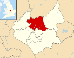
Location within Leicestershire
Population581 (2011)
District
Shire county
Region
Country England
Sovereign state United Kingdom
Post town Leicester
Postcode district LE7
Dialling code 01664
Police Leicestershire
Fire Leicestershire
Ambulance East Midlands
UK Parliament
List of places
UK
England
Leicestershire
52°44′13″N1°02′28″W / 52.736944°N 1.041111°W / 52.736944; -1.041111 Coordinates: 52°44′13″N1°02′28″W / 52.736944°N 1.041111°W / 52.736944; -1.041111
Thrussington Holy Trinity north aspect Thrussington Holy Trinity north aspect.JPG
Thrussington Holy Trinity north aspect
The Blue Lion Thrussington The Blue Lion.JPG
The Blue Lion

Thrussington is a village and civil parish in the Charnwood district of Leicestershire, England. The population of the civil parish at the 2011 census was 587. [1] It is on the River Wreake, near to Rearsby, Ratcliffe on the Wreake, Hoby and Brooksby, and not far from the path of the Fosse Way.

Contents

Toponymy

The place-name 'Thrussington' is first attested in the Domesday Book of 1086, where it appears as Turstanetone. It appears as Tursteineston in the Pipe Rolls of 1175. The name means 'Thursten's town or settlement'. [2]

Events

The village boasts several annual events, including the Thrussington Fun Run, Skittles on The Green, and various social and fund–raising events (most of which raise money for the local school, church, or village hall). According to the Thrussington Parish council web site Thrussington is a small village which originated as a Danish settlement on the western side of the River Wreake. The village is a thriving community of approximately 550 residents, and has a school, hairdresser and two public houses. The village church is Holy Trinity and is of Norman origin. [3] The village seems to have been shared, in political and historical terms, between the Lords of Loughborough and Melton, [4] as there is no record of a "Lord of the Manor". In the 19th century, Sir Harry Goodrick, Bart., was a patron of the sports of cockfighting, boxing, and hunting with hounds. [5] [6]

John Marius Wilson's Imperial Gazetteer of England and Wales described Thrussington: "THRUSSINGTON, a parish, with a village, in Barrow-upon-Soar district, Leicester; on the river Wreak, ½ a mile N of Rearsby r. station, and 7½ WSW of Melton-Mowbray. It has a post-office under Leicester. Acres, 2,200. Real property, £4,113. Pop., 574. Houses, 136. The manor is divided among four. The living is a vicarage in the diocese of Peterborough. Value, £240. Patron, Mrs. Bishop. The church was repaired in 1836. There are three dissenting chapels, a slightly endowed school, and charities £11." [7] The Anglican church is dedicated to The Holy Trinity and seats 250. It was built in the 14th century, substantially repaired in 1836, and further restored in 1877, including the tower. [4]

The village has had some success in promoting its "in bloom" image. [3]

Population

The Parish of Thrussington has a population of around 500 people.

Transport

Thrussington is situated 1 mile East of the A46 giving easy access by car to both Leicester and Nottingham.

World Wars

A cenotaph on Thrussington's Village Green honours the citizens of the village who served their country in military service during the twentieth century's wars.

Related Research Articles

<span class="mw-page-title-main">Melton Mowbray</span> Town in Leicestershire, England

Melton Mowbray is a town and unparished area in the Melton district in Leicestershire, England, 19 miles (31 km) north-east of Leicester, and 20 miles (32 km) south-east of Nottingham. It lies on the River Eye, known below Melton as the Wreake. The town had a population of 27,670 in 2019. The town is sometimes promoted as Britain's "Rural Capital of Food"; it is the home of the Melton Mowbray pork pie and is the location of one of six licensed makers of Stilton cheese.

<span class="mw-page-title-main">Frisby on the Wreake</span> Human settlement in England

Frisby on the Wreake is a village and civil parish on the River Wreake about 3.5 miles (5.6 km) west of Melton Mowbray, Leicestershire, England. The 2011 Census recorded the parish's population as 557.

<span class="mw-page-title-main">Hungarton</span> Human settlement in England

Hungarton is a small village and civil parish in the Harborough district, in the county of Leicestershire, England, about 10 miles (16 km) north-east of Leicester and 13 miles (21 km) south-west of Melton Mowbray. The population of the civil parish was 269 at the 2001 census, including Ingarsby, and increased to 289 at the 2011 census.

<span class="mw-page-title-main">Cossington, Leicestershire</span> Human settlement in England

Cossington is a village within the Soar Valley in Leicestershire, England. It lies between Sileby, Rothley, Ratcliffe-on-the-Wreake and Syston. The population of the civil parish at the 2011 census was 598.

<span class="mw-page-title-main">Asfordby</span> Human settlement in England

Asfordby is a village and civil parish in the Melton district of Leicestershire, to the west of Melton Mowbray on the A6006 road. The village is north-east of Leicester.

<span class="mw-page-title-main">Ratcliffe on the Wreake</span> Human settlement in England

Ratcliffe on the Wreake is a village and civil parish in the Charnwood district of Leicestershire, England. The population of the civil parish at the 2011 census was 179. It is just to the north of the River Wreake, opposite East Goscote.

<span class="mw-page-title-main">Rearsby</span> Human settlement in England

Rearsby is a village and civil parish in the Charnwood district of Leicestershire, England. It is known for its Seven Arch Bridge, and is also home to the Preachers Stone.

<span class="mw-page-title-main">South Croxton</span> Human settlement in England

South Croxton is a village and civil parish in the Charnwood district of Leicestershire, England. It had a population of 261 in the 2011 census. Nearby villages include Beeby, Barsby and Twyford.

<span class="mw-page-title-main">Freeby</span> Human settlement in England

Freeby is a village and civil parish in the Melton district of Leicestershire, England, about 3 miles (5 km) east of Melton Mowbray. As well as the village of Freeby the civil parish includes the villages of Brentingby, Saxby, Stapleford and Wyfordby. The 2011 Census recorded the parish population as 244.

<span class="mw-page-title-main">Granby, Nottinghamshire</span> Human settlement in England

Granby is a small village in the Rushcliffe district of Nottinghamshire, England. It lies in the Vale of Belvoir.

<span class="mw-page-title-main">Melton Mowbray Navigation</span>

The Melton Mowbray Navigation was formed when the River Wreake in Leicestershire, England, was made navigable upstream from its junction with the River Soar and the Leicester Navigation near Syston to Melton Mowbray, opening in 1797. Largely river navigation, there were numerous lock cuts, to accommodate the 12 broad locks built along its length, many of which were built at sites where it was necessary to maintain the water levels for an adjacent mill.

<span class="mw-page-title-main">A607 road</span> Road in England

The A607 is an A road in England that starts in Belgrave, Leicester and heads northeastwards through Leicestershire and the town of Grantham, Lincolnshire, terminating at Bracebridge Heath, a village on the outskirts of Lincoln. It is a primary route from Thurmaston to the A1 junction at Grantham.

<span class="mw-page-title-main">Thorpe Arnold</span> Village in Leicestershire, England

Thorpe Arnold is a farming village and former civil parish, now in the parish of Waltham on the Wolds and Thorpe Arnold in the district of Melton, which is approximately 1.2 miles (1.9 km) northeast of Melton Mowbray in Leicestershire, England. In 1931 the parish had a population of 128. On 1 April 1936 the parish was abolished and to form Waltham.

<span class="mw-page-title-main">Muston, Leicestershire</span> Village in Leicestershire, England

Muston is an village and former civil parish, now in the parish of Bottesford, in the Melton district, in north-east Leicestershire, England. It is 18.6 miles (30 km) east of Nottingham, five miles (8 km) west of Grantham on the A52 and 12.5 miles (20 km) north of Melton Mowbray. It lies on the Leicestershire/Lincolnshire county border, two miles east of Bottesford. The River Devon flows through the village. In 1931 the parish had a population of 218. On 1 April 1936 the parish was abolished and merged with Bottesford.

<span class="mw-page-title-main">Kirby Bellars</span> Human settlement in England

Kirby Bellars is a village and civil parish near Melton Mowbray in Leicestershire, England. The population of the civil parish at the 2011 census was 369.

<span class="mw-page-title-main">St Peter & St Paul's Church, Syston</span> Church in Syston, England

St Peter and St Paul's Church, Syston is a Grade I listed parish church in the Church of England in Syston, Leicestershire.

<span class="mw-page-title-main">North Piddle</span> Human settlement in England

North Piddle is a small civil parish in the Wychavon district of Worcestershire, England. It is located within a loop of Piddle Brook.

<span class="mw-page-title-main">St Botolph's Church, Ratcliffe on the Wreake</span> Church in Ratcliffe on the Wreake, England

St Botolph's Church is a Grade II* listed Church of England church in the village of Ratcliffe on the Wreake, Leicestershire, England.

References

  1. "Civil Parish population 2011". Neighbourhood Statistics. Office for National Statistics. Archived from the original on 11 October 2016. Retrieved 22 June 2016.
  2. Eilert Ekwall, The Concise Oxford Dictionary of English Place-names, pp.471, 470.
  3. 1 2 "Thrussington Parish council (website)". Archived from the original on 31 August 2011. Retrieved 5 January 2011.
  4. 1 2 "www.genuki.org". Archived from the original on 16 October 2010. Retrieved 5 January 2011.
  5. "Thrumpton - Thurlby." A Topographical Dictionary of England. Ed. Samuel Lewis. London: S Lewis, 1848. 349-351. British History Online. Retrieved 24 May 2019. http://www.british-history.ac.uk/topographical-dict/england/pp349-351 Archived 17 May 2021 at the Wayback Machine .
  6. McQuaid, John. (15 March 2015)."Yesterday in Melton Mowbray". John McQuaid (Blog website) Archived 19 April 2021 at the Wayback Machine Retrieved 24 May 2019.
  7. "Imperial Gazetteer". Archived from the original on 4 November 2012. Retrieved 5 January 2011.

Commons-logo.svg Media related to Thrussington at Wikimedia Commons