Hathern

Last updated

Hathern
Hathern parish church 2006-04-06 023web.jpg
St Peter & St Paul Church, Hathern
Leicestershire UK location map.svg
Red pog.svg
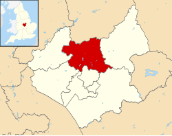
Hathern
Location within Leicestershire
Population1,866 (2011)
District
Shire county
Region
Country England
Sovereign state United Kingdom
Post town Loughborough
Postcode district LE12
Dialling code 01509
Police Leicestershire
Fire Leicestershire
Ambulance East Midlands
UK Parliament
List of places
UK
England
Leicestershire
52°47′44″N1°15′23″W / 52.7956°N 1.2563°W / 52.7956; -1.2563

Hathern is a village and civil parish in the Charnwood district of Leicestershire, England. The village itself is located in the north of the district, and is just north of Loughborough. It is served by the A6. The parish has a population of about 1,800. Nearby places are Dishley, Long Whatton, and Zouch, over the border in Nottinghamshire. Residents of the village have, in recent years, campaigned to prevent the green "wedge" separating Loughborough, Shepshed and Hathern from being built on. [1] The village is home to the Swift Sock Factory, one of only a small number of independent sock manufacturers left in the UK. [2]

Contents

Hathern Signpost UK Hathern.jpg
Hathern Signpost

Notable residents

John Heathcoat (1783–1861), inventor and industrialist, operated a textile mill in Hathern (where, in 1808–9, he invented the bobbin net machine, for weaving a lace-like hexagonal net), before moving his business first to Loughborough, and later to Tiverton, Devon.

History

A settlement probably existed here in the Saxon period but the first written record was in the Domesday Book where it was called Avederne, Old English for hawthorne. [3] Prominent in the centre of the village is Hathern cross, dating from the 14th century. Like most villages in this part of the country, farming and framework knitting were major sources of employment. The parish church dates mainly from the 14th century although a place of worship probably existed on the site in earlier times. An ancient font, one of the oldest in the county is regularly used for baptisms. [4]

Related Research Articles

<span class="mw-page-title-main">Loughborough</span> Town in Leicestershire, England

Loughborough is a market town in the Charnwood Borough of Leicestershire, England; it is the administrative centre of Charnwood Borough Council. At the United Kingdom 2021 census, the town's built-up area had a population of 64,884.

<span class="mw-page-title-main">Borough of Charnwood</span> Borough and non-metropolitan district in England

Charnwood is a local government district with borough status in the north of Leicestershire, England. It is named after Charnwood Forest, much of which lies within the borough. Towns in the borough include Loughborough, Shepshed and Syston. Villages in the borough include Barrow upon Soar, Birstall, Hathern, Mountsorrel, Quorn, Rothley, Sileby and Woodhouse Eaves.

<span class="mw-page-title-main">Kegworth</span> Village in Leicestershire, England

Kegworth is a large village and civil parish in the North West Leicestershire district of Leicestershire, in the East Midlands region, England. It forms part of the border with Nottinghamshire and is situated 6 miles north of Loughborough, 12 miles southwest of Nottingham, 12.5 miles southeast of Derby and 17 miles north of Leicester. The population of Kegworth as of the 2011 census was 3,601.

Much Hadham, formerly known as Great Hadham, is a village and civil parish in the district of East Hertfordshire, Hertfordshire, England. The parish of Much Hadham contains the hamlets of Perry Green and Green Tye, as well as the village of Much Hadham itself and Hadham Cross. It covers 4,490 acres (1,820 ha). The village of Much Hadham is situated midway between Ware and Bishop's Stortford. The population of the parish was recorded as 2,087 in the 2011 census, an increase from 1,994 in 2001.

<span class="mw-page-title-main">Chadlington</span> Human settlement in England

Chadlington is a village and civil parish in the Evenlode Valley about 3 miles (5 km) south of Chipping Norton, Oxfordshire. The village has four neighbourhoods: Brookend, Eastend, Greenend and Westend.

<span class="mw-page-title-main">Buckhorn Weston</span> Human settlement in England

Buckhorn Weston is a village and civil parish in the English county of Dorset, situated in the Blackmore Vale about 3 miles west of the town of Gillingham. It lies on the western edge of the former royal hunting ground of Gillingham Forest. The underlying geology is Oxford clay and Corallian limestone. In the 2011 census the civil parish had a population of 356.

<span class="mw-page-title-main">Mountsorrel</span> Human settlement in England

Mountsorrel is a village in Leicestershire on the River Soar, just south of Loughborough with a population in 2001 of 6,662 inhabitants, increasing to 8,223 at the 2011 census.

<span class="mw-page-title-main">John Heathcoat</span> English inventor

John Heathcoat was an English inventor from Duffield, Derbyshire. During his apprenticeship he made an improvement to the warp-loom, so as to produce mitts of a lace-like appearance. He set up his own business in Nottingham but was forced to move away to Hathern in Leicestershire, and after this new factory was attacked by former Luddites in 1816 he moved the business to Tiverton in Devon where it became most successful and established the Tiverton lace-making industry.

<span class="mw-page-title-main">Ruddington</span> Village in Nottinghamshire, England

Ruddington is a large village in the Borough of Rushcliffe in Nottinghamshire, England. The village is 5 miles (8 km) south of Nottingham and 11 miles (18 km) northwest of Loughborough. It had a population of 6,441 at the 2001 Census, increasing to 7,216 at the 2011 Census and 7,674 in 2021. Ruddington is twinned with Grenay, France.

<span class="mw-page-title-main">Loughborough (UK Parliament constituency)</span> Parliamentary constituency in the United Kingdom, 1885 onwards

Loughborough is a constituency in Leicestershire represented in the House of Commons of the UK Parliament since 2024 by Jeevun Sandher of the Labour Party. The constituency is a considered a bellwether, as it has reflected the national result at every general election since February 1974.

<span class="mw-page-title-main">Rampton, Nottinghamshire</span> Human settlement in England

Rampton is a village in the civil parish of Rampton and Woodbeck, about 6 miles (10 km) east of Retford in the Bassetlaw district, in the county of Nottinghamshire, England. The parish is long and thin, extending about 7 miles (11 km) east–west but only about 1 mile (1.6 km) north–south. Its eastern boundary is the River Trent, which here also forms the county boundary with Lincolnshire.

<span class="mw-page-title-main">East Leake</span> Village in South Nottinghamshire, England

East Leake is a large village and civil parish in the Rushcliffe district of Nottinghamshire, England, although its closest town and postal address is Loughborough in Leicestershire. Census data from 2021 shows that the village now has a population of 8,553. The original village was located on the Sheepwash Brook. Kingston Brook also runs through the village. Near the centre of the village is the historic St. Mary's Church, dating back to the 11th century, which Sheepwash Brook flows past, and an old ford, which provided access to the pinfold. The church has six bells.

<span class="mw-page-title-main">Pendock</span> Human settlement in England

Pendock is a village and civil parish in the Malvern Hills district in the county of Worcestershire, England, situated about halfway between the towns of Tewkesbury and Ledbury. The name is probably from old Welsh, possibly penn heddioc, meaning 'head of the barley field.

<span class="mw-page-title-main">Great Gransden</span> Village in Huntingdonshire, England

Great Gransden is a civil parish and village in the Huntingdonshire district of Cambridgeshire, England. In 2001, the parish population was 969, which rose to 1,023 at the 2011 Census. It lies 16 miles (25 km) west of Cambridge and 13 miles (21 km) south of Huntingdon. It contains the oldest post mill in England.

<span class="mw-page-title-main">Church of St Nicholas, Bradfield</span> Listed church in Sheffield, South Yorkshire, England

The Church of St. Nicholas, Bradfield is situated in the small village of High Bradfield, which is located 6 miles (10 km) north west of the centre of the city of Sheffield in South Yorkshire, England. It is one of only five Grade One Listed buildings in Sheffield. The church is situated 260 metres (850 ft) above sea level, overlooking the Peak District National Park.

<span class="mw-page-title-main">Long Whatton</span> Human settlement in England

Long Whatton is a village and former civil parish, now in the parish of Long Whatton and Diseworth, in the North West Leicestershire district, in the English county of Leicestershire. It is south of East Midlands Airport, off Junctions 23 and 23A of the M1 motorway, and has easy access to Loughborough via the A6 and to Shepshed, Ashby-de-la-Zouch and Kegworth.

<span class="mw-page-title-main">Wistow, Leicestershire</span> Human settlement in England

Wistow is a deserted medieval village and civil parish in the Harborough district, in the English county of Leicestershire, and lies seven miles south-east of the city of Leicester in the valley of the River Sence. Since 1 April 1936 it has included most of the former civil parish of Newton Harcourt which was a chapelry of Wistow. The population of the civil parish at the 2011 census was 256.

<span class="mw-page-title-main">Hoby with Rotherby</span> Civil parish in Leicestershire, England

Hoby with Rotherby is a civil parish in Leicestershire, England. In the 2001 census it had a population of 594, reducing to 556 at the time of the 2011 census. It includes the villages of Hoby, Rotherby, Ragdale and Brooksby. The parish is part of Melton local government district, and within the Rutland and Melton constituency. There is a Parish Council for Hoby with Rotherby that manages the area. It meets six times a year and the meetings are open to the public.

St Thomas the Apostle Rural, also known as St Thomas-by-Launceston is a civil parish in east Cornwall, England, United Kingdom. It is centred on the village of Tregadillett and is in the Registration District of Launceston.

<span class="mw-page-title-main">St Mary's Church, Ashwell, Hertfordshire</span> Church in Hertfordshire, England

The Church of St Mary the Virgin in Ashwell, in the English county of Hertfordshire, is the Anglican parish church for the village. It comes under the Diocese of St Albans and is one of the largest village churches in the county. The Church is part of a wider benefice, together with St Nicholas', Hinxworth and St Vincent's, Newnham, and the Rector of all three parishes is Reverend Christine Campbell, who was licensed to the parishes in September 2021. As a village church in the heart of the community, St Mary’s exists "to welcome everyone and share the love and life of Christ with all, through our worship, teaching and life together, now and into the future".

References

  1. "www.GPCPG.co.uk". www.garendon.org.uk. Archived from the original on 29 November 2018. Retrieved 31 May 2013.
  2. "About us our history". J. Alex Swift.
  3. "Key to English Place-names". kepn.nottingham.ac.uk. Archived from the original on 18 September 2021. Retrieved 18 September 2021.
  4. "Church and cross". www.hathernhistory.co.uk. Archived from the original on 19 June 2020. Retrieved 28 November 2018.

Commons-logo.svg Media related to Hathern at Wikimedia Commons