Ratcliffe on the Wreake

Last updated

Ratcliffe on the Wreake
Ratcliffe on the Wreake - geograph.org.uk - 146597.jpg
Leicestershire UK location map.svg
Red pog.svg
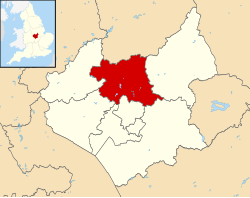
Ratcliffe on the Wreake
Location within Leicestershire
Population179 
District
Shire county
Region
Country England
Sovereign state United Kingdom
Post town LEICESTER
Postcode district LE7
Police Leicestershire
Fire Leicestershire
Ambulance East Midlands
UK Parliament
List of places
UK
England
Leicestershire
52°43′30.50″N1°4′5.00″W / 52.7251389°N 1.0680556°W / 52.7251389; -1.0680556

Ratcliffe on the Wreake is a village and civil parish in the Charnwood district of Leicestershire, England. The population of the civil parish at the 2011 census was 179. [1] It is just to the north of the River Wreake, opposite East Goscote.

Contents

The village is small enough not to have a parish council; instead it has a parish meeting consisting of all the electorate. The 14th-century St Botolph parish church is a Grade II* listed building. [2]

Ratcliffe Hall is a Grade II listed country house built c. 1812 by Robert Shirley, 7th Earl Ferrers and was inherited by his granddaughter, Caroline Shirley, Duchess Sforza Cesarini, who had married into the Italian aristocracy. [3] [4] It subsequently descended to the pioneer aviator, Sir William Lindsay Everard, who set up Ratcliffe Aerodrome, which opened with a 'Grand Air Pageant' on 6 September 1930. Famed aviator Amy Johnson made an unexpected trip from London to participate with Sir Sefton Brancker, Director of Civil Aviation. Some 5,000 spectators were treated to a show with 100 planes and staged bombings of Chinese pirates. There was one crash, but no one was killed. Ratcliffe Aerodrome was one of the finest in civil aviation with a comfortable clubhouse and an outdoor pool. The hangars were first class and the many air shows and displays had the atmosphere of a garden party. [5]

Ratcliffe is known for its abundance in wildlife especially crayfish which inhabit the River Wreake right through the village.

RAF Ratcliffe

As RAF Ratcliffe, it was an important Air Transport Auxiliary ferry pool in World War II. [5]

Apart from East Goscote, nearby places are Thrussington, further up the Wreake, Syston, further down, and Sileby, to the north-west.

Related Research Articles

<span class="mw-page-title-main">Saltfleet</span> Coastal village in the East Lindsey district of Lincolnshire, England

Saltfleet is a coastal village in the East Lindsey district of Lincolnshire, England. It is approximately 8 miles (13 km) north of Mablethorpe and 11 miles (18 km) east of Louth.

<span class="mw-page-title-main">Borough of Charnwood</span> Borough and non-metropolitan district in England

Charnwood is a local government district with borough status in the north of Leicestershire, England. It is named after Charnwood Forest, much of which lies within the borough. The council is based in Loughborough, the area's largest town. The borough also contains the towns of Shepshed and Syston, along with numerous villages and surrounding rural areas. In the south of the borough it includes parts of the Leicester Urban Area, notably at Birstall and Thurmaston.

<span class="mw-page-title-main">Cossington, Leicestershire</span> Village in Leicestershire, England

Cossington is a village within the Soar Valley in Leicestershire, England. It lies between Sileby, Rothley, Ratcliffe-on-the-Wreake and Syston. The population of the civil parish at the 2011 census was 598.

<span class="mw-page-title-main">Burton on the Wolds</span> Human settlement in England

Burton on the Wolds is a village in Leicestershire, England situated on the B676 road 3 miles (4.8 km) west of the A46 and about the same distance to the east of Loughborough, close to the county border with Nottinghamshire. In the 2011 census, the population was measured at 1,218. The Parish Council of Burton on the Wolds, Cotes and Prestwold serves the village and its two neighbouring hamlets. The local borough council is Charnwood.

Longthorpe is an area of the city of Peterborough, in the ceremonial county of Cambridgeshire, England. Located two miles (3.2 km) west from the city centre, the area covers 1,390 acres. For electoral purposes it forms part of Peterborough West ward.

<span class="mw-page-title-main">Charnwood (UK Parliament constituency)</span> UK Parliament constituency since 1997

Charnwood is a constituency in Leicestershire represented in the House of Commons of the UK Parliament since 2015 by Edward Argar, a Conservative.

<span class="mw-page-title-main">Rearsby</span> Human settlement in England

Rearsby is a village and civil parish in the Charnwood district of Leicestershire, England. It is known for its Seven Arch Bridge, and is also home to the Preachers Stone.

<span class="mw-page-title-main">Seagrave</span> Human settlement in England

Seagrave is a village and civil parish in the Charnwood district of Leicestershire, England. It has a population of around 500, measured at the 2011 census as 546, It is north of Sileby and close to Thrussington and Barrow upon Soar.

<span class="mw-page-title-main">Thrussington</span> Human settlement in England

Thrussington is a village and civil parish in the Charnwood district of Leicestershire, England. The population of the civil parish at the 2011 census was 587. It is on the River Wreake, near to Rearsby, Ratcliffe on the Wreake, Hoby and Brooksby, and not far from the path of the Fosse Way.

<span class="mw-page-title-main">East Goscote</span> Human settlement in England

East Goscote is a modern village and civil parish in the Borough of Charnwood district of Leicestershire, England, just north of the market town of Syston. It is a medium-sized village, with a population measured at 2,866 in the 2011 census. The village is twinned with Fleury-sur-Andelle, France.

<span class="mw-page-title-main">Allerthorpe</span> Village and civil parish in the East Riding of Yorkshire, England

Allerthorpe is a village and civil parish in the East Riding of Yorkshire, England. It is situated approximately 1.5 miles (2.4 km) south-west from the town of Pocklington.

<span class="mw-page-title-main">Bylaugh</span> Human settlement in England

Bylaugh is a civil parish in Norfolk, England 4.5 miles (7.2 km) north-east of East Dereham and 13.5 miles (21.7 km) WNW of Norwich. For the purposes of local government it falls within the Upper Wensum Ward of Breckland District Council and the Elmham and Mattishall Division of Norfolk County Council. According to the 2001 census it had a population of 65. At the 2011 census the population remained less than 100 and was included in the civil parish of Sparham.

<span class="mw-page-title-main">Shenley</span> Human settlement in England

Shenley is a village and civil parish in Hertfordshire, England, between Barnet and St Albans. The village is located 14 miles from Central London. As of 2021, the population of the parish was 5,390; however, the parish stretches far beyond the village itself; it is the largest parish in Hertsmere and is very rural, including hamlets and farming settlements such as Dancers Hill, Green Street, Kitts End, Ridge, Saffron Green, Shenleybury, and the largest other settlement, South Mimms.

<span class="mw-page-title-main">Long Whatton</span> Human settlement in England

Long Whatton is a village and former civil parish, now in the parish of Long Whatton and Diseworth, in the North West Leicestershire district, in the English county of Leicestershire. It is south of East Midlands Airport, off Junctions 23 and 23A of the M1 motorway, and has easy access to Loughborough via the A6 and to Shepshed, Ashby-de-la-Zouch and Kegworth.

<span class="mw-page-title-main">Coleorton</span> Human settlement in England

Coleorton is a village and civil parish in North West Leicestershire, England. It is situated on the A512 road approximately 2 miles (3.2 km) east of Ashby de la Zouch. Nearby villages include Newbold, to the north, Thringstone to the east, and Swannington to the south-east.

Sir William Lindsay Everard was a brewer, politician, and philanthropist from Leicestershire, United Kingdom. As the founder and supporter of the Ratcliffe Aerodrome, Sir Lindsay was a pioneer aviator, knighted for his crucial efforts in World War II with the Air Transport Auxiliary (ATA). He controlled Everards Brewery for nearly 25 years and was a member of parliament.

<span class="mw-page-title-main">St Mary's Church, Barkby</span> Church in United Kingdom

St Mary's Church, Barkby is the Church of England Parish Church for Barkby, Leicestershire, England. The church mostly dates from the 13th century. It was Grade I listed in 1966.

<span class="mw-page-title-main">St Mary's Church, Queniborough</span> Church in United Kingdom

St Mary's Church, Queniborough is the Church of England parish church of Queniborough, Leicestershire, England. The church mostly dates from the late 13th and early 14th centuries. It was Grade I listed in 1966. The church has a ring of 6 bells for bell ringing.

<span class="mw-page-title-main">St Peter & St Paul's Church, Syston</span> Church in Syston, England

St Peter and St Paul's Church, Syston is a Grade I listed parish church in the Church of England in Syston, Leicestershire.

<span class="mw-page-title-main">St Botolph's Church, Ratcliffe on the Wreake</span> Church in Ratcliffe on the Wreake, England

St Botolph's Church is a Grade II* listed Church of England church in the village of Ratcliffe on the Wreake, Leicestershire, England.

References

  1. "Civil Parish population 2011". Neighbourhood Statistics. Office for National Statistics. Retrieved 19 June 2016.
  2. Historic England. "CHURCH OF ST BOTOLPH (1278781)". National Heritage List for England . Retrieved 10 November 2013.
  3. "Ratcliffe Hall, Ratcliffe on the Wreake". British Listed Buildings. Retrieved 11 November 2013.
  4. "Ratcliffe on the Wreake Conservation Area Character Appraisal". Charnwood Borough Council. Archived from the original on 11 November 2013. Retrieved 11 November 2013.
  5. 1 2 Clark, Steve (2004). "The History and Aviation Heritage of Ratcliffe Aerodrome 1930-1950". Ratcliffe College . Archived from the original on 14 May 2008.

Commons-logo.svg Media related to Ratcliffe on the Wreake at Wikimedia Commons

52°43′30.50″N1°4′5.00″W / 52.7251389°N 1.0680556°W / 52.7251389; -1.0680556