Seagrave

Last updated

Seagrave
Village sign, Seagrave, Leicestershire. - geograph.org.uk - 829256.jpg
The Village Sign
Leicestershire UK location map.svg
Red pog.svg
Seagrave
Location within Leicestershire
Population546 
District
Shire county
Region
Country England
Sovereign state United Kingdom
Post town LOUGHBOROUGH
Postcode district LE12
Dialling code 01509
Police Leicestershire
Fire Leicestershire
Ambulance East Midlands
UK Parliament
List of places
UK
England
Leicestershire
52°45′6.00″N1°5′2.00″W / 52.7516667°N 1.0838889°W / 52.7516667; -1.0838889

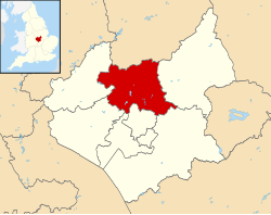
Seagrave is a village and civil parish in the Charnwood district of Leicestershire, England. It has a population of around 500, measured at the 2011 census as 546, [1] It is north of Sileby and close to Thrussington and Barrow upon Soar.

Contents

History

One of the earliest mentions of this place is in the Domesday book where named Segrave, [2] [3] it is listed amongst the lands in the wapentake of Goscote given to Henry de Ferrers [4] by King William I. The land consisted of work for one plough and four acres of meadow.

By the twelfth century, Seagrave was owned by the de Segrave family, who built a fortified manor house in the parish. [5] Their familial coat of arms was later adopted by the village. In March 1234, Richard Siward, at the head of a company of outlaws, ravaged Stephen de Segrave's native place, evidently Seagrave; burnt his fine houses, oxen, and stores of grain, and carried off many valuable horses and rich spoil. Later, the same band ravaged Alconbury, and burnt his buildings there. [6] In 1346, population growth led to the division of the wapentake; for judicial matters, Seagrave was in the hundred of East Goscote.

The effects of parliamentary enclosure on social and economic aspects of England and its people can be understood by examining the results of the Seagrave Inclosure Act 1759 (33 Geo. 2. c. 25Pr.), which effectively converted copyhold tenure in the open fields to freehold tenure.

The village attempts to preserve its better buildings through repurposing. [5] The Primitive Methodist chapel was converted into a house which still has the original nameplate, with Primitive spelled in an obsolete form as 'Primative'.

Leicester City F.C. opened a new state of the art training facility on the site of the village's former Park Hill Golf Club in December 2020. [7]

1963 air crash

A BAC Jet Provost crashed on 29 July 1963. The two pilots ejected. One was 19 year old Pilot Officer Paul Fisher of Strood, from RAF Syerston. The instructor, 42 year old Alex Naismith, was taken to Leicester Royal Infirmary with a back injury. The pilots were given a cup of tea at the Black Cat Cafe at Six Hills, on the A46. Anthony Wilkin of Willowbrook Road, saw the pilots land. [8] [9] [10] [11]

Notable people

Gilbert de Segrave of Segrave, High Sheriff of Warwickshire and Leicestershire in 1193, father of Stephen de Segrave (c. 1171 – 1241) Chief Justiciar of England.

Robert Burton, author of The Anatomy of Melancholy , was rector of All Saints' Church in Seagrave from 1630 to his death.

Related Research Articles

<span class="mw-page-title-main">Donisthorpe</span> Village in Leicestershire, England

Donisthorpe is a village in the North West Leicestershire district of Leicestershire, England, historically an exclave of Derbyshire.

<span class="mw-page-title-main">Borough of Charnwood</span> Borough and non-metropolitan district in England

Charnwood is a local government district with borough status in the north of Leicestershire, England. It is named after Charnwood Forest, much of which lies within the borough. Towns in the borough include Loughborough, Shepshed and Syston. Villages in the borough include Barrow upon Soar, Birstall, Hathern, Mountsorrel, Quorn, Rothley, Sileby and Woodhouse Eaves.

<span class="mw-page-title-main">Shepshed</span> Town and civil parish in Leicestershire, England

Shepshed is a market town and civil parish in the Charnwood Borough of Leicestershire, England with a population of 14,875 at the 2021 census. It is the second biggest settlement in the borough, after the town of Loughborough.

Sparkenhoe was a hundred of Leicestershire, England in the south-west of the county, covering Market Bosworth and Hinckley, broadly corresponding to the modern districts of Blaby and Hinckley and Bosworth. The meeting place of the Sparkenhoe Hundred was probably at Shericles Farm near Desford (SK467026), which derives from scirac meaning "the hundred oak". Sparkenhoe hundred was not recorded in the Domesday Book as a wapentake, being formed in 1346 from part of Guthlaxton and Goscote.

Goscote was a wapentake in the county of Leicestershire, England; consisting of the north and north-west of the county. It was recorded in the Domesday Book, but as the wapentakes evolved to form hundreds, was split into East Goscote Hundred and West Goscote Hundred in 1346.

<span class="mw-page-title-main">Groby</span> Human settlement in England

Groby is a village in the Hinckley and Bosworth borough Leicestershire, England. It is to the north west of Leicester. The population at the time of the 2011 census was 6,796.

<span class="mw-page-title-main">History of Leicestershire</span>

This article is intended to give an overview of the history of Leicestershire, England.

<span class="mw-page-title-main">Charnwood (UK Parliament constituency)</span> Parliamentary constituency in the United Kingdom, 1997-2024

Charnwood was a constituency of the House of Commons in the UK Parliament from 1997 to 2024.

<span class="mw-page-title-main">Scraptoft</span> Human settlement in England

Scraptoft is a village in Leicestershire, England. It has a population of about 1,500, measured at the 2011 census as 1,804. It lies north of the A47 road east of Leicester, and runs directly into the built up area of Thurnby and Bushby to the south. For local government the village forms part of the district of Harborough, and constitutes a civil parish.

<span class="mw-page-title-main">Barrow upon Soar</span> Village in Leicestershire, England

Barrow upon Soar is a large village in northern Leicestershire, in the Soar Valley between Leicester and Loughborough, with a population at the 2011 census of 5,856.

<span class="mw-page-title-main">Newbold Verdon</span> Village in Leicestershire, England

Newbold Verdon is a village and civil parish in the county of Leicestershire, England. The parish includes Newbold Heath to the north and Brascote to the south. Originally an agricultural centre Newbold Verdon grew in size during the 1850s with the expansion of coal mining in the area. That industry has now ceased leaving Newbold Verdon as a commuter village primarily serving Leicester and Hinckley. The 2001 census recorded a population of 3,193, which had reduced to 3,012 at the 2011 census.

<span class="mw-page-title-main">Sileby</span> Human settlement in England

Sileby is a former industrial village and civil parish in the Soar Valley in the Charnwood borough of Leicestershire, England. It is located between Leicester and Loughborough. The village is close to Barrow upon Soar, Mountsorrel, Ratcliffe-on-the-Wreake, Seagrave and Cossington. The population of the civil parish at the 2011 census was 7,835, rising to 8,959 at the 2021 census.

<span class="mw-page-title-main">East Goscote</span> Village in Leicestershire, England

East Goscote is a modern village and civil parish in the Borough of Charnwood district of Leicestershire, England, just north of the market town of Syston. It is a medium-sized village, with a population measured at 2,866 in the 2011 census. The village is twinned with Fleury-sur-Andelle, France.

East Goscote Hundred was a hundred of Leicestershire, that arose from the division of the ancient Goscote hundred into two. It covered the eastern part of today's Charnwood district, along with the northern part of Harborough District, and extended south-east to meet Rutland.

<span class="mw-page-title-main">Barton Seagrave</span> Human settlement in England

Barton Seagrave is a large village and civil parish in the North Northamptonshire, England. The village is about 1.5 miles (2.4 km) south-east of Kettering, town centre. The older part of the village is known for its Norman Church and attractive buildings.

<span class="mw-page-title-main">Gaddesby</span> Human settlement in England

Gaddesby is a village and civil parish in the Melton borough of Leicestershire, England. The population of the civil parish at the 2011 census was 762. It is located around 5.5 miles (8.9 km) southwest of Melton Mowbray and 8 miles (13 km) northeast of Leicester.

<span class="mw-page-title-main">Stephen de Segrave</span>

Stephen de Segrave was a medieval Chief Justiciar of England.

<span class="mw-page-title-main">Staunton Harold</span> Human settlement in England

Staunton Harold is a civil parish in North West Leicestershire about 3 miles (5 km) north of Ashby-de-la-Zouch. The parish is on the county boundary with Derbyshire and about 9 miles (14 km) south of Derby. The 2011 Census recorded the parish's population as 141.

The identification of Deserted Villages and Lost Places in Leicestershire owes much to the pioneering work of William George Hoskins during his time at the University of Leicester.

References

  1. "Civil Parish population 2011". Neighbourhood Statistics. Office for National Statistics. Retrieved 20 June 2016.
  2. "Domesday Book of William the Conqueror". DomesdayMap.co.uk. Domesday Map. Retrieved 15 March 2020.
  3. "32434 Domesday Book place-name forms alphabetic order" (PDF). KeithBriggs.info. Keith Briggs. 2014. Retrieved 15 March 2020.
  4. Williams & Haward Martin 2003 , pp. 656–7
  5. 1 2 "Seagrave and its background" (PDF). Seagrave.LeicestershireParishCouncils.org. Seagrave Parish Council. 28 January 2015.
  6. Hunt, William. "Segrave Stephen de (d.1241)" via Wikisource.
  7. "Leicester City make historic move to new Seagrave training ground". www.LCFC.com. Leicester City Football Club. 22 December 2020. Retrieved 19 January 2021.
  8. Leicester Mercury Monday 29 July 1963, page 1
  9. Leicester Mercury Tuesday 30 July 1963, page 12
  10. Nottingham Evening Post Monday 29 July 1963, page 1
  11. July 1963 air crash

Bibliography

Williams, Ann; Haward Martin, Geoffrey (2003), Domesday Book: A Complete Translation, Penguin, ISBN   0-14-143994-7

Commons-logo.svg Media related to Seagrave at Wikimedia Commons

52°45′6.00″N1°5′2.00″W / 52.7516667°N 1.0838889°W / 52.7516667; -1.0838889