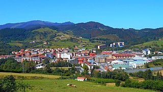
The town is a part of the Greater Bilbaoconurbation, being only a few kilometers south of Bilbao. It is an industrial town with monuments such as the tower house of Ariz. It is home to the province's only prison, located where the Nervión and Ibaizabal rivers meet. The municipality had a population of 40,589 in 2019.
Geography
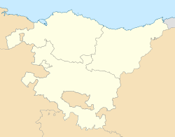
Basauri is located in the metropolitan region of Greater Bilbao, on both sides of the river Nervión and the lower valley of the Nervión and the Ibaizabal. Basauri is located at the confluence of the two, the longest rivers in Biscay, forming a small river plain (on the border with Etxebarri) on which a series of meanders have been built, now mostly occupied by industrial facilities. Basauri is also the point at which roads coming from Orduña-Urduña and Durango meet, following the course of the two rivers. The neighborhood of Bidebieta ('two roads' in Basque) takes its name from this meeting.
From the river area where the municipality originated, the land rises gradually, culminating in the Malmasín mountain (361 m), on the border with Arrigorriaga.
Basauri has a warm and humid oceanic climate. Rainfall is evenly distributed throughout the year with no particular rainy season. Temperatures are moderate throughout the year, with small thermal fluctuations.
Several elements influenced the strong growth experienced by Basauri in the 20th century. Being a communications hub was a very important factor. Its proximity to the mines of Ollargan, Morro and Miravilla, and those of the Basauri-Galdakao Group, caused an increase in the municipality's population. The conversion of the mills into a baking industry also contributed to this increase. However, the element that most contributed to the population development was the installation in 1892 of the first major factory, "La Basconia", an iron and steelworks.
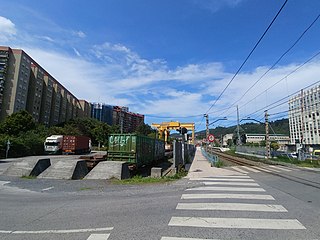
Basauri from Bolueta
The rapid growth that the municipality underwent made its population multiply by 24.6 between 1900 and 1975. The largest population increases started in the 1950s with the installation of new industries, creating a population growth of 97% between 1950 and 1960. This continued in the next decade with an increase of 80%.
Year
1900
1910
1920
1930
1940
1950
1960
1970
1980
1990
2000
2001
2003
2007
2009
2012
Population
1,989
3,456
5,194
9,444
10,405
11,626
22,991
41,558
55,648
50,940
47,376
46,669
45,346
43,250
42,657
41,971
In 1984 a slow but progressive population decline began, although it had already been in decline since 1979, when the peak population of 55,648 inhabitants was reached, due to the industrial crisis. According to Spain's National Statistics Institute, the population of Basauri was 41,971 in 2012.
History
Basauri became independent from Arrigorriaga around 1510. 1510 is the official date, although there is no document to verify that any meetings were held between the mayors of the two towns in that year. Basauri was not represented at the General Assembly of Guernica until 1858. Thereafter, it remained the largest population center and municipality in the district of San Miguel de Basauri until 1902, when the transfer of the town hall to Arizgoiti was approved. This was an area with a growing population, equidistant from the two furthest apart points of the municipality, Finaga and San Miguel.
Basauri was up to the end of the 19th century a predominantly rural town, until the arrival of the Basconia factory and with it the industrialization of the town, which went in 50 years from a few thousand inhabitants to 55,000 in 1978. Thousands of families from all regions of Spain provided Basauri with new people and buildings, radically changing its image and urban landscape.
Toponymy
The name Basauri comes from Basque and means 'town in the forest.' It comprises two elements, Basa (from basoa), meaning 'forest' and uri (a Biscay variant of hiri), meaning 'city'. The town of Bajauri in the County of Treviño derives its name from the same roots.
Toponyms in Basauri include Ariz, Arizgoiti, Arizgain and Arizbarren (Azbarren) Basozelai, Etxerre, Sarratu, Urbi, Bizkotxalde (Beaskoetxealde) Pozokoetxe, Pagobieta, Iruaretxeta, Artundoaga, Abaroa, Gaztañabaltza, Uriarte, Errekalde, Lapatza, Arteaga, Arteagagoitia, Uribarri, Kalero, Bidebieta, Soloarte, Ugarte, Kantarazarra, Iturrigorri, Elexalde. Bidebieta appears as Dos Caminos (Two Roads) at the train station, resulting in a popular misconception that this was the original name of the town. The district now called Kalero was originally known as Calero. Although some authors believe this to be a Castilian translation of Kareaga, its name refers to the fact that a holding of limestone for the manufacture of lime was located in this area; such places are called 'Calero' in Spanish. There are two areas or neighborhoods called Kareaga: Kareaga Goikoa and Kareaga Behekoa and now called 'El Calero', since both areas had lime plants.
Festivities
The festival of Faustus the Labourer (San Fausto) on 13 October celebrates the patron saint of the municipality.
Basauri's festivities
Festival
Location
Date
St Isidore
Benta
May 15
St Martin of Finaga
Finaga
May 21
St John
Pozokoetxe, Basozelai
June 24
-
Kalero
first weekend of September
St Michael
San Miguel
September 29
St Faustus the Labourer (patron saint)
Basauri
October 13
Virtually every major neighborhood in Basauri celebrates its own festivities each year, but the most popular festivals in the town are those held in honor of St Faustus the Labourer. Symbols of the festival include a local character, the Escarabillera[es], and zurracapote, the typical drink, which is prepared by the fifteen crews belonging to the cultural association Herriko Taldeak, served to participants in a jug. Zurracapote is a drink similar to sangria, made with red wine, lemon, cinnamon, liquor, sugar and condiments.
The Escarabillera is a character based on the women and men who, in Basauri (as in many other municipalities) went, in times of great need at the beginning of the 20th century, to the tracks where the steam trains ran or to the dumps of the foundry companies (La Basconia) in search of coal that had not been entirely burnt (called escarabilla). This coal was used for cooking in old cast iron cookers. Similarly, coal was used as asphalt on many of the streets and lanes of Basauri in the early 20th century. The escarabillera walks from the start of the festival until the end, when it is released into the air attached to balloons with a message written in several languages, with the hope that someone will recover it. Although in many cases it does not return, on one occasion it reached Prague, where one of the crews travelled in order to retrieve it.
Economy
Until the industrial transformation of the late 19th century, Basauri was a purely agricultural area where corn was grown and pasture for cattle and sheep were harvested, and there were some flour mills. Faced with the massive development of industry and housing, the agricultural sector has gradually receded to near extinction.
From the end of the 19th century, its location near Bilbao, its industrial area, and its role as a crossroads in the middle and upper valley of the Nervión and Ibaizábal resulted in the arrival of both industry and large numbers of migrant workers, making Basauri a mostly industrial town. Maintaining the industrial population, the services sector has grown significantly in recent years. The active population of Basauri is 20,265 people, of whom 21.3% were unemployed in 2013.
Communications
Basauri is 1.24 miles (2km) from Bilbao. This proximity has given the town a good communications system. The provincial capital can be reached via the A-8, the Bilbao-Orduña road in the south and the Bilbao-Galdakao (N-634) road in the north. The railway lines of Renfe and Euskotren Trena cross the town and make several stops in Basauri.
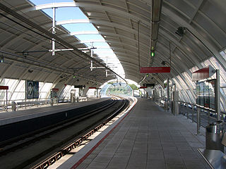
The underground (Bilbao metro) also has two stops: one in the neighborhood of Ariz (inaugurated on February 28, 2011) and one in the neighborhood of Arizgoiti (November 11, 2011), called Basauri. Ariz and Basauri are the two last stations on Line 2 of the Bilbao metro.
There is also a free shuttle bus connecting the Basauri underground station with the neighborhood of San Miguel de Basauri.
The modification of the San Miguel shuttle bus to provide more services to Basauri is being considered.
Culture
Since 2005, the International Festival of Animated Film Basauri-Bizkaia (Animabasauri-Animasbasque) has been held annually. Antzokia Social theatre is the venue of the main project, together with other projection centers scattered around the region.
In 2008 the 23rd National Congress of Vexillology was held in Basauri, organized by the council and the Spanish Society of Vexillology.
The La Sexta series Qué vida más triste ('What a Sad Life') is set in Basauri.
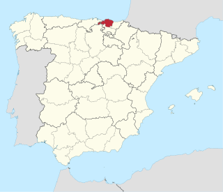
Biscay or Bizkaia, is a province of the Basque Autonomous Community, heir of the ancient Lordship of Biscay, lying on the south shore of the eponymous bay. The capital and largest city is Bilbao.
Nervión is a river that runs through the town of Bilbao, Spain into the Cantabrian Sea. Its lowermost course, downstream of its confluence with the Ibaizabal River, is known as the Estuary of Bilbao.
Amorebieta-Etxano, also known as Zornotza, is a town and municipality located in Biscay in the Basque Country, an Autonomous Community in northern Spain.
The Bilbao metro is a rapid transit system serving the city of Bilbao and the region of Greater Bilbao. Lines 1 and 2 have a "Y" shape, as they transit both banks of the river Ibaizabal and then combine to form one line that ends in the south of Bilbao. Line 3 has a "V" shape connecting the municipality of Etxebarri with the Bilbao neighbourhood of Matiko; the apex of the "V" is Zazpikaleak/Casco Viejo station, where all three current lines meet. The metro is connected with the Bilbao tram, Bilboko Aldiriak, Euskotren Trena, Feve, Renfe long-distance trains, and Bilbao's bus station. All three lines use metre gauge.
Arrigorriaga is a town and municipality located in the province of Bizkaia, in the autonomous community of Basque Country, northern Spain. Arrigorriaga is located 7 km south of Bilbao and is part of Bilbao's metropolitan area. Its official population at the 2019 census was 12,160 inhabitants living on a land area of 16.36 square kilometres (6.32 sq mi).
Atxondo is a municipality located in the province of Biscay, in the Basque Country, Spain. Atxondo is part of the comarca of Durangaldea and has a population of 1,447 inhabitants as of 2007 according to the Spanish National Statistics Institute.
Etxebarri, Doneztebeko Elizatea is a town and municipality located in the province of Biscay, in the Autonomous Basque Community, in the North of Spain.
Galdakao is a town and municipality located in the province of Biscay, in the Basque Country.
Zaldibar is an elizate, town and municipality located in the province of Biscay, in the Basque Country, Spain. Zaldibar is part of the comarca of Durangaldea and has a population of 3,043 inhabitants as of 2019 and according to the Spanish National Statistics Institute.
Greater Bilbao is an administrative division of the province of Biscay, in the Basque Country, Spain. It is one of the seven comarcas of Biscay and the most populated. The capital city of Greater Bilbao is Bilbao.
The Estuary of Bilbao lies at the common mouth of the rivers Nervion, Ibaizabal and Cadagua, which drain most of Biscay and part of Alava in the Basque Country, Spain. In this instance, the Spanish word estuario is used to describe what in English would normally be called part estuary, part tidal river. The estuary becomes a tidal river which extends 16 km (9.9 mi) into the city of Bilbao, starting from the Bilbao Abra bay. It hosts the port of Bilbao throughout its length, although the Port Authority has recently restored most of the upper reaches to Bilbao and other municipalities for their urban regeneration. The port is now being transferred to the seaboard on the coast at Santurtzi and Zierbena.
The Ibaizabal is a river that drains southeastern Biscay to the Estuary of Bilbao. It is 43 kilometres (27 mi) long from its source at Elorrio to the Nervión, and it passes by the towns of Durango and Amorebieta and joins the Nervión river at Basauri. Both rivers run then together for a short length until they merge with the sea at Bilbao. It is disputed which river is the one that actually reaches Bilbao. It is commonly agreed that it is the Nervión, but there are some who argue that the Ibaizabal carries more water.
Hego Uribe is a modern conventional subdivision of Biscay, Basque Country. Located within the comarca of Greater Bilbao, directly south of the city of Bilbao itself, the area includes the towns of Basauri, Galdakao, Etxebarri and Arrigorriaga, among others. It is noted for its production of high quality wool.
Bolueta is a station on lines 1 and 2 of the Bilbao metro. The station is located in the neighborhood of the same name, in the district of Begoña. It opened on 5 July 1997.
Etxebarri is a station on lines 1 and 2 of the Bilbao metro. It is the southern terminus of line 1. The station is located in the municipality of Etxebarri, part of the Bilbao metropolitan area. It was opened in 2005. The station is on Fuenlabrada street, next to a park and ride parking facility.
Moyua is a station on lines 1 and 2 of the Bilbao metro. The station is located in the neighborhood of Abando, in the district with the same name. The station is located under the Moyua Plaza, named after Federico Moyúa, mayor of Bilbao during the early 20th century. It opened on 11 November 1995.
Line 2 of the Bilbao metro is a rapid transit line in Biscay, Basque Country, Spain. It runs from Basauri to Kabiezes. Its route covers the municipalities of Basauri and Etxebarri, the city of Bilbao and the left bank of the Nervión river. The line has 25 stations.
The Bilbao Metropolitan Area is the metropolitan area or continuous urban area based around the city of Bilbao, in the Basque Country, Spain. It comprises the city of Bilbao, the 25 municipalities that make the comarca of Greater Bilbao plus ten other surrounding municipalities, all of them in the province of Biscay.
Ibilaldia, meaning trip, journey, or march in English, is a festival organized every year the last Sunday of May or first of June to help the ikastolak in Biscay, Basque Country in Spain.
The Ariz–Basurto line is a short single-track unelectrified railway line in Biscay, Basque Country, Spain. Owned by Euskal Trenbide Sarea, it connects the Basque narrow-gauge railway network with the Santander–Bilbao line. It is used for freight transport.
This page is based on this Wikipedia article Text is available under the CC BY-SA 4.0 license; additional terms may apply. Images, videos and audio are available under their respective licenses.