Bassfield, Mississippi

Last updated

Bassfield, Mississippi
Jefferson Davis County Mississippi Incorporated and Unincorporated areas Bassfield Highlighted.svg
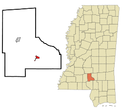
Location of Bassfield, Mississippi
Usa edcp location map.svg
Red pog.svg
Bassfield, Mississippi
Location in the United States
Coordinates: 31°29′50″N89°44′46″W / 31.49722°N 89.74611°W / 31.49722; -89.74611
Country United States
State Mississippi
County Jefferson Davis
Area
[1]
  Total1.00 sq mi (2.59 km2)
  Land1.00 sq mi (2.59 km2)
  Water0.00 sq mi (0.00 km2)
Elevation
456 ft (139 m)
Population
 (2020)
  Total192
  Density192.00/sq mi (74.13/km2)
Time zone UTC-6 (Central (CST))
  Summer (DST) UTC-5 (CDT)
ZIP code
39421
Area code 601
FIPS code 28-03580
GNIS feature ID0666563

Bassfield is a town in Jefferson Davis County, Mississippi, United States. The population was 192 at the 2020 census, [2] down from 254 at the 2010 census. [3]

Contents

Geography

Bassfield is located in southeastern Jefferson Davis County at 31°29′50″N89°44′46″W / 31.49722°N 89.74611°W / 31.49722; -89.74611 (31.497090, -89.746008). [4] Mississippi Highway 42 passes through the town, leading northwest 11 miles (18 km) to Prentiss, the county seat, and southeast 14 miles (23 km) to Sumrall. Mississippi Highway 35 passes through the west side of Bassfield, leading north 21 miles (34 km) to Mount Olive and south 19 miles (31 km) to Columbia.

According to the United States Census Bureau, Bassfield has a total area of 1.1 square miles (2.8 km2), all land. [3]

2020 tornadoes

On April 12, 2020, at approximately 4:15 CDT, Bassfield was struck by a large, violent EF4 tornado, causing catastrophic damage. The town just barely avoided being hit again when a large EF3 tornado passed just north of the city only 35 minutes later.

Demographics

2020 census

At the 2020 census, there was 192 people, 103 housing units, and 118 families in the town. [2]

2000 census

Historical population
CensusPop.Note
1910 344
1920 265−23.0%
1930 33426.0%
1940 277−17.1%
1950 32015.5%
1960 295−7.8%
1970 35420.0%
1980 325−8.2%
1990 249−23.4%
2000 31526.5%
2010 254−19.4%
2020 192−24.4%
U.S. Decennial Census [5]

As of the census [6] of 2000, there were 315 people, 124 households, and 76 families residing in the town. The population density was 290.4 inhabitants per square mile (112.1/km2). There were 144 housing units at an average density of 132.8 per square mile (51.3/km2). The racial makeup of the town was 64.13% White, 35.56% African American and 0.32% Native American. Hispanic or Latino of any race were 1.27% of the population.

There were 124 households, out of which 24.2% had children under the age of 18 living with them, 41.9% were married couples living together, 16.1% had a female householder with no husband present, and 38.7% were non-families. 36.3% of all households were made up of individuals, and 20.2% had someone living alone who was 65 years of age or older. The average household size was 2.31 and the average family size was 3.08.

In the town, the population was spread out, with 20.3% under the age of 18, 9.2% from 18 to 24, 23.2% from 25 to 44, 19.0% from 45 to 64, and 28.3% who were 65 years of age or older. The median age was 43 years. For every 100 females, there were 71.2 males. For every 100 females age 18 and over, there were 69.6 males.

The median income for a household in the town was $18,500, and the median income for a family was $27,500. Males had a median income of $17,292 versus $14,250 for females. The per capita income for the town was $13,283. About 22.7% of families and 25.0% of the population were below the poverty line, including 24.1% of those under age 18 and 34.8% of those age 65 or over.
Education

Bassfield is served by the Jefferson Davis County School District. The school district was taken over by the state of Mississippi due to low graduation rates and mismanaged finances.[ citation needed ]

Notable residents

Related Research Articles

<span class="mw-page-title-main">Montrose, Arkansas</span> City in Arkansas, United States

Montrose is a city in Ashley County, Arkansas, United States. The population was 354 at the 2010 census. Montrose is located where U.S. Route 165 intersects with U.S. Route 82. The town was heavily damaged by an EF2 tornado on January 2, 2023.

<span class="mw-page-title-main">Columbus, Kentucky</span> City in Kentucky, United States

Columbus is a home rule-class city in Hickman County, Kentucky, in the United States. The population was 170 at the 2010 census, a decline from 229 in 2000. The city lies at the western end of the state, less than a mile from the Mississippi River.

<span class="mw-page-title-main">Derma, Mississippi</span> Town in Mississippi, United States

Derma is a town in Calhoun County, Mississippi, United States. The population was 1,025 at the 2010 census.

<span class="mw-page-title-main">Silver City, Mississippi</span> Town in Mississippi, United States

Silver City is a town in Humphreys County, Mississippi, United States. The population was 217 at the 2021 census, a massive decline from the 2000 census.

<span class="mw-page-title-main">Louin, Mississippi</span> Town in Mississippi, United States

Louin is a town in Jasper County, Mississippi, United States, located along Mississippi Highway 15. The population was 277 at the 2010 census, down from 339 at the 2000 census. On June 18, 2023, the town was hit by a destructive EF3 tornado causing 1 death.

<span class="mw-page-title-main">Prentiss, Mississippi</span> Town in Mississippi, United States

Prentiss is a town in Jefferson Davis County, Mississippi. The population was 1,081 at the 2010 census, down from 1,158 at the 2000 census. It is the county seat.

<span class="mw-page-title-main">Sandersville, Mississippi</span> Town in Mississippi, United States

Sandersville is a town in Jones County, Mississippi, United States. The population was 636 at the 2020 census, down from 731 at the 2010 census. It is part of the Laurel micropolitan area.

<span class="mw-page-title-main">Soso, Mississippi</span> Town in Mississippi, United States

Soso is a town in Jones County, Mississippi, United States. The population was 418 at the 2020 census.

<span class="mw-page-title-main">Decatur, Mississippi</span> Town in Mississippi, United States

Decatur is a town in and the county seat of Newton County, Mississippi. The population was 1,841 at the 2010 census. This town is named after war hero Stephen Decatur, Jr.

<span class="mw-page-title-main">Sardis, Mississippi</span> Town in Mississippi, United States

Sardis is a town in Panola County, Mississippi. As of the 2010 census, the town population was 1,703. Sardis is one of two county seats for Panola County; the other is Batesville, on the south side of the Tallahatchie River.

<span class="mw-page-title-main">Beaumont, Mississippi</span> Town in Mississippi, United States

Beaumont is a town in Perry County, Mississippi. It is part of the Hattiesburg, Mississippi Metropolitan Statistical Area, and located on the edge of the De Soto National Forest. The population was 951 at the 2010 census.

<span class="mw-page-title-main">Raleigh, Mississippi</span> Town in Mississippi, United States

Raleigh is a town and the county seat of Smith County, Mississippi, United States. The population was 1,094 at the 2020 census, making it the second largest town in Smith County. Named for English explorer Sir Walter Raleigh, Raleigh has been home to such Mississippians as Governor Robert Lowry, Governor/U.S. Senator Anselm McLaurin and pioneer William H. Hardy.

<span class="mw-page-title-main">Lula, Mississippi</span> Town in Mississippi, United States

Lula is a town in Coahoma County, Mississippi, United States. Per the 2020 census, the population was 204.

<span class="mw-page-title-main">Lena, Mississippi</span> Town in Mississippi, United States

Lena is a town in Leake County, Mississippi, United States. The population was 148 at the 2010 census. The center of population of Mississippi is located in Lena.

<span class="mw-page-title-main">Polkville, Mississippi</span> Town in Mississippi, United States

Polkville is a town in Smith County, Mississippi. The population is at 833 as of the 2010 census.

<span class="mw-page-title-main">Westport, South Dakota</span> Town in South Dakota, United States

Westport is a town in western Brown County, South Dakota, United States. The population was 88 at the 2020 census.

<span class="mw-page-title-main">Oakland, Jefferson County, Wisconsin</span> Town in Wisconsin, United States

Oakland is a town in Jefferson County, Wisconsin, United States. The population was 3,100 at the 2010 census. The unincorporated communities of Breezy Knoll, Oakland, and Sylvan Mounds, as well as the census-designated place of Lake Ripley, are located in the town.

<span class="mw-page-title-main">Enterprise, Wisconsin</span> Town in Wisconsin, United States

Enterprise is a town in Oneida County, Wisconsin, United States. The population was 274 at the 2000 census. The unincorporated community of Enterprise is located in the town.

<span class="mw-page-title-main">Verona, Wisconsin</span> City in Wisconsin, United States

Verona is a city in Dane County, Wisconsin, in the United States and is a suburb of Madison. The population was 14,030 at the 2020 census. The city is located ten miles southwest of downtown Madison within the Town of Verona. It is part of the Madison Metropolitan Statistical Area.

<span class="mw-page-title-main">Jefferson Valley, New York</span> Census-designated place in New York, United States

Jefferson Valley-Yorktown, commonly known as Jefferson Valley, is a census-designated place (CDP) located in the town of Yorktown in Westchester County, New York, United States. The population was 14,142 at the 2010 census. It is a hot spot for local shoppers, due to its Jefferson Valley Mall.

References

  1. "2020 U.S. Gazetteer Files". United States Census Bureau. Retrieved July 24, 2022.
  2. 1 2 "Bassfield town, Mississippi". United States Census Bureau. Retrieved April 19, 2023.
  3. 1 2 "Geographic Identifiers: 2010 Census Summary File 1 (G001): Heidelberg town, Mississippi". American Factfinder. U.S. Census Bureau. Archived from the original on February 13, 2020. Retrieved August 13, 2018.
  4. "US Gazetteer files: 2010, 2000, and 1990". United States Census Bureau. February 12, 2011. Retrieved April 23, 2011.
  5. "Census of Population and Housing". Census.gov. Retrieved June 4, 2015.
  6. "U.S. Census website". United States Census Bureau . Retrieved January 31, 2008.
  7. 1 2 3 Barshop, Sarah (September 25, 2019). "Three NFL players from a tiny town of 300? Meet the Bassfield Boys". ESPN.com . Retrieved October 2, 2019.
  8. "Wilbur Myers Stats". Pro-Football Reference. Retrieved February 13, 2022.