
Beaufort County was one of the 26 counties of Western Australia that were designated in 1829 as cadastral divisions. It approximately corresponds to the far eastern end of the Avon Land District which forms the basis for land titles in the area. [1]
Beaufort County was one of the 26 counties of Western Australia that were designated in 1829 as cadastral divisions. It approximately corresponds to the far eastern end of the Avon Land District which forms the basis for land titles in the area. [1]

The Arctic Archipelago, also known as the Canadian Arctic Archipelago, is an archipelago lying to the north of the Canadian continental mainland, excluding Greenland and Iceland.

The Java Sea is an extensive shallow sea on the Sunda Shelf, between the Indonesian islands of Borneo to the north, Java to the south, Sumatra to the west, and Sulawesi to the east. Karimata Strait to its northwest links it to the South China Sea. It is a part of the western Pacific Ocean.
Crevasse Valley Glacier is a broad glacier about 30 miles (50 km) long, flowing west-southwest between the Chester Mountains and the Saunders Mountain to the Sulzberger Ice Shelf in Marie Byrd Land, Antarctica. It was discovered by a sledging party of the Byrd Antarctic Expedition, which visited this area in November–December 1934, and so named because of its extensively crevassed surface.
Granite outcrops of Western Australia are weathered landforms that occur throughout the state of Western Australia, composed primarily of the rock type granite. All recognised types of this landform can be observed, commonly as bornhardts, but also as inselbergs, castle koppies and nubbins. Rising abruptly from the surrounding landscape they create a variety of microhabitats for plants, and provide seasonal resources and refuge for a range of animals. These areas thus have rich biodiversity and many endemic species. They are significant locations that tie in with the Aboriginal and European cultural heritage of Western Australia.

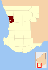
The Shire of Westonia is a local government area in the eastern Wheatbelt region of Western Australia, about 310 kilometres (193 mi) east of Perth, the state capital. Its seat of government is the small town of Westonia.
The Harvey River is a river in Western Australia and is the southernmost of the three major waterways which drain into the Peel-Harvey Estuary, with its delta in the southern extreme of the Harvey Estuary. It is about 90 km in length, rising near Mount Keats. Due to flooding of grazing land the river was diverted to discharge directly into the ocean in 1934.
The County of Perth was one of the 26 counties of Western Australia that were designated in 1829. It contained the city of Perth, with its south-eastern corner near Mount Dale. It was part of the Lands administrative divisions of Western Australia. Today, land titles in the area are associated with the Swan, Canning or Cockburn Sound land districts.

Carnarvon County was one of the 26 counties of Western Australia that were designated in 1829 as cadastral divisions. It approximately corresponds to southern part of the Yilgarn Land District which was gazetted in 1903 and forms the basis for land titles in the area.
Grantham County was one of the 26 counties of Western Australia that were designated in 1829 as cadastral divisions. It approximately corresponds to parts of the Avon Land District and Williams Land District which form the basis for land titles in the area.
Lansdowne County was one of the 26 counties of Western Australia that were designated in 1829 as cadastral divisions. It was named after Henry Petty-Fitzmaurice, 3rd Marquess of Lansdowne, Secretary of State for the Home Department from 1827 to 1828. It approximately corresponds to the Jilbadji Land District which was gazetted in 1903 and forms the basis for land titles in the area.
Minto County was one of the 26 counties of Western Australia that were designated in 1829 as cadastral divisions. It approximately corresponds to parts of the Avon Land District and Williams Land District which form the basis for land titles in the area.
Murray County was one of the 26 counties of Western Australia that were designated in 1829 as cadastral divisions. It was named after George Murray, Secretary of State for War and the Colonies from 1828 to 1830, a personal friend of Lieutenant-Governor James Stirling.

The borders of the oceans are the limits of Earth's oceanic waters. The definition and number of oceans can vary depending on the adopted criteria. The principal divisions of the five oceans are the Pacific Ocean, Atlantic Ocean, Indian Ocean, Southern (Antarctic) Ocean, and Arctic Ocean. Smaller regions of the oceans are called seas, gulfs, bays, straits, and other terms. Geologically, an ocean is an area of oceanic crust covered by water.

Nurina Land District is a land district of Western Australia, located within the Eucla Land Division on the Nullarbor Plain. It spans roughly 31°00'S - 32°20'S in latitude and 125°30'E - 127°30'E in longitude.
Annean Station is a pastoral lease in Western Australia.

Gippsland North was an electoral district of the Legislative Assembly in the Australian state of Victoria located in northern Gippsland from 1859 to 1955.
Belele Station is a pastoral lease in Western Australia that operates as a cattle station and as a sheep station for the production of wool.

County of Le Hunte is a cadastral unit located in the Australian state of South Australia that covers land located in the centre of Eyre Peninsula. It was proclaimed in 1908 and named after George Le Hunte who was the Governor of South Australia from July 1903 to February 1909.
31°46′S118°30′E / 31.767°S 118.500°E
| | This article about a location in Western Australia is a stub. You can help Wikipedia by expanding it. |