
The South West region is one of the nine regions of Western Australia. It is so named because it is located in the south-west corner of Western Australia. The South West region has an area of 23,970 km², and a population of about 170,000 people, which is predicted to rise to 217,000 people by 2023.
The County of Perth was one of the 26 counties of Western Australia that were designated in 1829. It contained the city of Perth, with its south-eastern corner near Mount Dale. It was part of the Lands administrative divisions of Western Australia. Today, land titles in the area are associated with the Swan, Canning or Cockburn Sound land districts.

Victoria County was one of the twenty six counties of Western Australia that were designated in 1829. It was named after Princess Alexandrina Victoria of Kent, from 1827 second in line to the throne. It approximately corresponds to the north-western section of the Avon Land District which forms the basis for land titles in the area.

Balgarup River is a river in Western Australia that has its headwaters south-east of Kojonup just below Byenup Hill.

Drygalski Glacier is a broad glacier, 18 nautical miles long and 15 miles (24 km) wide at its head, which flows from Herbert Plateau southeast between Ruth Ridge and Kyustendil Ridge, and enters Solari Bay immediately north of Sentinel Nunatak on Nordenskjöld Coast, the east coast of Graham Land, Antarctica. It was discovered in 1902 by the Swedish Antarctic Expedition, under Otto Nordenskiöld, and named "Drygalski Bay" after Professor Erich von Drygalski. The feature was determined to be a glacier by the Falkland Islands Dependencies Survey in 1947.

Petelea is a commune in Mureș County, Romania that is composed of two villages: Habic and Petelea. It has a population of 2977: 48.3% Roma, 48.2% Romanians and 2.5% Hungarians.

Wólka Dańkowska is a village in the administrative district of Gmina Błędów, within Grójec County, Masovian Voivodeship, in east-central Poland. It lies approximately 18 kilometres (11 mi) south-west of Grójec and 58 km (36 mi) south of Warsaw.
Dybki is a village in the administrative district of Gmina Ostrów Mazowiecka, within Ostrów Mazowiecka County, Masovian Voivodeship, in east-central Poland. It lies approximately 15 kilometres (9 mi) south-west of Ostrów Mazowiecka and 76 km (47 mi) north-east of Warsaw.
The Kent River is a river in the Great Southern of Western Australia.
Rahkama is a village in Põhja-Pärnumaa Parish, Pärnu County in western-central Estonia.

Glenelg County was one of the 26 counties of Western Australia that were designated in 1829 as cadastral divisions. It was named after Charles Grant, 1st Baron Glenelg, President of the Board of Trade and Treasurer of the Navy from September 1827 to June 1828.
Goderich County was one of the 26 counties of Western Australia that were designated in 1829 as cadastral divisions. It was named after F. J. Robinson, 1st Viscount Goderich, Prime Minister of the United Kingdom from August 1827 to January 1828.
Grantham County was one of the 26 counties of Western Australia that were designated in 1829 as cadastral divisions. It approximately corresponds to parts of the Avon Land District and Williams Land District which form the basis for land titles in the area.
Howick County was one of the 26 counties of Western Australia that were designated in 1829 as cadastral divisions. It was named after Viscount Howick, a well-connected Whig MP who was to become Under-Secretary of State for War and the Colonies in 1830. It approximately corresponds to the southeastern part of the Avon Land District which forms the basis for land titles in the area.
Lanark County was one of the 26 counties of Western Australia that were designated in 1829 as cadastral divisions. It was named after the County of Lanark, Scotland, birthplace of Lieutenant-Governor James Stirling.
Murray County was one of the 26 counties of Western Australia that were designated in 1829 as cadastral divisions. It was named after George Murray, Secretary of State for War and the Colonies from 1828–1830, a personal friend of Lieutenant-Governor James Stirling.
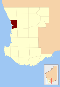
Nelson County was one of the 26 counties of Western Australia that were designated in 1829 as cadastral divisions. It approximately corresponds to the northern part of the Nelson Land District which forms the basis for land titles in the area.
Wellington County was one of the 26 counties of Western Australia that were designated in 1829 as cadastral divisions. It was named after Arthur Wellesley, 1st Duke of Wellington, Commander-in-Chief of the British Army from 1827-1828. It approximately corresponds to the Wellington Land District which forms the basis for land titles in the area.
Wicklow County was one of the 26 counties of Western Australia that were designated in 1829 as cadastral divisions. It was named after William Howard, 4th Earl of Wicklow, a Representative Peer for Ireland.
York County was one of the 26 counties of Western Australia that were designated in 1829 as cadastral divisions. It was named after Prince Frederick, Duke of York and Albany, who was until his death in 1827, the heir presumptive to King George IV. It approximately corresponds to the western part of the Avon Land District which forms the basis for land titles in the area.


