
Ferrar Glacier is a glacier in Antarctica. It is about 35 nautical miles long, flowing from the plateau of Victoria Land west of the Royal Society Range to New Harbour in McMurdo Sound. The glacier makes a right (east) turn northeast of Knobhead, where it also feeds the upper end of the Taylor Glacier, which flows on the other (northern) side of the Kukri Hills from the Ferrar Glacier, which continues east along the south side of the Kukri Hills to New Harbour.
The County of Perth was one of the 26 counties of Western Australia that were designated in 1829. It contained the city of Perth, with its south-eastern corner near Mount Dale. It was part of the Lands administrative divisions of Western Australia. Today, land titles in the area are associated with the Swan, Canning or Cockburn Sound land districts.

Plantagenet County was one of the 26 counties of Western Australia that were designated in 1829 as cadastral divisions, and was centred on the coastal settlement of Albany. It approximately corresponds to the modern-day Plantagenet Land District which forms the basis for land titles in the area.
Swan Land District is one of the land districts of Western Australia, which is located within the South West Division. It covers all of the northern and eastern suburbs of Perth, as well as some inner southern areas such as Belmont and Applecross and the area to the north up to the Moore River, including Muchea and Gingin. It is bounded on the north by the Melbourne Land District; on the east by Avon Land District; and on the south by Canning Land District.
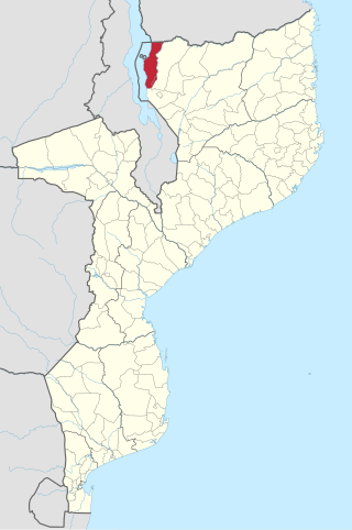
Lago District is a district of Niassa Province in north-western Mozambique. The principal town is Metangula. Lago District is bordered to the west by Lake Nyasa, on the south by Lichinga, on the east by Sanga District. Lago shares its northern boundary with Tanzania.

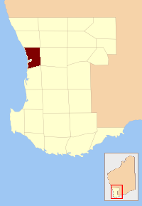
The Shire of Korumburra was a local government area located about 115 kilometres (71 mi) southeast of Melbourne, the state capital of Victoria, Australia. The shire covered an area of 613.8 square kilometres (237.0 sq mi), and existed from 1891 until 1994.
Pogorzałe Ługi is a village in the administrative district of Gmina Rokiciny, within Tomaszów Mazowiecki County, Łódź Voivodeship, in central Poland. It lies approximately 25 kilometres (16 mi) north-west of Tomaszów Mazowiecki and 26 km (16 mi) east of the regional capital Łódź.
Okołowice is a village in the administrative district of Gmina Koniecpol, within Częstochowa County, Silesian Voivodeship, in southern Poland. It lies approximately 4 kilometres (2 mi) north of Koniecpol, 42 km (26 mi) east of Częstochowa, and 81 km (50 mi) north-east of the regional capital Katowice.
Mochała is a village in the administrative district of Gmina Herby, within Lubliniec County, Silesian Voivodeship, in southern Poland. It lies approximately 10 kilometres (6 mi) east of Lubliniec and 52 km (32 mi) north of the regional capital Katowice.

Lisie Jamy is a village in the administrative district of Gmina Pisz, within Pisz County, Warmian-Masurian Voivodeship, in northern Poland. It lies approximately 10 kilometres (6 mi) north of Pisz and 88 km (55 mi) east of the regional capital Olsztyn.
Szczechy Wielkie is a village in the administrative district of Gmina Pisz, within Pisz County, Warmian-Masurian Voivodeship, in northern Poland. It lies approximately 10 kilometres (6 mi) north of Pisz and 88 km (55 mi) east of the regional capital Olsztyn.
Rzepczyno is a village in the administrative district of Gmina Brzeżno, within Świdwin County, West Pomeranian Voivodeship, in north-western Poland. It lies approximately 10 km (6 mi) south of Świdwin and 88 km (55 mi) east of the regional capital Szczecin.
The electoral district of Nunawading was an electoral district of the Legislative Assembly in the Australian state of Victoria, located in the eastern Melbourne suburb of Nunawading. A notable former member was future Prime Minister, Robert Menzies.

Glenelg County was one of the 26 counties of Western Australia that were designated in 1829 as cadastral divisions. It was named after Charles Grant, 1st Baron Glenelg, President of the Board of Trade and Treasurer of the Navy from September 1827 to June 1828.
Grey County was one of the 26 counties of Western Australia that were designated in 1829 as cadastral divisions. It was named after Charles Grey, 2nd Earl Grey, a powerful opposition Whig MP, who was to become Prime Minister of the United Kingdom of Great Britain and Ireland from 1830-1834. It approximately corresponds to the southern part of the Ninghan Land District which forms the basis for land titles in the area.
Twiss County was one of the 26 counties of Western Australia that were designated in 1829 as cadastral divisions. It was named after Horace Twiss, Under-Secretary of State for War and the Colonies from 1828 to 1830, a personal friend of Lieutenant-Governor James Stirling.
York County was one of the 26 counties of Western Australia that were designated in 1829 as cadastral divisions. It was named after Prince Frederick, Duke of York and Albany, who was until his death in 1827, the heir presumptive to King George IV. It approximately corresponds to the western part of the Avon Land District which forms the basis for land titles in the area.
Navalgatti is a village in Belgaum district of Karnataka, India.

Gippsland North was an electoral district of the Legislative Assembly in the Australian state of Victoria located in northern Gippsland from 1859 to 1955.
