USS Barbel (SS-316), a Balao-class submarine, was the first ship of the United States Navy to be named for the barbel, a fish commonly called a minnow or carp.

The Java Sea is an extensive shallow sea on the Sunda Shelf, between the Indonesian islands of Borneo to the north, Java to the south, Sumatra to the west, and Sulawesi to the east. Karimata Strait to its northwest links it to the South China Sea. It is a part of the western Pacific Ocean.

The Flores Sea covers 240,000 square kilometres (93,000 sq mi) of water in Indonesia. The sea is bounded on the north by the island of Celebes and on the south by Sunda Islands of Flores and Sumbawa.
The County of Perth was one of the 26 counties of Western Australia that were designated in 1829. It contained the city of Perth, with its south-eastern corner near Mount Dale. It was part of the Lands administrative divisions of Western Australia. Today, land titles in the area are associated with the Swan, Canning or Cockburn Sound land districts.

Plantagenet County was one of the 26 counties of Western Australia that were designated in 1829 as cadastral divisions, and was centred on the coastal settlement of Albany. It approximately corresponds to the modern-day Plantagenet Land District which forms the basis for land titles in the area.

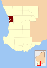
Durham County was one of the 26 counties of Western Australia that were designated in 1829 as cadastral divisions. It was named after Baron Durham, a British Whig statesman. His father-in-law was Earl Grey. It approximately corresponds to the north-eastern part of the Avon Land District which forms the basis for land titles in the area.
Glenelg County was one of the 26 counties of Western Australia that were designated in 1829 as cadastral divisions. It was named after Charles Grant, 1st Baron Glenelg, President of the Board of Trade and Treasurer of the Navy from September 1827 to June 1828.
Howick County was one of the 26 counties of Western Australia that were designated in 1829 as cadastral divisions. It was named after Viscount Howick, a well-connected Whig MP who was to become Under-Secretary of State for War and the Colonies in 1830. It approximately corresponds to the southeastern part of the Avon Land District which forms the basis for land titles in the area.
Melbourne County was one of the 26 counties of Western Australia that were designated in 1829 as cadastral divisions. It was named after William Lamb, 2nd Viscount Melbourne, Chief Secretary for Ireland by Lieutenant-Governor James Stirling.
Minto County was one of the 26 counties of Western Australia that were designated in 1829 as cadastral divisions. It approximately corresponds to parts of the Avon Land District and Williams Land District which form the basis for land titles in the area.
Peel County was one of the 26 counties of Western Australia that were designated in 1829 as cadastral divisions. It was named after Sir Robert Peel, Home Secretary from 1822–1827, and Home Secretary and Leader of the House of Commons from 1828–1830.
York County was one of the 26 counties of Western Australia that were designated in 1829 as cadastral divisions. It was named after Prince Frederick, Duke of York and Albany, who was until his death in 1827, the heir presumptive to King George IV. It approximately corresponds to the western part of the Avon Land District which forms the basis for land titles in the area.

The borders of the oceans are the limits of Earth's oceanic waters. The definition and number of oceans can vary depending on the adopted criteria. The principal divisions of the five oceans are the Pacific Ocean, Atlantic Ocean, Indian Ocean, Southern (Antarctic) Ocean, and Arctic Ocean. Smaller regions of the oceans are called seas, gulfs, bays, straits, and other terms. Geologically, an ocean is an area of oceanic crust covered by water.
Kukri Hills is a prominent east-west trending range, about 25 nautical miles (46 km) long and over 2,000 metres (6,600 ft) high, forming the divide between Ferrar Glacier on the south and Taylor Glacier and Taylor Valley on the north, in Victoria Land, Antarctica.
South America Glacier is a small glacier near the southwest corner of the Kukri Hills in Victoria Land. The ice hangs down a cliff 2,000 m high, and takes a form similar to the continent for which it is named. Named by the Western Journey Party, led by Taylor, of the British Antarctic Expedition, 1910–13.

The County of Newcastle is a county in the Wide Bay–Burnett region of Queensland, Australia. On 7 March 1901, the Governor issued a proclamation legally dividing Queensland into counties under the Land Act 1897. Its schedule described Newcastle thus:
Bounded on the east by the counties of Mackenzie and Boondooma; on the south by the Main Dividing Range; on the west by the eastern watershed of the Dawson River; on the north by the northern boundaries of the leased parts of Auburn and Hawkwood Runs and the Auburn River from the confluence of Narayen Creek downwards to its junction with the Burnett River.
The Blue Mountain Creek, an intermittent stream that is part of the Macleay River catchment, is located in the Northern Tablelands region of New South Wales, Australia.
