
The Java Sea is an extensive shallow sea on the Sunda Shelf. It lies between the Indonesian islands of Borneo to the north, Java to the south, Sumatra to the west, and Sulawesi to the east. Karimata Strait to its northwest links it to the South China Sea.

The South West region is one of the nine regions of Western Australia. It is so named because it is located in the south-west corner of Western Australia. The South West region has an area of 23,970 km², and a population of about 170,000 people, which is predicted to rise to 217,000 people by 2023.

The Hotham River is one of the major tributaries of the Murray River in Western Australia. It is about 160 kilometres long with its upper reaches being the Hotham River North, which begins in the Dutarning Range and joins the Hotham at its crossing of the Great Southern Highway near Popanyinning. A 15 km long southern tributary, Hotham River South begins near Cuballing and flows generally northerly before joining the Hotham near Yornaning.
Devil's Lair is a single-chamber cave with a floor area of around 200 m2 (2,200 sq ft) that formed in a Quaternary dune limestone of the Leeuwin–Naturaliste Ridge, 5 km (3.1 mi) from the modern coastline of Western Australia. The stratigraphic sequence in the cave floor deposit consists of 660 cm (260 in) of sandy sediments, with more than 100 distinct layers, intercalated with flowstone and other indurated deposits. Excavations have been made in several areas of the cave floor. Since 1973, excavations have been concentrated in the middle of the cave, where 10 trenches have been dug. Archaeological evidence for intermittent human occupation extends down about 350 cm (140 in) to layer 30, with hearths, bone, and stone artefacts found throughout. The site provides evidence of human habitation of Southwest Australia 50,000 years before the present day.
The County of Perth was one of the 26 counties of Western Australia that were designated in 1829. It contained the city of Perth, with its south-eastern corner near Mount Dale. It was part of the Lands administrative divisions of Western Australia. Today, land titles in the area are associated with the Swan, Canning or Cockburn Sound land districts.

Victoria County was one of the twenty six counties of Western Australia that were designated in 1829. It was named after Princess Alexandrina Victoria of Kent, from 1827 second in line to the throne. It approximately corresponds to the north-western section of the Avon Land District which forms the basis for land titles in the area.

The Collie River is a river in the South West region of Western Australia.

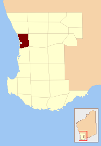
Balgarup River is a river in Western Australia that has its headwaters south-east of Kojonup just below Byenup Hill.

Wellington Land District is a land district of Western Australia, located within the South-West Land Division on the state's west coast. It spans roughly 32°56'S - 33°40'S in latitude and 115°25'E - 116°50'E in longitude.

Goderich County was one of the 26 counties of Western Australia that were designated in 1829 as cadastral divisions. It was named after F. J. Robinson, 1st Viscount Goderich, Prime Minister of the United Kingdom from August 1827 to January 1828.
Grantham County was one of the 26 counties of Western Australia that were designated in 1829 as cadastral divisions. It approximately corresponds to parts of the Avon Land District and Williams Land District which form the basis for land titles in the area.
Lanark County was one of the 26 counties of Western Australia that were designated in 1829 as cadastral divisions. It was named after the County of Lanark, Scotland, birthplace of Lieutenant-Governor James Stirling.
Murray County was one of the 26 counties of Western Australia that were designated in 1829 as cadastral divisions. It was named after George Murray, Secretary of State for War and the Colonies from 1828–1830, a personal friend of Lieutenant-Governor James Stirling.
Nelson County was one of the 26 counties of Western Australia that were designated in 1829 as cadastral divisions. It approximately corresponds to the northern part of the Nelson Land District which forms the basis for land titles in the area.
Peel County was one of the 26 counties of Western Australia that were designated in 1829 as cadastral divisions. It was named after Sir Robert Peel, Home Secretary from 1822–1827, and Home Secretary and Leader of the House of Commons from 1828–1830.
Stirling County was one of the 26 counties of Western Australia that were designated in 1829 as cadastral divisions. It approximately corresponds to the southern part of the Hay Land District which forms the basis for land titles in the area.
Wicklow County was one of the 26 counties of Western Australia that were designated in 1829 as cadastral divisions. It was named after William Howard, 4th Earl of Wicklow, a Representative Peer for Ireland.
York County was one of the 26 counties of Western Australia that were designated in 1829 as cadastral divisions. It was named after Prince Frederick, Duke of York and Albany, who was until his death in 1827, the heir presumptive to King George IV. It approximately corresponds to the western part of the Avon Land District which forms the basis for land titles in the area.
Ferguson River is a river in the South West region of Western Australia.
Worsley River is a river in the South West region of Western Australia. The river rises in the Darling Range 2 km south of the old timber town of Worsley then flows east and south discharging into the Collie River in Wellington Reservoir.


