
Shamong Township is a township in Burlington County, in the U.S. state of New Jersey. As of the 2020 United States census, the township's population was 6,460, a decrease of 30 (−0.5%) from the 2010 census count of 6,490, which in turn reflected an increase of 28 (+0.4%) from the 6,462 counted in the 2000 census. The township, and all of Burlington County, is a part of the Philadelphia-Reading-Camden combined statistical area and the Delaware Valley.

Southampton Township is a township in Burlington County, in the U.S. state of New Jersey. As of the 2020 United States census, the township's population was 10,317, a decrease of 147 (−1.4%) from the 2010 census count of 10,464, which in turn reflected an increase of 76 (+0.7%) from the 10,388 counted in the 2000 census. The township, and all of Burlington County, is a part of the Philadelphia-Reading-Camden combined statistical area and the Delaware Valley.

Woodland Township is a township in Burlington County, in the U.S. state of New Jersey. As of the 2020 United States census, the township's population was 1,544, a decrease of 244 (−13.6%) from the 2010 census count of 1,788, which in turn reflected an increase of 618 (+52.8%) from the 1,170 counted in the 2000 census. The township, and all of Burlington County, is a part of the Philadelphia-Reading-Camden combined statistical area and the Delaware Valley.
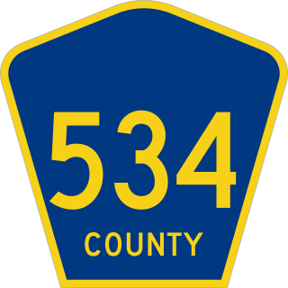
County Route 534 is a county highway in the U.S. state of New Jersey. The highway extends 22.86 miles (36.79 km) from Cooper Street on the border of Woodbury and Deptford Township to Indian Mills Road in Shamong Township.

Columbus is an unincorporated community located within Mansfield Township in Burlington County, in the U.S. state of New Jersey. The area is served as United States Postal Service ZIP Code 08022. Most of Mansfield Township's governmental offices are located in and around Columbus. It is also the main business district in the township with many businesses lining the main roads in the area. It is located at the junction of County Route 543 and U.S. Route 206 which is a major highway that heads north and south. US 206 originally passed through the center of Columbus on Atlantic Avenue and New York Avenue until it was moved to a short four-lane bypass of downtown in the late 1950s/early 1960s. The old surface route became state-maintained New Jersey Route 170 but became a county-maintained road in 1986.

Jobstown is an unincorporated community and census-designated place (CDP) located within Springfield Township in Burlington County, in the U.S. state of New Jersey. The area is served as United States Postal Service ZIP Code 08041.

New Lisbon is an unincorporated community located within Pemberton Township in Burlington County, New Jersey, United States. It is a settlement along Four Mile Road where it intersects Mount Misery Road. The community is located along the Philadelphia and Long Branch Railway, later a part of the Pennsylvania Railroad, and featured a train station.

Route 170 was a short, 0.79-mile (1.27 km) state highway in Burlington County, New Jersey, United States. The route was a former alignment of U.S. Route 206 and New Jersey Route 39 in the downtown portions of Mansfield Township and Columbus. Route 170 began at an intersection with U.S. Route 206 in Mansfield Township, headed northward along Atlantic Avenue and New York Avenue in Columbus before merging with U.S. Route 206 at a wye connection further north.

Smithburg is an unincorporated community located where the municipal boundaries of Freehold, Manalapan and Millstone townships intersect in Monmouth County, in the U.S. state of New Jersey. County Route 527 and Monmouth Road pass through the center of the quaint village of Smithburg.

Chairville is a rural unincorporated community located along the border of Medford and Southampton townships in Burlington County, in the U.S. state of New Jersey. The settlement is named for a chair parts factory that operated from 1845 to 1890. Also located in the area were the Peacock Cemetery, a sawmill, and a one-room schoolhouse. Today, the site is located at the intersection of Chairville Road and New Jersey Route 70 and Little Creek.

Retreat is an unincorporated community and former hamlet located within Southampton Township in Burlington County, in the U.S. state of New Jersey. The area consists of some residential houses grouped together along Big Hill Road and Retreat Road. A large cranberry bog exists to the southeast of the community while Leisuretowne retirement community is located southwest of here. Most of the remaining area consists of forestland.
Buddtown is an unincorporated community located within Southampton Township in Burlington County, in the U.S. state of New Jersey. Located between Vincentown and Pemberton, it is named for Thomas Budd who owned farmland in the area in the 18th century. The area itself contains houses and churches in the community itself and farmland surrounding the settlement. The stream that runs through Buddtown is named Stop the Jade Run supposedly named for the cry made by the owners of a runaway horse, "jade" being an old name for a horse.

Burrs Mill is an unincorporated community located within Southampton Township in Burlington County, in the U.S. state of New Jersey. Found in a rural portion of the township near Route 70, it is located along its eponymous brook in a forested area within the Pine Barrens. A low density of houses surround nearby roads including Burrs Mill Road and Route 70's fire roads.

Penns Neck is an unincorporated community located within West Windsor Township in Mercer County, New Jersey, United States. The community developed at the intersection of the Trenton-New Brunswick Turnpike and Washington Road. The Penns Neck Circle and the historic Penns Neck Baptist Church (1812) are both located in Penns Neck. The Princeton Branch rail line, known as the Dinky, has run through the area since 1865, and stopped at Penns Neck station until January 1971.

Burlington Heights is an unincorporated community located within Freehold Township in Monmouth County, in the U.S. state of New Jersey. The community was created in the early 1960s and originally consisted of 112 homes of mixed styles designed by Peter Petillo and Associates of Freehold. It is located along Colts Neck Road on the east side of the township, near New Jersey Route 18 and the Colts Neck municipal line.

Ewansville or Ewanville is an unincorporated community located in Burlington County, in the U.S. state of New Jersey. The community is centered on the crossing of U.S. Route 206 (US 206) and the North Branch Rancocas Creek just north of the former Philadelphia and Long Branch Railway. Ewansville was the site of a station on the aforementioned railroad and was the terminus for a short spur track to Vincentown.

Browns Mills Junction is an unincorporated community located within Pemberton Township in Burlington County, in the U.S. state of New Jersey. The site, located about 1.6 miles (2.6 km) southwest of downtown Browns Mills, is located at the crossing of Junction Road and the Philadelphia and Long Branch Railway, later a part of the Pennsylvania Railroad. It was the site of a train station named Browns Mills in-the-Pines where a short branch connected the main line to Browns Mills. The settlement features a few houses along Junction Road and Mount Misery Road but is otherwise very forested as a part of the New Jersey Pine Barrens.

Comical Corner or Comical Corners is an unincorporated community located within Pemberton Township in Burlington County, in the U.S. state of New Jersey. The site of the actual corners is at the intersection of Pemberton Road and Arneys Mount Road. The original name may have been "Conical Corner" based on the cone-like shape of the skewed intersection but had turned to "Comical Corner" based on a mishearing. The area, located just to the north of Pemberton Borough, is mostly rural and is surrounded by farmland on the two obtuse sides of the intersection.

Davisville is an unincorporated community located within Chesterfield Township in Burlington County, in the U.S. state of New Jersey. The settlement, located at the intersection of County Route 528 and Chesterfield-Arneytown Road, is in a rural area in the eastern portion of the township. It consists mainly of farmland with some houses dotting the few roads that pass through the area.

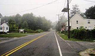
Red Lion is an unincorporated community located within Southampton Township in Burlington County, in the U.S. state of New Jersey.


