Bedford Township, Bedford County, Pennsylvania

Last updated

Bedford Township, Pennsylvania
2009 10 03 - 09974 - Bedford - Old Bedford Village Covered Bridge.jpg
Old Bedford Village Covered Bridge in Bedford Township
Map of Bedford Township, Bedford County, Pennsylvania Highlighted.png
Map of Bedford County, Pennsylvania highlighting Bedford Township
Map of Pennsylvania highlighting Bedford County.svg
Map of Bedford County, Pennsylvania
Country United States
State Pennsylvania
County Bedford
Settled1761
Incorporated1768
Area
[1]
  Total68.31 sq mi (176.91 km2)
  Land68.08 sq mi (176.31 km2)
  Water0.23 sq mi (0.60 km2)
Population
 (2020) [2]
  Total5,161 Decrease2.svg
  Estimate 
(2021) [2]
5,142
  Density76.31/sq mi (29.46/km2)
Time zone UTC-5 (Eastern (EST))
  Summer (DST) UTC-4 (EDT)
Area code 814
FIPS code 42-009-04952
Website bedfordtwppagov.com

Bedford Township is a township in Bedford County, Pennsylvania, United States. The population was 5,161 at the 2020 census. [2]

Contents

History

The Bedford Village Archeological Site is located in northern Bedford Township, north of the borough of Bedford. The site of a village of the Monongahela tribe, it is currently occupied by Old Bedford Village, a living history museum. [3]

Geography

Bedford Township is located in the center of Bedford County and surrounds the borough of Bedford. According to the United States Census Bureau, the township has a total area of 68.3 square miles (176.9 km2), of which 68.1 square miles (176.3 km2) is land and 0.23 square miles (0.6 km2), or 0.34%, is water. [4]

Adjacent municipalities

Geology

Bedford valley is a synclinal valley, with Evitts Mountain forming the eastern limb and Wills Mountain forming a part of the western limb. The northern end of Wills Mountain is known as Kinton Knob and is the crest of a plunging anticline. The Silurian Tuscarora Formation, a hard sandstone, outcrops at the crests of these ridges and is stratigraphically lower and thus older than the rest of the bedrock in the township. The overlying formations are either Silurian or Devonian in age, and include (in ascending order) the Clinton Group, the Bloomsburg Formation, the Mifflintown Formation, the Wills Creek Formation, the Tonoloway Formation, the Keyser Formation, the Old Port Formation, the Onondaga Formation, and the Hamilton Group, which is composed of the Marcellus Shale and the Mahantango Formation. The Ridgeley Member of the Old Port Formation, another sandstone and conglomerate, forms the low ridge in the center of the township south of the town of Bedford, as well as Stiffler Ridge in Dunning Cove. Dunning Cove itself is a structural basin. [5]

Recreation

A portion of the Pennsylvania State Game Lands Number 48 is located in the township. [6] [7]

Demographics

Historical population
CensusPop.Note
2000 5,417
2010 5,395−0.4%
2020 5,161−4.3%
2021 (est.)5,142 [2] −0.4%
U.S. Decennial Census [8]

As of the census [9] of 2000, there were 5,417 people, 2,144 households, and 1,560 families residing in the township. The population density was 79.0 inhabitants per square mile (30.5/km2). There were 2,403 housing units at an average density of 35.0 per square mile (13.5/km2). The racial makeup of the township was 97.14% White, 1.33% African American, 0.06% Native American, 0.48% Asian, 0.24% from other races, and 0.76% from two or more races. Hispanic or Latino of any race were 0.59% of the population.

There were 2,144 households, out of which 28.6% had children under the age of 18 living with them, 61.8% were married couples living together, 7.3% had a female householder with no husband present, and 27.2% were non-families. 23.7% of all households were made up of individuals, and 11.6% had someone living alone who was 65 years of age or older. The average household size was 2.43 and the average family size was 2.86.

In the township the population was spread out, with 21.3% under the age of 18, 6.3% from 18 to 24, 28.7% from 25 to 44, 23.8% from 45 to 64, and 20.0% who were 65 years of age or older. The median age was 41 years. For every 100 females, there were 98.9 males. For every 100 females age 18 and over, there were 93.9 males.

The median income for a household in the township was $36,395, and the median income for a family was $43,235. Males had a median income of $28,833 versus $21,177 for females. The per capita income for the township was $18,676. About 5.3% of families and 6.5% of the population were below the poverty line, including 6.8% of those under age 18 and 7.4% of those age 65 or over.

Related Research Articles

<span class="mw-page-title-main">Colerain Township, Bedford County, Pennsylvania</span> Township in Pennsylvania, United States

Colerain Township is a township in Bedford County, Pennsylvania, United States. The population was 1,127 at the 2020 census.

<span class="mw-page-title-main">Cumberland Valley Township, Bedford County, Pennsylvania</span> Township in Pennsylvania, United States

Cumberland Valley Township is a township in Bedford County, Pennsylvania, United States. The population was 1,445 at the 2020 census.

<span class="mw-page-title-main">East St. Clair Township, Bedford County, Pennsylvania</span> Township in Pennsylvania, United States

East St. Clair Township is a township in Bedford County, Pennsylvania, United States. The population was 2,897 at the 2020 census.

<span class="mw-page-title-main">Harrison Township, Bedford County, Pennsylvania</span> Township in Pennsylvania, United States

Harrison Township is a township in Bedford County, Pennsylvania, United States. The population was 929 at the 2020 census.

<span class="mw-page-title-main">Hopewell, Bedford County, Pennsylvania</span> Borough in Pennsylvania, United States

Hopewell is a borough in Bedford County, Pennsylvania, United States. The population was 188 at the 2020 census.

<span class="mw-page-title-main">Hyndman, Pennsylvania</span> Borough in Pennsylvania, United States

Hyndman is a borough in Bedford County, Pennsylvania, United States. As of the 2020 census, the population was 859.

<span class="mw-page-title-main">Liberty Township, Bedford County, Pennsylvania</span> Township in Pennsylvania, United States

Liberty Township is a township in Bedford County, Pennsylvania, United States. The population was 1,382 at the 2020 census. Warriors Path State Park is located in the township.

<span class="mw-page-title-main">Manns Choice, Pennsylvania</span> Borough in Pennsylvania, United States

Manns Choice is a borough in Bedford County, Pennsylvania, United States. The population was 313 at the 2020 census.

<span class="mw-page-title-main">Napier Township, Bedford County, Pennsylvania</span> Township in Pennsylvania, United States

Napier Township is a township in Bedford County, Pennsylvania, United States. The population was 2,026 at the 2020 census.

<span class="mw-page-title-main">New Paris, Pennsylvania</span> Borough in Pennsylvania, United States

New Paris is a borough in Bedford County, Pennsylvania, United States. The population was 201 at the 2020 census.

<span class="mw-page-title-main">Pleasantville, Bedford County, Pennsylvania</span> Borough in Pennsylvania, United States

Pleasantville, also known as Alum Bank, is a borough in Bedford County, Pennsylvania, United States. The population was 195 at the 2020 census.

<span class="mw-page-title-main">Schellsburg, Pennsylvania</span> Borough in Pennsylvania, United States

Schellsburg is a borough in Bedford County, Pennsylvania, United States. The population was 329 at the 2020 census.

<span class="mw-page-title-main">Snake Spring Township, Bedford County, Pennsylvania</span> Township in Pennsylvania, United States

Snake Spring Township is a township in Bedford County, Pennsylvania, United States. The population was 1,830 at the 2020 census.

<span class="mw-page-title-main">Springhill Township, Fayette County, Pennsylvania</span> Township in Pennsylvania, United States

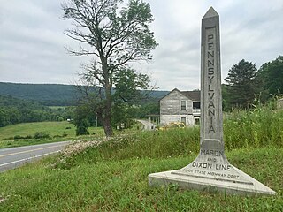
Springhill Township is a township in Fayette County, Pennsylvania, United States. The population was 2,723 at the 2020 census. The Albert Gallatin Area School District serves the region.

<span class="mw-page-title-main">Mayberry Township, Montour County, Pennsylvania</span> Township in Pennsylvania, United States

Mayberry Township is a township in Montour County, Pennsylvania, United States.

<span class="mw-page-title-main">Elk Lick Township, Somerset County, Pennsylvania</span> Township in Pennsylvania, United States

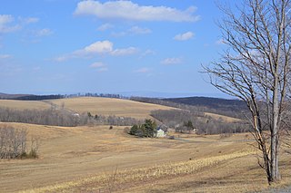
Elk Lick Township is a township in Somerset County, Pennsylvania, United States. The population was 2,257 at the 2020 census. Mount Davis, the highest point in Pennsylvania, is located within the township.

<span class="mw-page-title-main">Fairhope Township, Somerset County, Pennsylvania</span> Township in Pennsylvania, United States

Fairhope Township is a township in Somerset County, Pennsylvania, United States. The population was 102 at the 2020 census. It is part of the Johnstown, Pennsylvania, Metropolitan Statistical Area.

<span class="mw-page-title-main">Milford Township, Somerset County, Pennsylvania</span> Township in Pennsylvania, United States

Milford Township is a township in Somerset County, Pennsylvania, United States. The population was 1,488 at the 2020 census. It is part of the Johnstown, Pennsylvania, Metropolitan Statistical Area.

<span class="mw-page-title-main">Quemahoning Township, Somerset County, Pennsylvania</span> Township in Pennsylvania, United States

Quemahoning Township is a township in Somerset County, Pennsylvania, United States. The population was 1,838 at the 2020 census. It is part of the Johnstown, Pennsylvania, Metropolitan Statistical Area.

<span class="mw-page-title-main">Tunnelhill, Pennsylvania</span> Borough in Pennsylvania, United States

Tunnelhill is a borough that is located in Cambria and Blair counties in Pennsylvania, United States. The population was 363 at the 2010 census. Of these, 245 were in Cambria County, and 118 were in Blair County. It is part of the Altoona, PA Metropolitan Statistical Area. Tunnelhill is named after the many railroad tunnels of the Pennsylvania Railroad near here known as the Gallitzin Tunnels.

References

  1. "2016 U.S. Gazetteer Files". United States Census Bureau. Retrieved August 13, 2017.
  2. 1 2 3 4 Bureau, US Census. "City and Town Population Totals: 2020—2021". Census.gov. US Census Bureau. Retrieved July 25, 2022.
  3. Beckerman, Ira. National Register of Historic Places Inventory/Nomination: Site 36BD90. National Park Service, n.d., 2.
  4. "Geographic Identifiers: 2010 Demographic Profile Data (G001): Bedford township, Bedford County, Pennsylvania". U.S. Census Bureau, American Factfinder. Archived from the original on February 12, 2020. Retrieved March 4, 2014.
  5. Berg, T.M., Edmunds, W.E., Geyer, A.R. and others, compilers, (1980). Geologic Map of Pennsylvania: Pennsylvania Geologic Survey, Map 1, scale 1:250,000.
  6. https://viewer.nationalmap.gov/advanced-viewer/ The National Map, retrieved 3 October 2018
  7. Pennsylvania State Game Lands Number 48, retrieved 6 October 2018
  8. "Census of Population and Housing". Census.gov. Retrieved June 4, 2016.
  9. "U.S. Census website". United States Census Bureau . Retrieved January 31, 2008.

40°00′02″N78°32′29″W / 40.00056°N 78.54139°W / 40.00056; -78.54139