Keyser Formation | |
---|---|
Stratigraphic range: Pridoli-Lochkovian [1] | |
![]() Outcrop of the Keyser Formation on U.S. Route 522 in Fulton County, Pennsylvania, north of Warfordsburg | |
Type | Sedimentary |
Unit of | Helderberg Group |
Sub-units | Byers Island, Jersey Shore & La Vale Members |
Underlies | New Creek Limestone and Old Port Formation |
Overlies | Tonoloway Formation |
Thickness | 33 m (108 ft) at Allegheny Furnace |
Lithology | |
Primary | Limestone |
Location | |
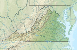
Coordinates | 38°18′N79°36′W / 38.3°N 79.6°W Coordinates: 38°18′N79°36′W / 38.3°N 79.6°W |
Approximate paleocoordinates | 36°18′S41°30′W / 36.3°S 41.5°W |
Region | Pennsylvania, Maryland, Virginia, West Virginia |
Country | ![]() |
Extent | Appalachian Mountains |
Type section | |
Named for | Keyser, West Virginia |
Named by | E. O. Ulrich |
Year defined | 1911 [2] |
The Late Silurian to Early Devonian Keyser Formation is a mapped limestone bedrock unit in Pennsylvania, Maryland, Virginia, and West Virginia.
The Keyser is a nodular limestone overlain by thick- and thin-bedded limestone and laminated limestone at its type locality in Keyser, West Virginia.
In central Pennsylvania, the basal "calico" limestone is a fossiliferous, medium-light- to medium-gray very thick bedded calcilutite containing numerous small irregular patches of clear calcite. The abundantly fossiliferous, nodular limestone at the base overlies the "calico". Overlying this is 5 to 6 m of fragmental calcarenite containing abundant crinoid columnals. Above the calcarenite is 6 m of fossiliferous, banded calcisiltite. The uppermost 15 m is a sequence alternating between laminated, stromatolitic calcisiltite, and calcilutite and calcisiltite that are argillaceous and fossiliferous. [3]
The depositional environment of the Keyser is interpreted as shallow marine and tidal flats, occurring in cycles. [4]
Contact with Tonoloway Formation is probably conformable, but sharp enough to suggest an unconformity. Upper contact with the Old Port Formation is conformable.
The Keyser was divided into three members by J. W. Head in 1972. [5] These are, from lowest to highest, the Byers Island Member, Jersey Shore Member, and La Vale Member. The type locality of the Byers Island Member is at Selinsgrove, Pennsylvania, where it is 93 feet thick. The type locality of the Jersey Shore Member is at Jersey Shore, Lycoming County, Pennsylvania. The type locality of the La Vale Member is at the Corriganville quarry, Allegany County, Maryland, and is named for the nearby town of La Vale. This nomenclature is accepted by the USGS.
In Virginia and West Virginia the Keyser is divided into Upper and Lower Members by the Big Mountain Shale Member. [6]
Relative age dating places the Keyser in the late Silurian to early Devonian, with the transition occurring near the top of the formation. Denkler and Harris used conodont biostratigraphy to confirm this. [7]
![]() | Wikimedia Commons has media related to Keyser Formation . |
Calcarenite is a type of limestone that is composed predominantly, more than 50 percent, of detrital (transported) sand-size, carbonate grains. The grains consist of sand-size grains of either corals, shells, ooids, intraclasts, pellets, fragments of older limestones and dolomites, other carbonate grains, or some combination of these. Calcarenite is the carbonate equivalent of a sandstone. The term calcarenite was originally proposed in 1903 by Grabau as a part of his calcilutite, calcarenite and calcirudite carbonate classification system based upon the size of the detrital grains composing a limestone. Calcarenites can accumulate in a wide variety of marine and non-marine environments. They can consist of grains of carbonate that have accumulated either as coastal sand dunes (eolianites), beaches, offshore bars and shoals, turbidites, or other depositional settings.
The Silurian Tuscarora Formation — also known as Tuscarora Sandstone or Tuscarora Quartzite — is a mapped bedrock unit in Pennsylvania, Maryland, West Virginia, and Virginia, USA.
Bedford County, Pennsylvania is situated along the western border of the Ridge and Valley physiographic province, which is characterized by folded and faulted sedimentary rocks of early to middle Paleozoic age. The northwestern border of the county is approximately at the Allegheny Front, a geological boundary between the Ridge and Valley Province and the Allegheny Plateau.
Wills Creek Formation is a mapped Silurian bedrock unit in Pennsylvania, Maryland, Virginia, and West Virginia.
The Hamilton Group is a Devonian-age geological group in the Appalachian region of the United States. It is present in New York, Pennsylvania, Maryland, Ohio, West Virginia, northwestern Virginia and Ontario, Canada. It is mainly composed of marine shale with some sandstone. There are two main formations encompassed by the group: the Mahantango Formation and the Marcellus Shale. In southwestern Virginia, where the two sub-units are not easily distinguishable, the Hamilton Group is broadly equivalent to the Millboro Shale or Millboro Formation. The group is named for the village of Hamilton, New York. These rocks are the oldest strata of the Devonian gas shale sequence.
The Devonian Mahantango Formation is a mapped bedrock unit in Pennsylvania, West Virginia, and Maryland. It is named for the North branch of the Mahantango Creek in Perry and Juniata counties in Pennsylvania. It is a member of the Hamilton Group, along with the underlying the Marcellus Formation Shale. South of Tuscarora Mountain in south central Pennsylvania, the lower members of this unit were also mapped as the Montebello Formation. Details of the type section and of stratigraphic nomenclature for this unit as used by the U.S. Geological Survey are available on-line at the National Geologic Map Database.
Chestnut Ridge is an elongate hill trending northeast-southwest in west-central Bedford County, Pennsylvania. It is partially forested with rural homes, farms, and notably apple orchards. Four small towns surround it: Schellsburg, New Paris, Fishertown, and Pleasantville. Shawnee State Park and Shawnee Lake lie immediately to the south of the ridge.
The Marcellus Formation or the Marcellus Shale is a Middle Devonian age unit of sedimentary rock found in eastern North America. Named for a distinctive outcrop near the village of Marcellus, New York, in the United States, it extends throughout much of the Appalachian Basin.
The Exshaw Formation is a stratigraphic unit in the Western Canada Sedimentary Basin. It takes the name from the hamlet of Exshaw, Alberta in the Canadian Rockies, and was first described from outcrops on the banks of Jura Creek north of Exshaw by P.S. Warren in 1937. The formation is of Late Devonian to Early Mississippian age as determined by conodont biostratigraphy, and it straddles the Devonian-Carboniferous boundary.
The Devonian Old Port Formation is a mapped bedrock unit in Pennsylvania, USA. Details of the type section and of stratigraphic nomenclature for this unit as used by the U.S. Geological Survey are available on-line at the National Geologic Map Database. Current nomenclature usage by U.S. Geological Survey restricts the name Old Port Formation to Pennsylvania, but correlative units are present in adjacent states.
The Palliser Formation is a stratigraphic unit of Late Devonian (Famennian) age in the Western Canada Sedimentary Basin. It is a thick sequence of limestone and dolomitic limestone that is present in the Canadian Rockies and foothills of western Alberta. Tall cliffs formed of the Palliser Formation can be seen throughout Banff and Jasper National Parks.
The Conococheague Formation is a mapped Appalachian bedrock unit of Cambrian age, consisting primarily of limestone and dolomite. It occurs in central Maryland, southern and central Pennsylvania, the Valley and Ridge of Virginia and easternmost West Virginia.
The Late Silurian Tonoloway Formation is a mapped limestone bedrock unit in Pennsylvania, Maryland, Virginia and West Virginia.
Calcisiltite is a type of limestone that is composed predominantly, more than 50 percent, of detrital (transported) silt-size carbonate grains. These grains consist either of the silt-size particles of ooids, fragments of fossil shells, fragments of older limestones and dolomites, intraclasts, pellets, other carbonate grains, or some combination of these. Calcisiltite is the carbonate equivalent of a siltstone. Calcisiltites can accumulate in a wide variety of coastal, lacustrine, and marine environments. It is typically the product of abrasion and bioerosion.
The Devonian Brallier Formation is a mapped bedrock unit in Pennsylvania, Maryland, West Virginia, and Virginia.
The Ridgeley sandstone is a sandstone or quartzite of Devonian age found in the Appalachian Mountains of Pennsylvania, Maryland, West Virginia, and Virginia, United States. The Ridgeley is fine-grained, siliceous, calcareous in its lower strata, sometimes fossiliferous, and sometimes locally pebbly or conglomeritic. Varying in thickness from 12 to 500 feet, this rock slowly erodes into white quartz sand that often washes or blows away, but sometimes accumulates at large outcrops. When freshly broken, the rock is white, but outcrop surfaces are often stained yellowish by iron oxides.
The Bluefield Formation is a geologic formation in West Virginia. It preserves fossils dating back to the Mississippian subperiod of the Carboniferous period. Sediments of this age formed along a large marine basin lying in the region of what is now the Appalachian Plateau. The Bluefield Formation is the lowest section of the primarily siliciclastic Mauch Chunk Group, underlying the Stony Gap Sandstone Member of the Hinton Formation and overlying the limestone-rich Greenbrier Group.
Oulodus is a genus of conodonts in the family Prioniodinidae.
The Bertie Group or Bertie Limestone, also referred to as the Bertie Dolomite and the Bertie Formation, is an upper Silurian geologic group and Lagerstätte in southern Ontario, Canada, and western New York State, United States. Details of the type locality and of stratigraphic nomenclature for this unit as used by the U.S. Geological Survey are available on-line at the National Geologic Map Database. The formation comprises dolomites, limestones and shales and reaches a thickness of 495 feet (151 m) in the subsurface, while in outcrop the group can be 60 feet (18 m) thick.