Bexar, Texas

Last updated

Bexar, Texas
USA Texas location map.svg
Red pog.svg
Bexar
Usa edcp location map.svg
Red pog.svg
Bexar
Coordinates: 29°13′32″N98°41′16″W / 29.22556°N 98.68778°W / 29.22556; -98.68778
Country United States
State Texas
County Bexar
Elevation
656 ft (200 m)
Time zone UTC-6 (Central (CST))
  Summer (DST) UTC-5 (CDT)
Area code 210
GNIS feature ID1379416 [1]

Bexar is an unincorporated community in Bexar County, in the U.S. state of Texas. [1] It is located within the Greater San Antonio metropolitan area.

Contents

History

Irish farmer and rancher John Kinney (or Kenney) was the community's first settler in 1854. He founded San Patricio de Bexar Catholic church alongside other settlers in 1868. His family operated an open pit coal mine in the area in the mid-1880s. Coal was transported to the area by ox cart to San Antonio. A post office was established at Bexar in 1883 inside the bright red painted general store. As a result, it also goes by the names "La Colorada" or "La Mina de la Colorada". The number of houses in the community ranged from 30 to 45, alongside a general store that was owned and operated by John Conoly and Dr. James A. Matthews. Other businesses in the community in 1894 included a doctor's office, a theater, the post office, a cotton gin, a dance hall, a cantina, and three churches. The Artesian Belt Railroad then passed by Bexar in 1909. Most of the area was integrated into nearby Somerset when it was established two miles east of the community along the railroad. Another railway spur was connected to the coal mine. Its economy shifted to oil production when it was discovered in Somerset by CC Kurtz in 1913 and became the largest oil-producing field in the world at the time. The community subsequently declined, when the general store closed, and all three churches were relocated to Somerset. There were three cemeteries and several scattered houses in Bexar in the late 2000s. [2] The post office closed in 1907, with no population estimates. In the 1930s, the community had a church, a store, and a cemetery. [3]

Geography

Bexar is located at the intersection of Farm to Market Road 2790 and Kinney Road, 2 mi (3.2 km) west of Somerset and 18 mi (29 km) southwest of Downtown San Antonio in southwestern Bexar County. [2]

Education

Bexar is served by the Somerset Independent School District.

Notable person

Related Research Articles

<span class="mw-page-title-main">Kinney County, Texas</span> County in Texas, United States

Kinney County is a county located in the U.S. state of Texas. As of the 2020 census, its population was 3,129. Its county seat is Brackettville. The county was created in 1850 and later organized in 1874. It is named for Henry Lawrence Kinney, an early settler.

<span class="mw-page-title-main">Somerset, Texas</span> City in Texas, United States

Somerset is a city located in Bexar County, Texas, United States. It is located less than 20 miles south of Downtown San Antonio and is part of the San Antonio–New Braunfels metropolitan area. The population was 1,756 at the 2020 census.

Von Ormy is a city in southwest Bexar County, Texas, United States. As of the 2020 census, it had a population of 1,174. It is part of the San Antonio metropolitan statistical area.

Pipe Creek is an unincorporated community in Bandera County, Texas, United States. According to the Handbook of Texas, it had a population of approximately 66 in 1990. It is part of the San Antonio Metropolitan Statistical Area.

Anarene is a ghost town in Archer County, Texas, United States. Its name was used for the town portrayed in the film adaptation of Larry McMurtry's novel, The Last Picture Show.

Sayers is a small unincorporated community in Bexar County, Texas, United States. It is part of the San Antonio Metropolitan Statistical Area.

Frelsburg is an unincorporated community in Colorado County, Texas, United States. It lies at the intersection of Farm to Market Road 109 and Farm to Market Road 1291. The community was founded around 1837 by immigrants from Germany. It is home to one of the oldest surviving general stores in Texas. Continuously operated since 1865 and owned by the Heinsohn family since 1920, the store is called Heinsohn's Country Store.

<span class="mw-page-title-main">Guy, Texas</span> Unincorporated community in Texas, United States

Guy is an unincorporated community in Fort Bend County, Texas, United States. According to the Handbook of Texas, the community had a population of 60 in 2000. It is located in the Greater Houston metropolitan area.

Atascosa is an unincorporated community located in southwestern Bexar County, Texas, United States. According to the Handbook of Texas, the community had a population of 300 in 2000. The community is part of the San Antonio Metropolitan Statistical Area.

Philip Dimmitt (1801–1841) was an officer in the Texian Army during the Texas Revolution. Born in Kentucky, Dimmitt moved to Texas in 1823 and soon operated a series of trading posts. After learning that Mexican General Martín Perfecto de Cos was en route to Texas in 1835 to quell the unrest, Dimmitt proposed that the general be kidnapped on his arrival at Copano. The plan was shelved when fighting broke out at Gonzales, but by early October, 1835, it had been resuscitated by a group of volunteers at Matamoros. Not knowing that Cos had already departed for San Antonio de Bexar, this group decided to corner Cos at Presidio La Bahia in Goliad. Dimmitt joined them en route, and participated in the battle of Goliad.

Campbellton is an unincorporated community in Atascosa County, Texas, United States. According to the Handbook of Texas, the community had an estimated population of 350 in 2000. Campbellton is part of the San Antonio Metropolitan Statistical Area.

McCoy is an unincorporated community in Atascosa County, Texas, United States. According to the Handbook of Texas, the community had a population of 30 in 2000. It is located within the San Antonio metropolitan area.

Losoya is an unincorporated community in Bexar County, Texas, United States. According to the Handbook of Texas, the community had a population of 322 in 2000. It is a part of the San Antonio–New Braunfels metropolitan area.

Anchorage is an unincorporated community in Atascosa County, in the U.S. state of Texas. It is located within the San Antonio metropolitan area.

Hindes is an unincorporated community in Atascosa County, in the U.S. state of Texas. According to the Handbook of Texas, the community had a population of 14 from 1974 through 2000. It is located within the San Antonio metropolitan area.

Papalote is an unincorporated community in Bee County, in the U.S. state of Texas. According to the Handbook of Texas, the community had a population of 70 in 2000. It is located within the Beeville micropolitan area.

Boldtville is an unincorporated community in Bexar County, in the U.S. state of Texas. According to the Handbook of Texas, the community had a population of 20 in 2000. It is located within the Greater San Antonio metropolitan area.
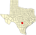
Cassin is an unincorporated community in Bexar County, in the U.S. state of Texas. According to the Handbook of Texas, the community had a population of 50 in 1990. It is located within the Greater San Antonio metropolitan area.

Southon is an unincorporated community in Bexar County, in the U.S. state of Texas. According to the Handbook of Texas, the community had a population of 113 in 2000. It is located within the Greater San Antonio metropolitan area.

Thelma is an unincorporated community in Bexar County, in the U.S. state of Texas. According to the Handbook of Texas, the community had a population of 45 in 2000. It is located within the Greater San Antonio metropolitan area.

References

  1. 1 2 U.S. Geological Survey Geographic Names Information System: Bexar, Texas
  2. 1 2 Martínez de Vara, Art (May 5, 2010). "Bexar, TX". tshaonline.org.
  3. "Bexar, Texas". Texas Escapes Online Magazine. Retrieved August 11, 2022.