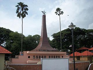
Kadirur is a census town and city suburb of Thalassery within the Thalassery Taluk of Kannur District in the State of Kerala, India. Kadirur is located about 8 km (5.0 mi) from the Thalassery Township. Kadirur is located on the Tellicherry-Mysore road.

Kaduru, also known as Kadur, is a town and a Taluk in Chikkamagaluru district, in Karnataka with an area of 2,813 m2 (30,280 sq ft). It is located at 13.553345°N 76.011260°E.located in the rain shadow region of western ghats,most of the taluk is dry unlike much of the district.Kadur is known for Arecanut production.
Kuthuparamba is a town and a municipality in the Kannur district, state of Kerala, India. It is about 24 km south east of Kannur and 14 km east of Thalassery.

Memari is a town and a municipality in Purba Bardhaman district in the Indian state of West Bengal.
Chandameta-Butaria is a town and a nagar panchayat in Chhindwara district in the state of Madhya Pradesh, India.
Doraha is a city and a municipal council in Ludhiana district in the state of Punjab, India.

Dubrajpur is a city and a municipality in Suri Sadar subdivision of Birbhum district in the Indian state of West Bengal.
Ghatlodiya is an area in Ahmedabad in the state of Gujarat, in western India.
Marakkanam is a coastal panchayat town & Taluk in Viluppuram district in the Indian state of Tamil Nadu. It is well connected to the state capital Chennai and the nearby union territory of Puducherry by the East Coast Road. To the west, Marakkanam is connected to the town of Tindivanam by the SH-134. Marakkanam is situated on the declared National Waterways NW-4. On materialisation of National Waterways NW-4, Marakkanam will be connected to two states Andhra Pradesh (Kakinada) and Puducherry through north and south of Buckingham Canal.
Nalkheda is a town (Tehsil) and a nagar Parishad in Agar Malwa district in the Indian state of Madhya Pradesh. Nalkheda is situated on the bank of river Lakhunder.
Reethapuram is a panchayat town in Kanniyakumari district in the Indian state of Tamil Nadu.
Sadulshahar is a town and a municipality in Sri Ganganagar district in the Indian state of Rajasthan.
Shahgarh is a town and a tahsil in Sagar district in the Indian state of Madhya Pradesh. Its connected with National Highway No. 86 Route, National Highway 539 and MP SH 37.
Thevaram is a town in Theni district in the Indian state of Tamil Nadu. Thevaram is located in Tamil Nadu near on border of Kerala at the Eastern side foot-hill of the Western Ghats. It is connected with State Highway SH100.
Thimiri is a panchayat town in Ranipet district in the Indian state of Tamil Nadu.The Town Panchayat was originally a religious centre with the presence of large number of temples, Mosque. The town has gained importance especially by the cultivation of paddy, Ragi. Ground nut and Sugar Cane.The Somanatha Pashana Lingeswarar Temple a Hindu temple dedicated to Lord Shiva and Kumaragiri Murugan Temple is a Hindu Temple dedicated to Lord Murugan located in Kumaragiri Hills are famous temple in Timiri. The present the area of the Town Panchayat is 6.47 km2. The town is divided into 15 election wards. Thimiri is a Town Panchayat coming under the administrative territory of Ranipet district and Arcot Taulk. This Town is located on 22 km away from Arani, 31 km at away from Vellore city and 125 km away from State capital Chennai.Thimiri is on State Highway 4 or SH4 between Arcot and Arani. This is on the main route from Arani to Chennai Highway. The State Roads connect Thimiri Town Panchayat with surrounding towns and other urban centers in the district.

Ujhani is an industry-based city and a municipal board in Badaun district in the Indian state of Uttar Pradesh.
Fatehabad is a town in Agra district in the state of Uttar Pradesh, India. It is nearly 35 km south-east of Agra in the direction of Etawah. The historical name of the town is Samugarh.
Yellapura is a town in the Uttara Kannada district of Karnataka, India. It is a major trading centre for Arecanut, which is the primary crop grown in the villages surrounding the city. Approximately 90% of the population of Yellapura are farmers who grow Arecanut and paddy.
Shahabad is a City in Kalaburagi district in the Indian state of Karnataka. Shahabad Taluka is famous for Shahabad Stone (limestone). Shahabad is located at a very prime location in terms of rail (train) connectivity having direct trains to several metro cities. Road NH150 Gulbarga to Gooty will connect to NH7 Hyderabad to Bangalore. SH125 & SH149.

Payyavoor is a village in Kannur district in the Indian state of Kerala. It's the headquarters of Payyavoor Grama Panchayat.

